


There’s a wide array of temperatures over the next few days.
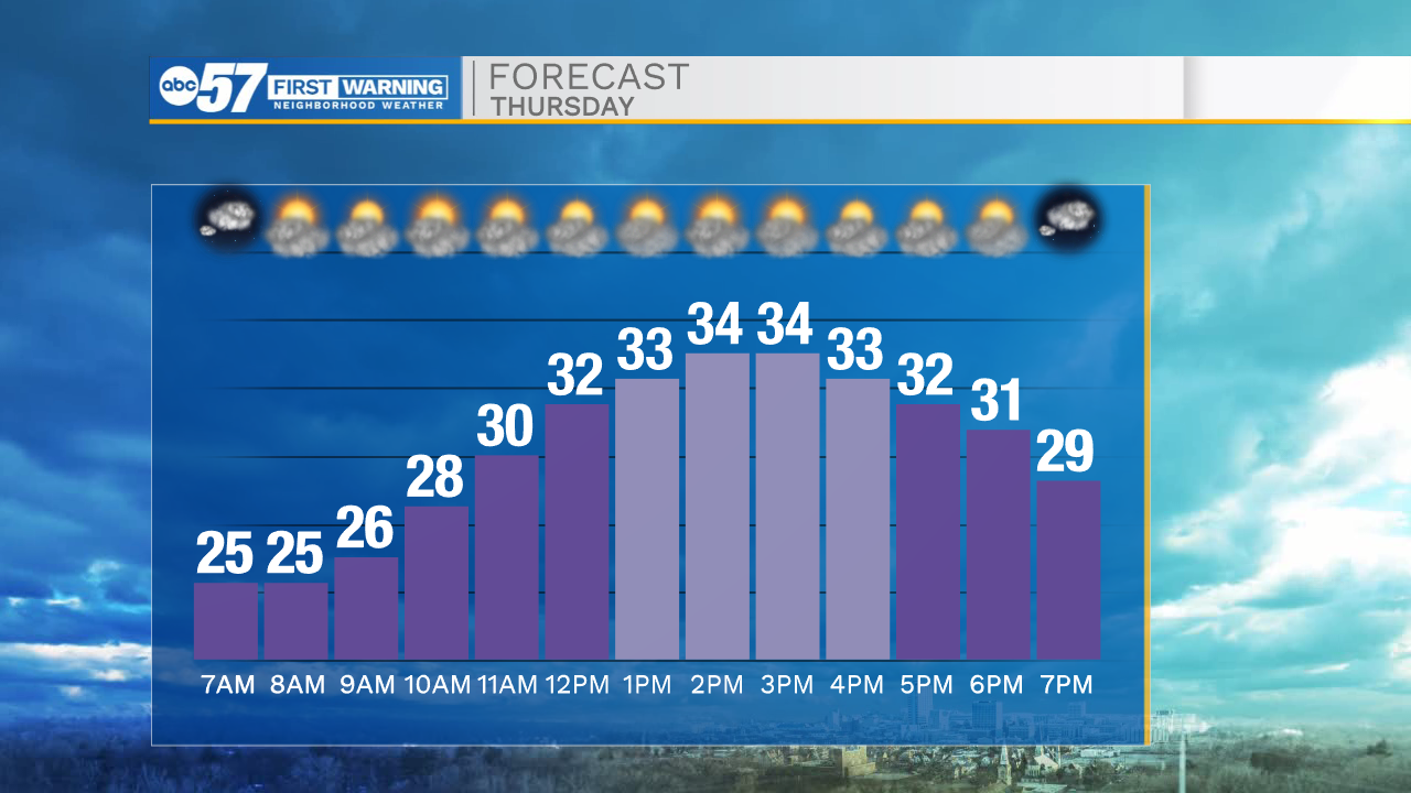
Today is the coolest day of the week. Temperatures in the mid 20s this morning will only improve into the mid 30s by afternoon. It should stay quiet today, tonight, and tomorrow.
Friday temperatures improve to the mid 40s, then we continue to climb into the 60s by Saturday. Most of Saturday is dry, although it will become windy as the day continues.
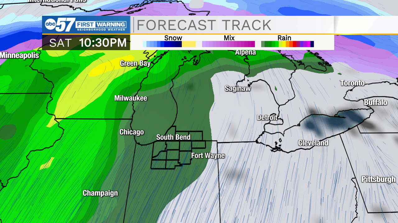
A round of rain starts late in the day Saturday. We could hear a few rumbles of thunder Saturday night into early Sunday morning.
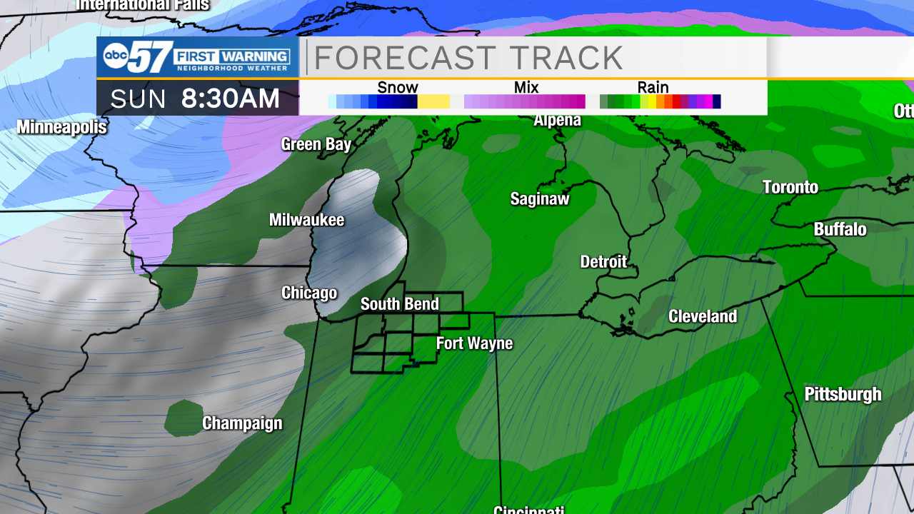
You'll want an umbrella to get to church on Sunday morning, before we dry out during the middle of the day.
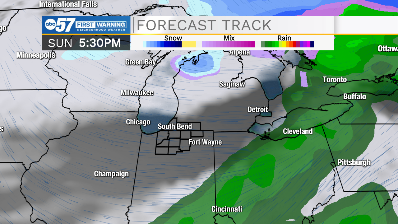
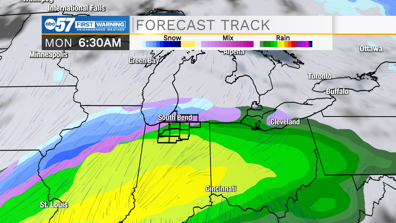
It stays windy Sunday between the rounds of rain. The second round of rain starts later Sunday night into early Monday morning. A rain / snow mix is possible by Monday.
Temperatures fall a bit for next week, back to normal high temperatures in the low 40s.
Today: Partly cloudy. High 34.
Tonight: Partly cloudy. Low 24.
Friday: Partly cloudy. High 44.
Saturday: Mostly cloudy and breezy. PM rain. High 64.