Dangerously cold and more lake effect snow


Lake effect snow showers have left some roads a mess along and north of US-20. Give yourself an extra 10-20 minutes this morning if you live in that area. The plunge of polar air has already begin to dip into the region. Temperatures will continue to fall throughout today, dropping below zero later this evening. Wind chill values will be dropping into the -20 degree range and below.
The deep freeze lasts through Thursday with possible cold record breaking highs on Wednesday as temperatures will only reach -10 degrees. With the windy conditions, wind chill will drop to dangerous levels (-35 to -50 range)! Limit time outside, wear extra layers and don’t leave skin uncovered. Frost bite can occur within 5-10 minutes.
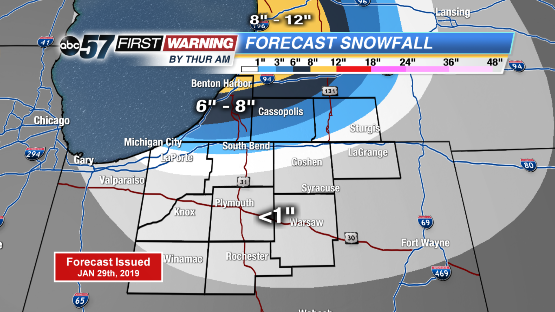
The lake effect snow continues through Thursday as well with snowfall totals over the next three days adding up to over 8” for northern Berrien County.
Today: Lake effect snow, breezy. Temperatures falling from the low teens.
Tonight: Lake effect snow, breezy. Low of -16.
Wednesday: Lake effect snow, record and dangerous cold. High of -10.
Thursday: AM lake effect snow, partly cloudy, dangerously cold. High of -3.