
-
1:25

New Buffalo vacationers and residents feel the effects of poor...
-
4:35

A mother’s worst nightmare: Hanna Dean fought off the man trying...
-
1:01

Fire and smoke season are lasting longer
-
2:18

St. Joseph County Clerk talks election security ahead of President...
-
2:38

The Big Boy Steam Locomotive made a stop in Indiana for the America’s...
-
1:20

La Porte County fair organizers adjust for heat and haze
-
2:56

“Mother Maddie” helps Notre Dame freshman Jacy Abii adjust...
-
1:56

Very Unhealthy Air in Michiana
-
2:45

Answering sun protection questions
-
1:47

Hot and smoky today
-
2:07

Locals have big visions for new skatepark in St. Joseph
-
2:29

Elkhart County residents still waiting for repair help a month...

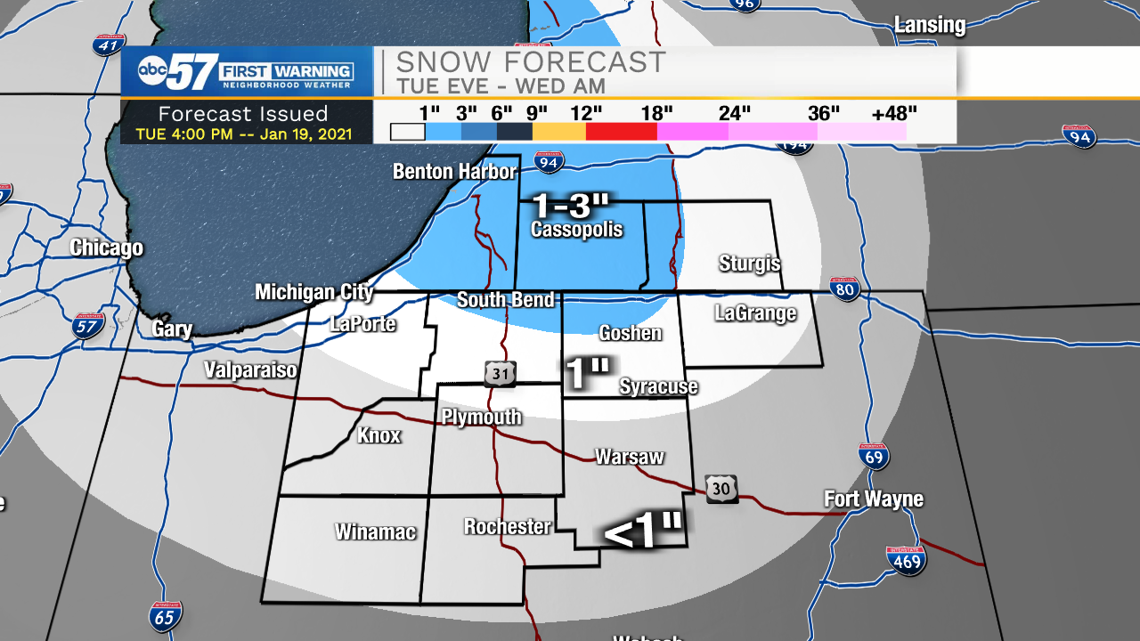
Tonight: Evening snow showers, mostly lake effect with the most accumulation, up to three inches, across Berrien and Cass counties. Snow will finish before the morning drive, but side and secondary roads may be slick and snow-covered.
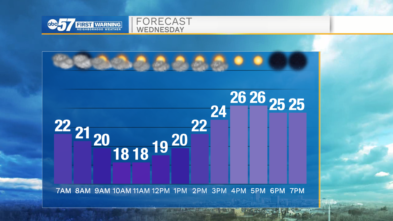
Wednesday is a cold day, in fact the coldest temperatures come mid-morning in the teens. Clouds break and we'll see some sunshine by the afternoon, the forecast is fair with a likely thaw Thursday. The forecast remains quiet heading into the weekend. The focus remains on the track of a low along the Ohio river Sunday through Tuesday. This path puts our area on a line between rain/snow. Plan for wintry weather to start next week.
Wednesday: Partly cloudy. High of 28.
Thursday: Mostly sunny. High of 38.
Friday: Partly cloudy. High of 30.