
-
2:11

Snow wrapping up today, returns tomorrow
-
4:39

The Morris debuts its 2026-27 season lineup
-
2:25

Lake effect snow through this morning
-
0:25

City commission approves new downtown paid parking plan
-
3:41

Community shares concerns at board meeting over offensive language...
-
2:03

Staying safe around downed power lines
-
3:10

Former players share stories of Lou Holtz before his burial
-
3:02

Trust, Love, and Commitment: Lou’s Life Lessons
-
1:32

Notre Dame ready for funeral traffic
-
3:23

Notre Dame community says their final farewell to Coach Lou Holtz
-
5:58

Remembering Lou Holtz: Broadcasters reflect on Holtz’ role...
-
16:25

ESPN’s Rece Davis remembers the life and legacy of Lou Holtz

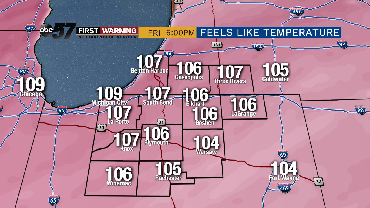
The extreme heat and humidity will peak Friday and last through Saturday. Highs in the mid-90s and a heat index will make it feel close to 110. Be proactive in reducing your exposure to the temperatures, especially during the hottest parts of the day in the late afternoon. The heat will break Sunday, the arrival of a cold front continues to trend earlier and this may bring showers and storms in the morning as relief arrives by the afternoon. Next week is mild with low humidity.
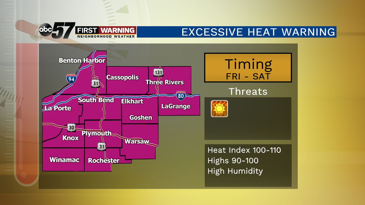
Tonight: Clearing, very humid, low of 77.
Friday: Extreme heat, mostly sunny, high of 96.
Saturday: Extreme heat, partly cloudy, high of 95.
Sunday: Showers & storms, high of 84.
Sign up for the ABC 57 Newsletter