
-
1:00

Scattered showers through the day
-
1:53

Hispanic Community Child Safety Meeting: A Call To Action
-
2:51

Obama Presidential Center features work of South Bend company
-
1:54

This week’s ABC57 Cub Reporter is Isaac Knefely
-
1:16

Real summer heat returns next week
-
2:28

South Bend storm drain mural project complete
-
5:17

Three local students return as national powerlifting champions
-
1:09

Rain showers to end the work week
-
5:36

Benefit Car Show supporting Berrien County’s first responders...
-
2:51

Governor Whitmer appeals FEMA federal aid denial for Southwest...
-
3:17

Benton Harbor leaders weigh Jean Klock Park upgrades amid debate...
-
1:40

Pollinator Playpath, a trail for kids, now open at Corson Riverwoods...

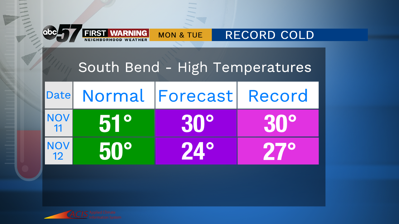
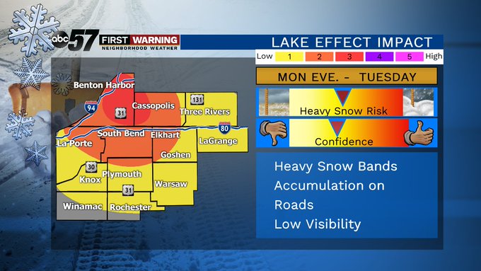
The weekend is fair and relatively mild by comparison to next with highs in the 40s. A cold front will move through early Monday morning, dropping temperatures and bringing widespread wintry mix and snow to the region. After the system snow, lake effect is likely to ramp-up Monday night into Tuesday morning. The record cold water temperature give the potential for significant snowfall.
Tonight: Partly to mostly cloudy. Low of 24.
Saturday: Partly cloudy. High of 42.
Sunday: Mostly cloudy. High of 44.
Monday: Snow showers. High of 30.
Tuesday: Lake effect snow: High of 24.
Sign up for the ABC 57 Newsletter