
-
2:15

Severe weather likely for portions of Michiana later today
-
2:34

Open House for a new pedestrian bridge leaves Riverside Residents...
-
2:16

Notre Dame’s CJ Carr embraces growing expectations while leading...
-
2:34

Injuries sideline key linebackers as Notre Dame leans on depth...
-
0:58

U.S. Army increases maximum enlistment age from 35 to 42
-
2:08

Large hail, damaging winds and tornadoes possible Thursday
-
1:40

Nicholas Stanley appears in court, prosecutors push to prevent...
-
3:18

Expert breaks down high gas prices and factors impacting price...
-
2:08

Westview community rallies around boys’ basketball team headed...
-
2:06

The threat for severe weather has increased
-
2:16

More sunshine today with a severe risk tomorrow
-
0:32

Granger residents share input on proposed S.R. 23 roundabout

The storm threat has ended for Michiana, skies clear and temperatures drop overnight.
Feeling fall-like this week as temperatures struggle to break 70. Fair but breezy Tuesday and much cooler midweek, with highs in the mid-60s. The northwest flow will produce lake effect clouds and rain showers, as air temps will be in the 60s and water temps are still in the 70s. Next weekend, fair and milder weather returns.
 Low in the 50s Tuesday morning.
Tonight: Evening storms, then clearing and cooling, low of 56.
Tuesday: Mostly sunny to partly cloudy, high of 70.
Wednesday: Mostly cloudy with showers likely, high of 64.
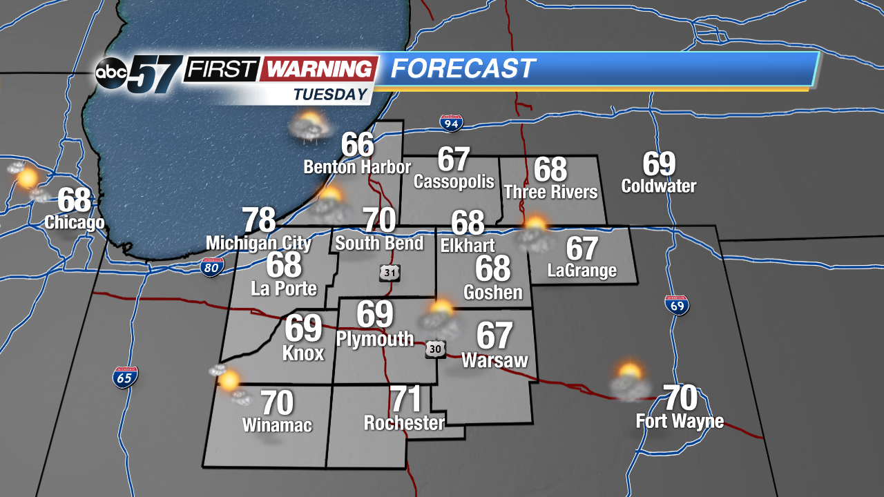 Highs struggle to break 70 Tuesday
Thursday: Partly cloudy, a chance of showers, highs in the mid-60s.
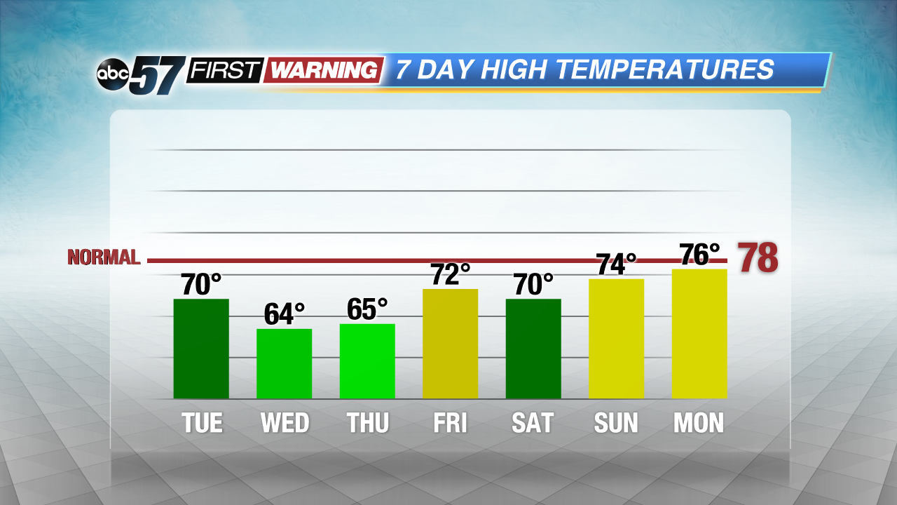 Highs 10-15 degrees BELOW normal this week.
Sign up for the ABC 57 Newsletter