


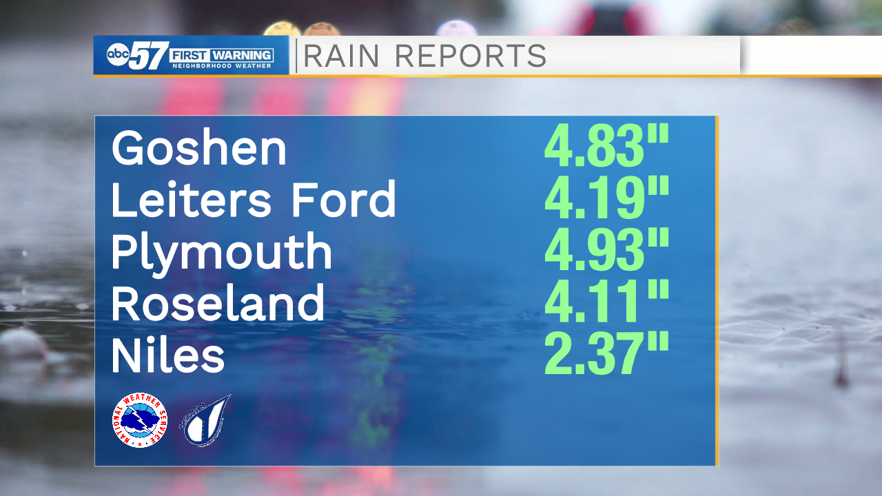
The flash flood watch remains in place through 8 a.m. Sunday. There are reports this morning of flooding in roads, so be careful as you are driving early – do not drive through standing water. In the past 24 hours, some areas in Michiana have seen nearly 5" of rain.
Showers continue this morning, before turning into heavier rain again by afternoon. We could pick up an additional 1-2” of rain later today. There is also the threat for a couple strong to even severe storms this evening. An isolated tornado can't be ruled out for this evening.
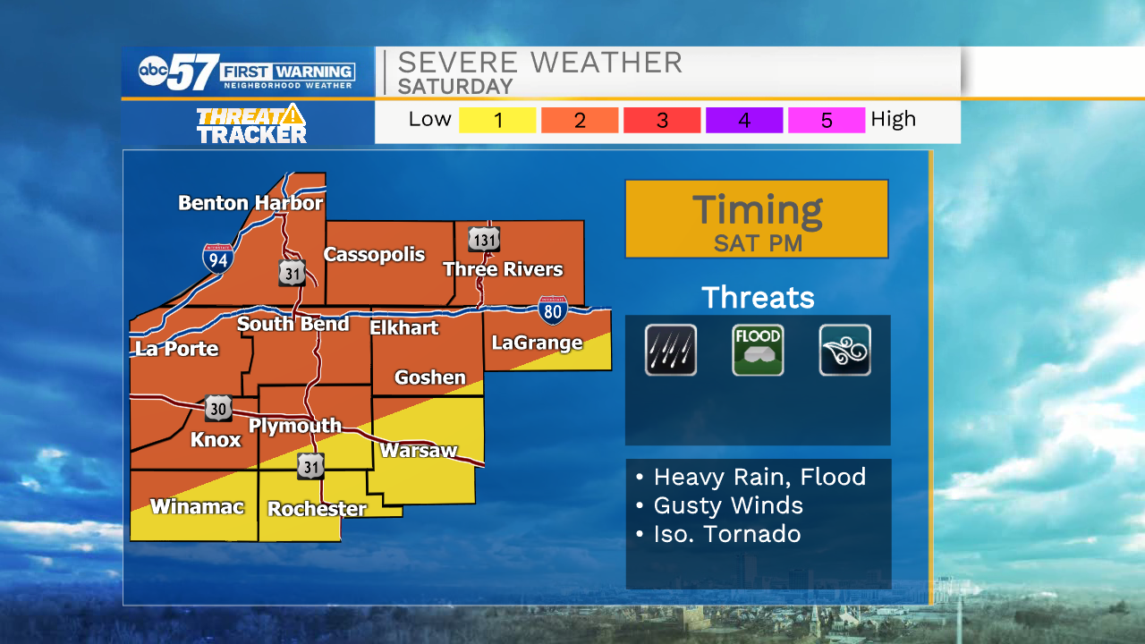
Storms likely start after 3 p.m. today and linger through the evening.
Rain showers continue into Sunday, although the day may have more of a lull between showers and afternoon thunderstorms.
Temperatures look to stay in the mid 80s this weekend and into early next week. Additional showers and thunderstorms are possible most days this work week.
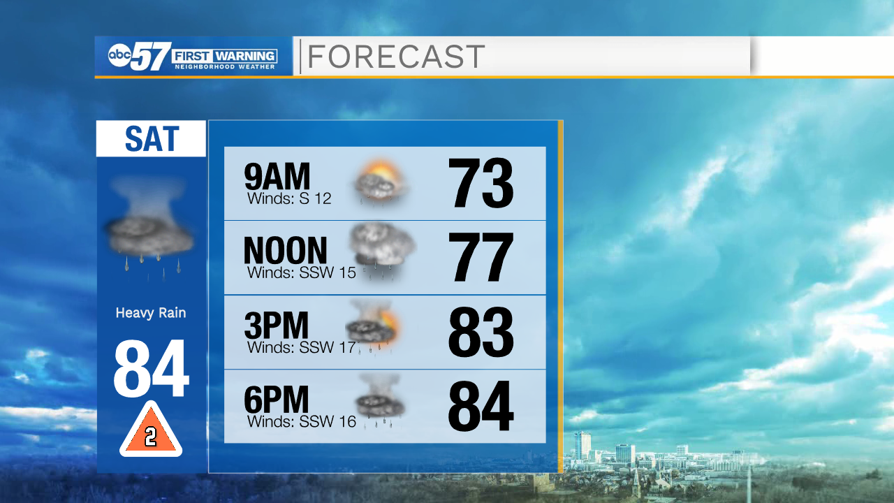
Today: Showers and thunderstorms. High 84.
Tonight: Scattered showers and storms. Low 72.
Sunday: Scattered showers and storms. High 84.
Monday: Scattered showers and storms. High 84.