


After a stretch of similar days this week, we finally see some changes in the forecast this weekend and a break in the clouds.
This morning there will be some light flurries. After noon, the day is dry and cloudy with temperatures in the mid 30s. Late tonight there is a chance again for flurries. Saturday morning the precipitation continues, but turns into more of a wintry mix or drizzle. By noon on Saturday, skies will be dry again. Less than an inch of snow is expected from now through tomorrow.
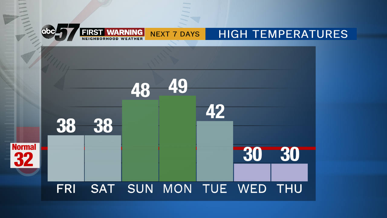
On Sunday, the clouds break and we get some much needed sunshine! Temperatures warm to the upper 40s. Monday remains unseasonably warm with a high of 49. Monday skies start partly sunny, but cloud cover will increase throughout the day. By Tuesday, we are cloudy and another winter system reaches Michiana. Primarily we see rain Tuesday, but overnight could turn into snow.
Today: Cloudy with early morning flurries. High 38.
Tonight: Late evening flurries. Low 31.
Saturday: Snow showers early then wintry mix. Dry by afternoon. High 38.
Sunday: Mostly sunny. High 48.