
-
2:15

Severe weather likely for portions of Michiana later today
-
2:34

Open House for a new pedestrian bridge leaves Riverside Residents...
-
2:16

Notre Dame’s CJ Carr embraces growing expectations while leading...
-
2:34

Injuries sideline key linebackers as Notre Dame leans on depth...
-
0:58

U.S. Army increases maximum enlistment age from 35 to 42
-
2:08

Large hail, damaging winds and tornadoes possible Thursday
-
1:40

Nicholas Stanley appears in court, prosecutors push to prevent...
-
3:18

Expert breaks down high gas prices and factors impacting price...
-
2:08

Westview community rallies around boys’ basketball team headed...
-
2:06

The threat for severe weather has increased
-
2:16

More sunshine today with a severe risk tomorrow
-
0:32

Granger residents share input on proposed S.R. 23 roundabout

Gloomy, with fog developing overnight, low visibility and temperatures near freezing, slick spots are possible on bridges and overpasses.
This week will be active but milder with highs closer to 50 most of this week. Tuesday is sunny, Wednesday is rainy and Thursday is sunny once again. The main focus will be on a power storm system this coming weekend. Strong wind may be the greatest threat, this is separate from any shower/storms that could produce higher gusts. Colder air return Sunday with a chance of snow.
Tonight: Mostly to partly cloudy, morning fog, low 32. 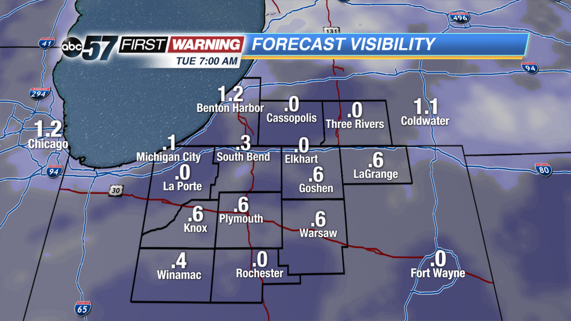 Forecast visibility Tuesday morning. The more clouds break, the more likely there could be dense fog.
Tuesday: Mostly sunny, high of 48.
Wednesday: Rain likely, high of 50.
Thursday: Mostly sunny, highs in the mid-40s. 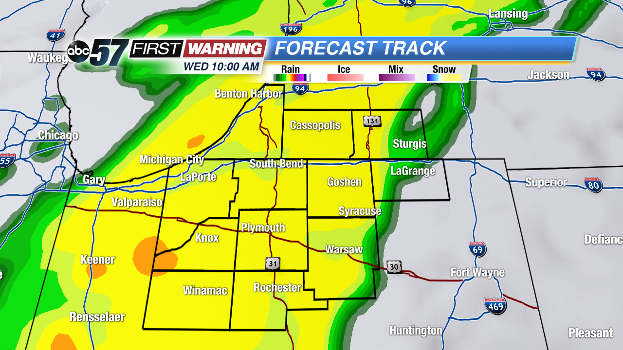 Swath of rain Wednesday could be moderate to heavy.