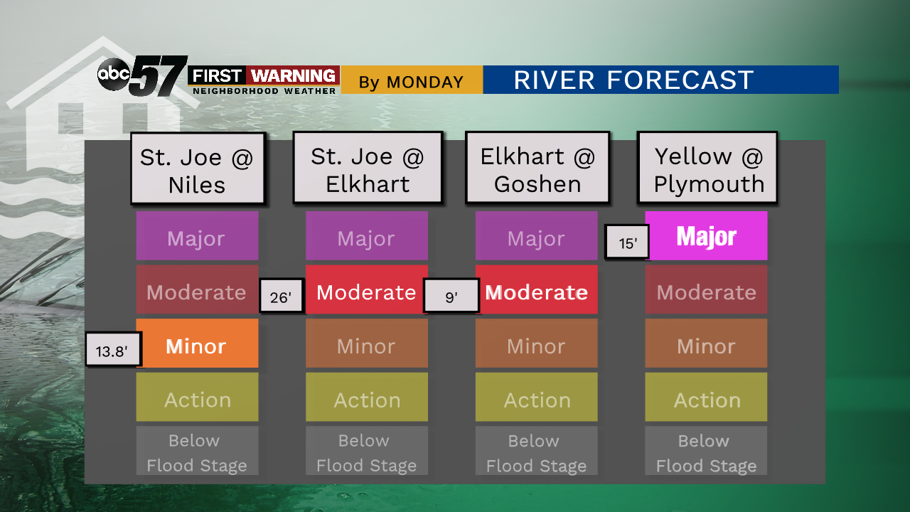
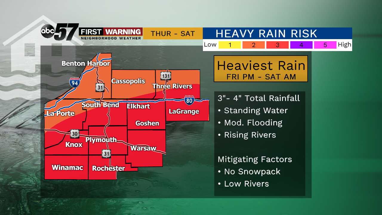
A record January rain event is expected Friday – Saturday, with three to four inches of rain through Saturday afternoon resulting in standing water, general flooding. Winter weather concerns are at a minimum. Temperatures fall Saturday night into Sunday but a flash freeze is not expected. There still could be slick spots as standing water freezing Sunday morning. Moderate to major river flooding is also expected as rivers rapidly rise, peaking Monday.
Tonight: Rain Showers. Low of 45.
Friday: Rain Showers. High of 50.
Friday Night: Heavy rain, flooding possible, temperatures hold close to 40.
Saturday: Heavy rain, flooding possible, breezy, temperatures fall from 39.
Saturday Night: Sleet possible, standing water will freeze, low 22.
Sunday: Mostly cloudy. High of 34.
Click here for a breakdown of record rainfall.