Freezing rain: how does it form and what impacts can we expect?


We have freezing rain in the forecast today, but what needs to happen in our atmosphere for us to see this type of precipitation over another?
It all comes down to temperatures, here on the ground and in the air above us. For freezing rain to form, the temperature profile of the atmosphere would need to be composed of air warmer than 32 degrees above a shallow layer of below-freezing air. The warmer air aloft would allow for raindrops to fall still in their water phase, but the colder air near ground would cause the raindrops to freeze on contact. This results in a glazing of ice following freezing rain events.
Today, most will see up to .25 inches of ice accumulation, but more than this is possible. Even though forecasted ice amounts don’t appear all that impressive at first glance, they shouldn't be underestimated - small totals still have massive impacts.
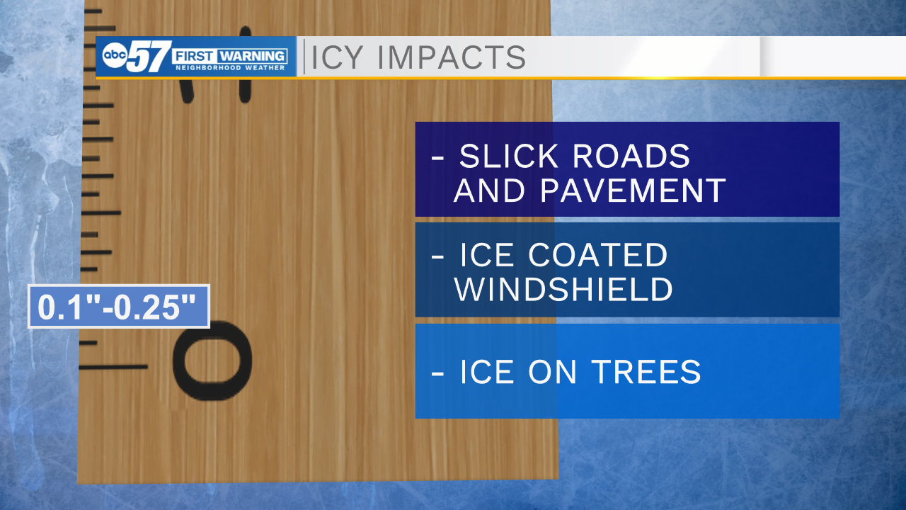
Ice accumulation between 0.1” and 0.25” results in slick spots on roads, especially on bridges and overpasses, as well as ice-coated windshields and trees. This is the range most of us can expect to fall within today.
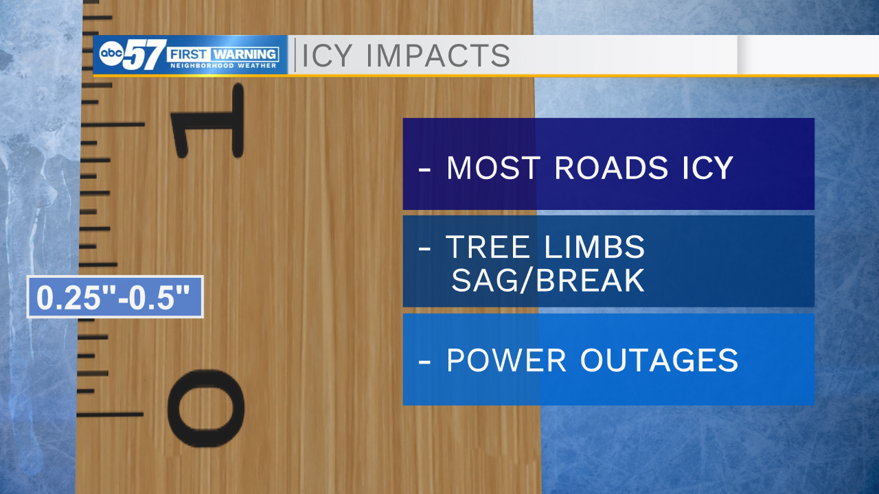
When there's 0.25” to 0.5” of ice, most roads are iced over, and travel becomes much more difficult. Tree limbs start to sag and can even break. This much ice also creates an issue for power lines and can cause power outages.
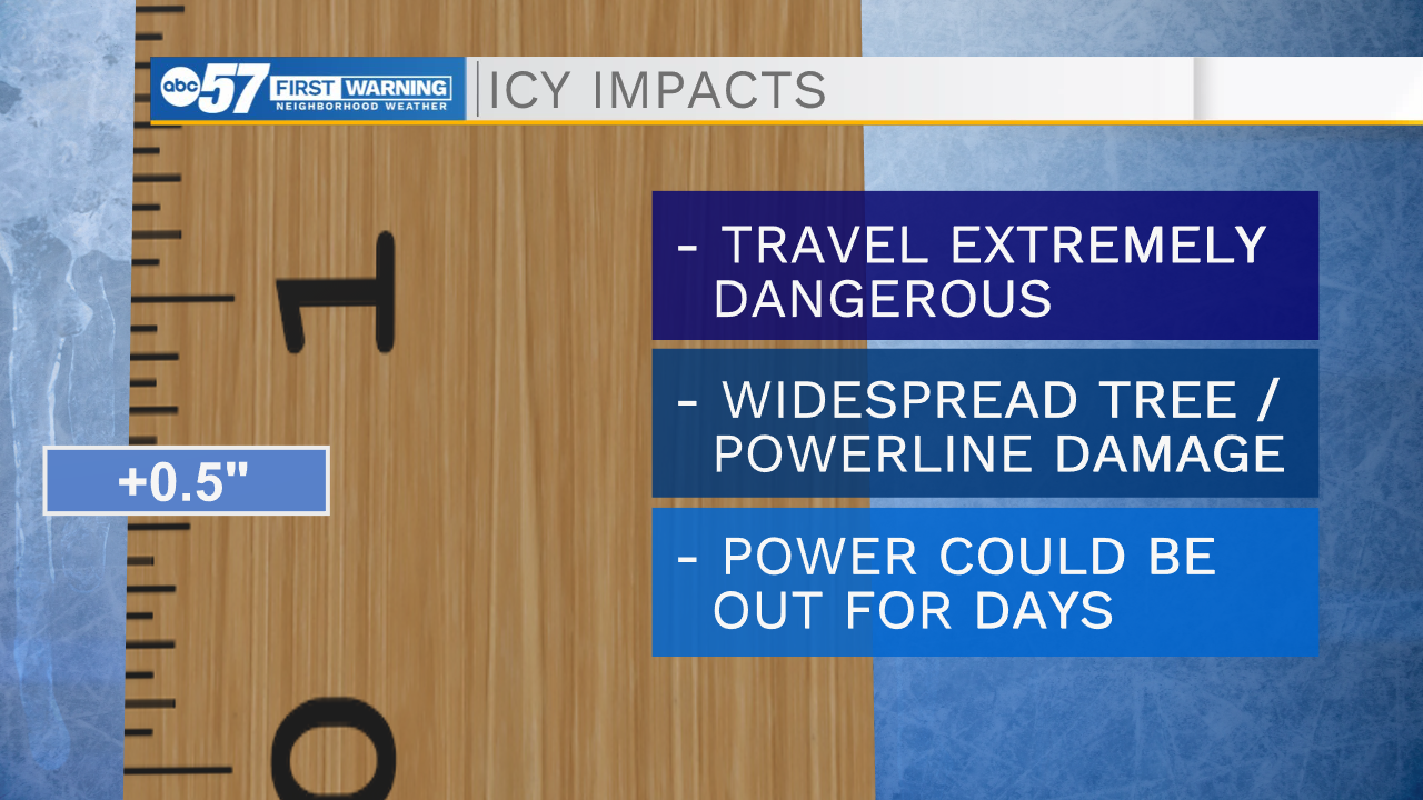
When ice accumulation is over 0.5”, travel becomes extremely dangerous, even impossible. We would expect widespread damage to trees and power lines, potentially resulting in days-long power outages.
Freezing rain is considered to be the most dangerous form of precipitation due to its significant impacts. Make sure to pack your patience if you need to be on the roads tomorrow, take it slow, and use extreme caution. Warming temperatures this week will help to melt the ice down, making things much safer very soon.