From borderline drought to very wet
Posted: Aug 8, 2018 1:12 PM EDT
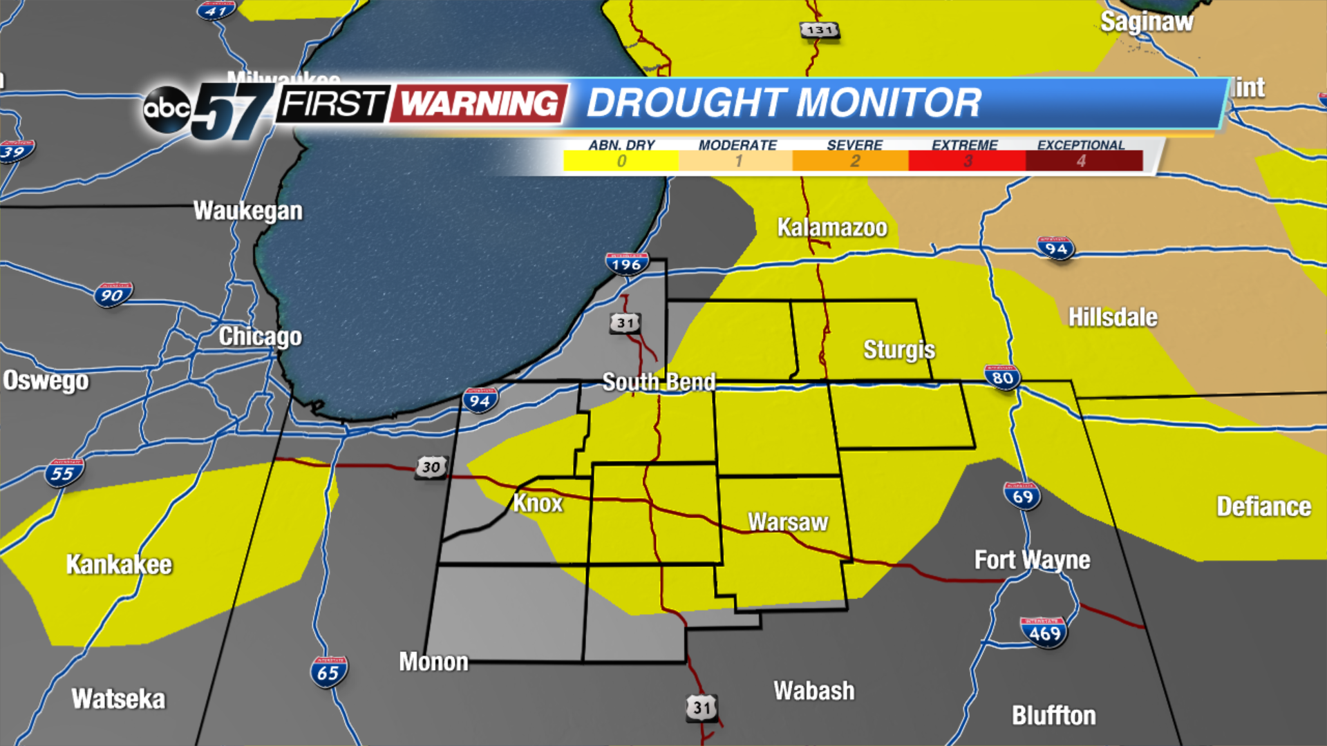
Rewind one week to August 1st. Roughly 75% of Michiana was in the "Abnormally Dry" category on the Drought Monitor. We were coming off of a dry stretch of weather to close out the month of July. Many lawns and crops were beginning to suffer and exhibit signs of dryness and stress. It was even worse in Michigan, where a good chunk of the state was in a "Moderate Drought."
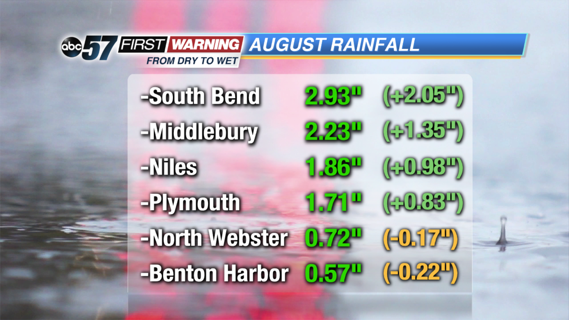
Now, fast-forward to the evening of August 8th. Most of Michiana has erased any sort of abnormally dry conditions thanks to a much wetter-than-normal first 8 days of August. Some towns and cities have recorded more rain than others, but most everyone has seen at least a half-inch of rainfall through the first 8 days of the month. A few higher totals include the nearly three inches in South Bend, the more than two inches in Middlebury and the nearly two inches in Niles and Plymouth.
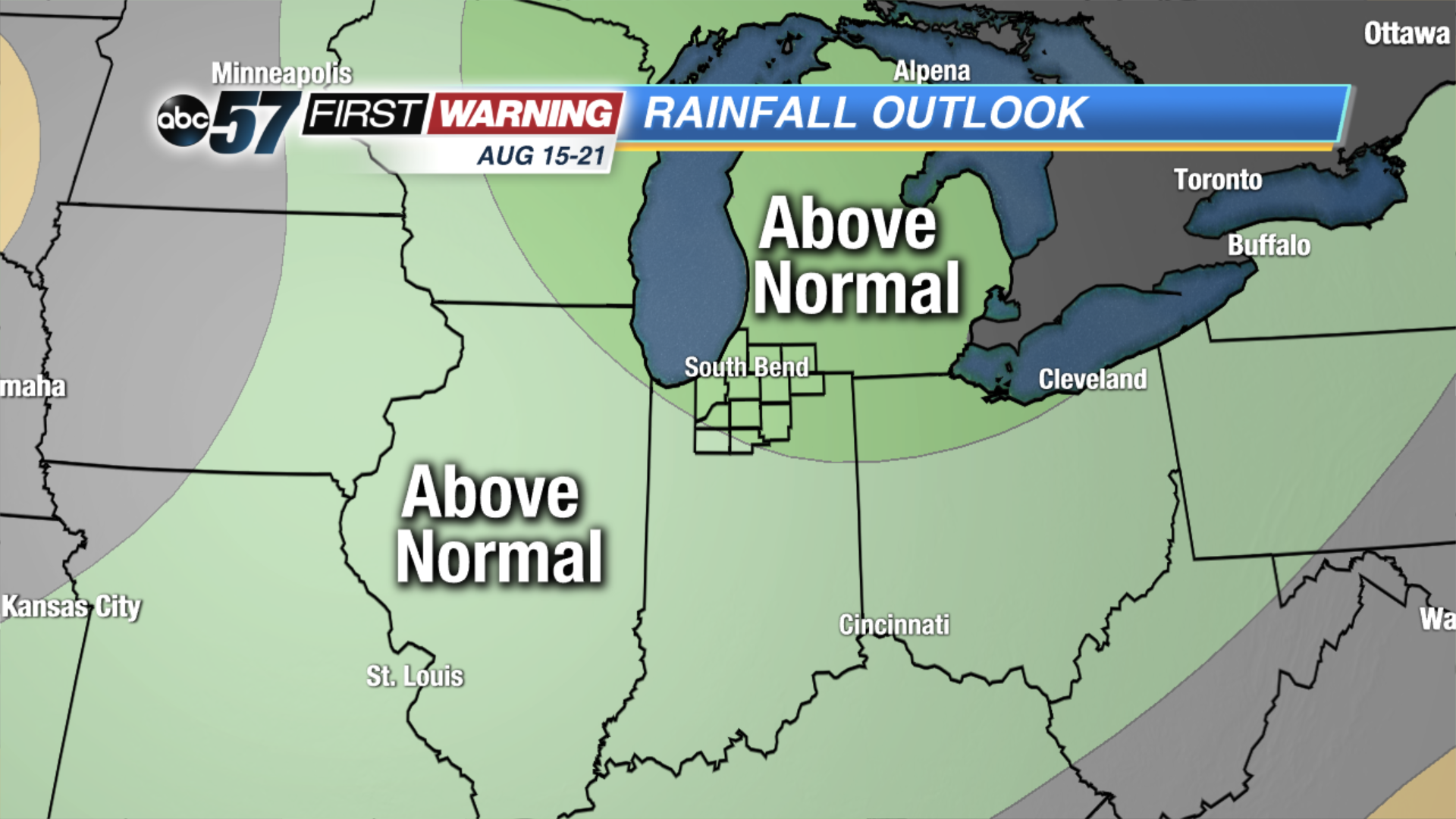
The unusually wet beginning to August will likely allow much of the region to be taken out of the "Abnormally Dry" category in the next Drought Monitor. That will be issued on Thursday, August 9th. Looking ahead, it is likely that a good chunk of the area sees some additional rain over the next week or so as the pattern looks to remain relatively active. Advancing even further into August, the Climate Prediction Center currently has all of Michiana in a 40% chance for above normal rainfall during the period of the 15th to the 21st. That doesn't mean we are guaranteed to see a hefty amount of rain during that 7-day stretch. It simply means we have a better chance of seeing rain than staying dry.


