From Category 1 to 5: Maria's intensification


Yesterday, Hurricane Maria was only a Category 1 storm with a maximum sustained wind speed of 90 mph. This morning, it has rapidly intensified into a Category 5 monster with 160 mph! How can a hurricane grow so powerful in a short amount of time? Well, there are a couple of factors that go into it.
First, the waters around the Caribbean are very warm, around the low to mid 80s. This is the perfect temperature range for developing and sustaining hurricanes. These storms need the very warm ocean waters, which Maria had direct access to as it slowly approached Dominica yesterday. Second, The atmosphere directly above the Caribbean is very quiet, meaning there is not much wind shear. Wind shear, which is the change in wind speed and/or direction with height in the atmosphere, can kill hurricane development as opposing wind directions can tear the storm apart.
The combination of very little wind shear and warm ocean temperatures allowed Maria to strengthen the way it did, and it is forecasted to stay a major hurricane as it continues to barrel towards Puerto Rico and the U.S. and British Virgin Islands over the next several hours.
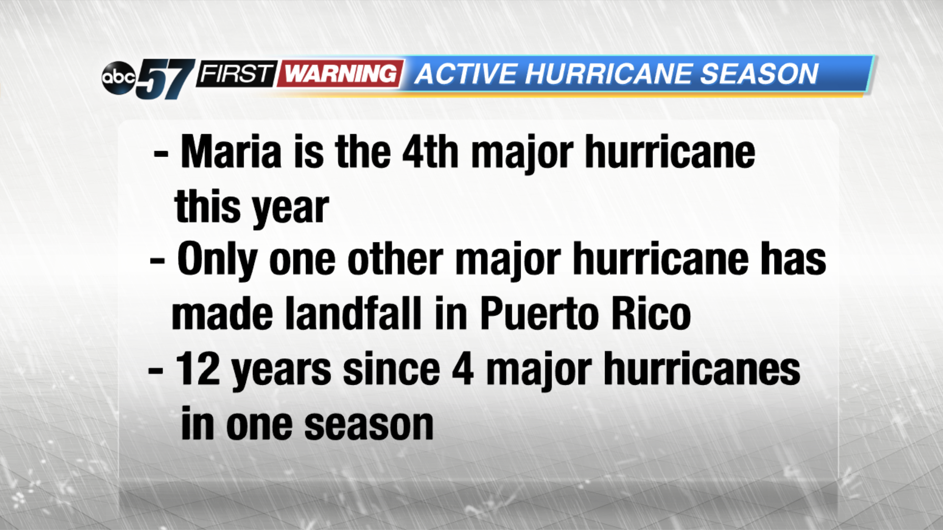 With Maria, 2017 has had 4 major hurricanes. This has not been seen since 2005 (Emily, Katrina, Rita, and Wilma).