
Frost / Freeze: A worrisome forecast for the fruit belt
By:
Tom Coomes
Posted: Apr 16, 2021 5:06 PM EDT

-
2:42

2027 JWAS Jaxson Scholarship Applications now open
-
4:05

28th Annual Michiana Chili Cookoff serving up the heat
-
1:51

Marshall County community runs for a purpose
-
1:07

After a lovely day, the cold returns
-
1:09

Music Enthusiasts talk tunes at the South Bend Record Show
-
2:30

Local woman turns 100
-
2:55

The apple cider slushie takes over as most popular snack at Four...
-
1:30

Cold Tuesday Morning Ahead
-
1:00

5th annual Blessing of the Pets
-
2:05

Elkhart celebrates 175 years of railroads
-
1:08

Cool tonight, Another beautiful day in store tomorrow
-
4:01

Notre Dame holds off North Carolina, 37-26

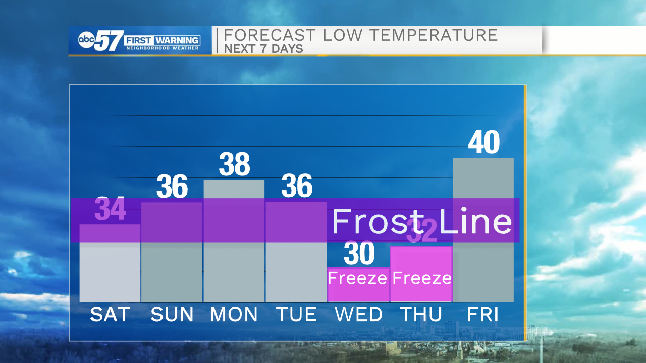
A slight warm-up this weekend, highs warm towards the mid-60s by Monday. Saturday is cloudier than Sunday but overall, the weekend is fair. The warm-up Monday is a key focus before temperatures crash Tuesday, will Monday's warmth prevent rain changing to any a few snowflakes Tuesday? A more serious concern is a likely freeze Wednesday morning. Multiple hours below 32 would be damaging to the tree fruit crop.
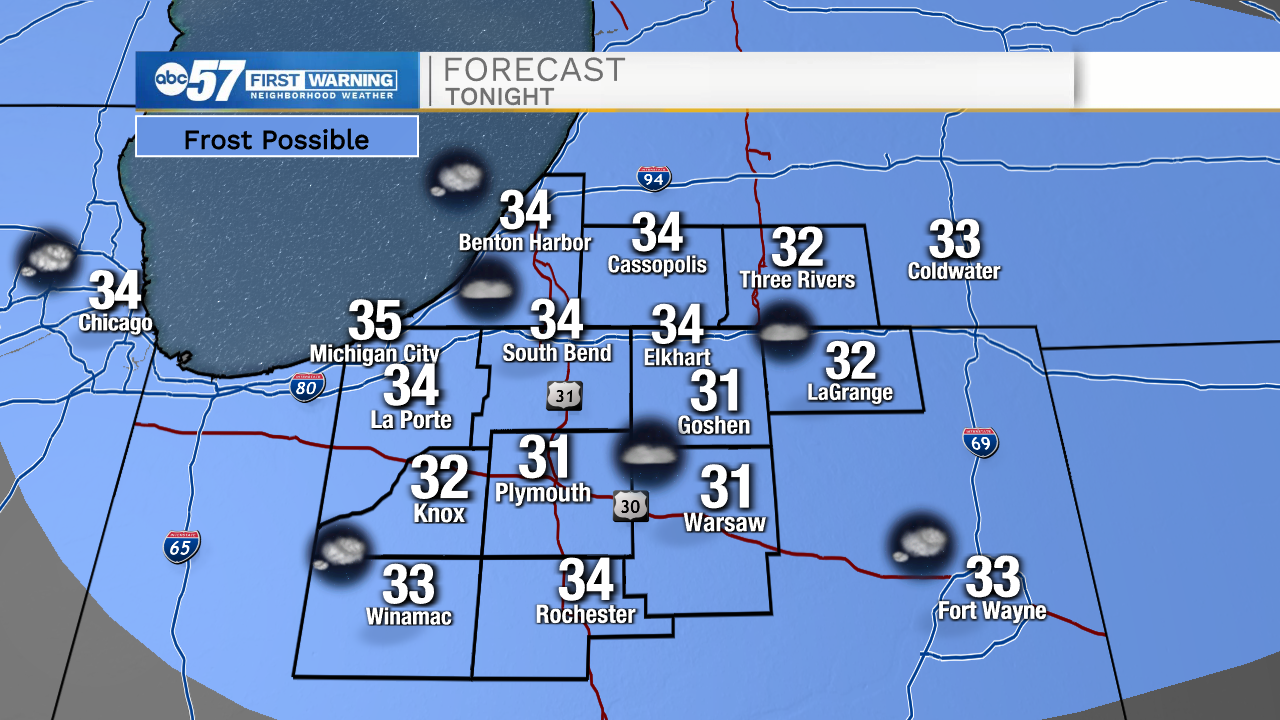
Tonight: Patchy frost, partly cloudy. Low 34.
Saturday: Mostly cloudy. High 56.
Sunday: Partly cloudy. High 58.
Monday: Mostly sunny. High 64.
Sign up for the ABC 57 Newsletter