


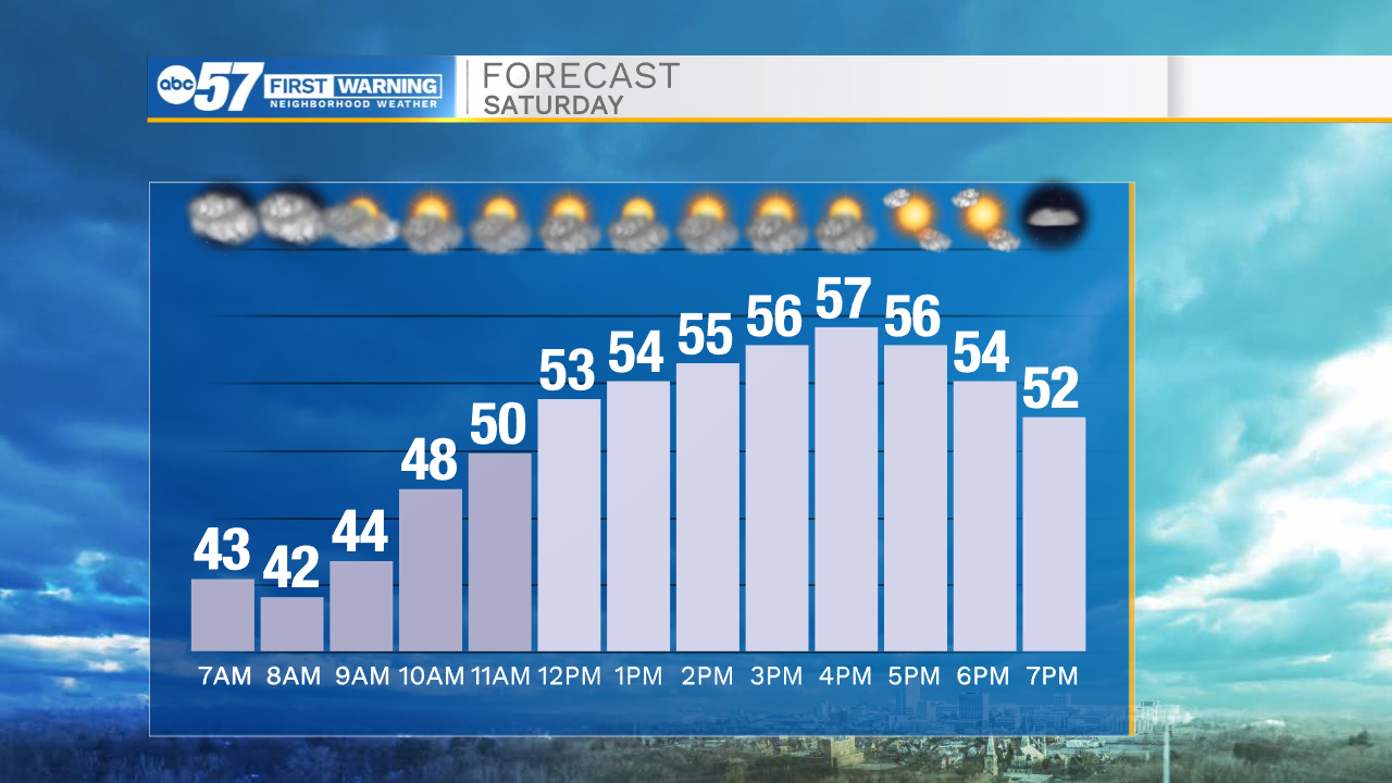
Even though it starts mostly cloudy today, there is a little sunshine to enjoy by afternoon. Temperatures climb into the upper 50s. A spotty shower is possible around the lunch hour, but most stay dry.
Skies stay clear overnight, allowing temperatures to fall into the upper 30s by tomorrow morning. A bit of patchy frost could be possible, so you may want to cover any late season flowers before you go to bed tonight.
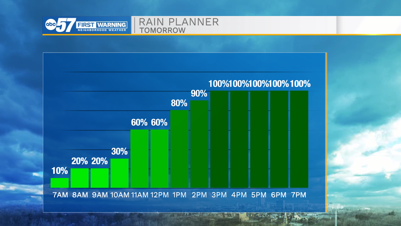
Use today to run any weekend errands – Sunday looks like a soaker. Showers are possible in the morning, but a steadier rain is here by tomorrow afternoon.
Rain continues Sunday night and during the day Monday. Periods of heavy rain are possible. We could also hear a few rumbles of thunder.
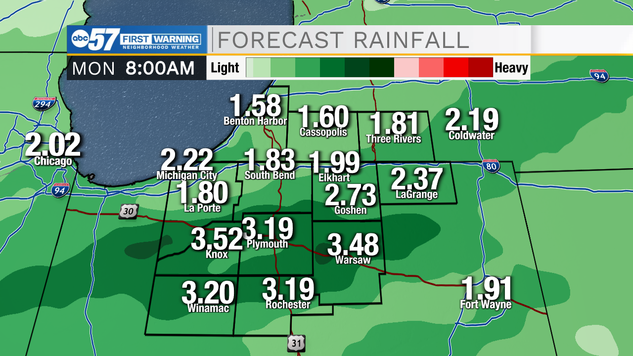
Right now, it looks like flooding could be a concern, as we’ll likely pick up 1-2” of rain.
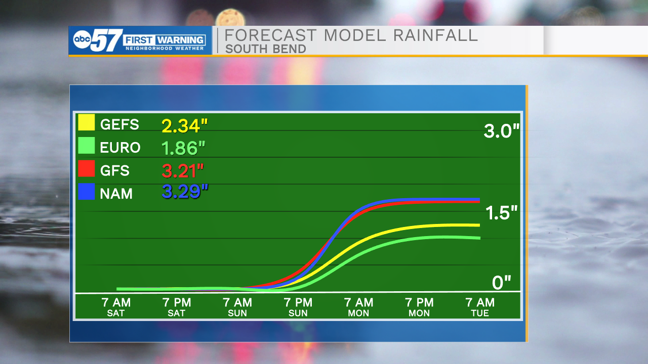
It’s hard to tell exactly who will be the bullseye for the highest rain totals right now, so keep checking for updates.
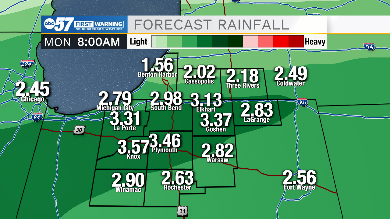 This set up has higher rain totals for central Michiana
 This set up shows the higher rain totals for our southern counties
Tuesday stays dry, then rain returns for another round starting Wednesday evening.
Today: Decreasing clouds. High 57.
Tonight: Mostly clear. Low 38.
Sunday: Rain. High 54.
Monday: Rainy and breezy. High 56.