
-
2:28

Kicking off day two of the Gus Macker Basketball Tournament
-
0:55

Enjoy this weekend
-
0:50

Beautiful weekend starts this morning
-
2:32

Gus Macker Three-on-Three Basketball Tournament is taking over...
-
1:44

Feeling like a sauna next week
-
3:12

How to keep yourself and others protected during firework season
-
0:49

Showers creeping into Michiana
-
1:32

Judge approves $25 million water lawsuit settlement in Benton...
-
1:00

Scattered showers through the day
-
1:53

Hispanic Community Child Safety Meeting: A Call To Action
-
2:51

Obama Presidential Center features work of South Bend company
-
1:54

This week’s ABC57 Cub Reporter is Isaac Knefely

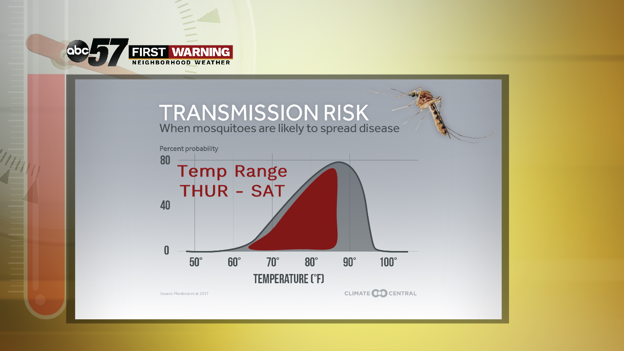
Temperatures and the humidity rise to end the week, one more surge of summer heat before the official start to fall Monday. Warm and sunny through Friday with clouds increasing on Saturday, then a fall front slides through Sunday into Monday. Rain is likely Sunday, storms could bring significant downpours. The forecast for next week features milder, fall-like temps.
Tonight: Clear. Low of 58.
Thursday: Sunny. High of 85.
Friday: Mostly sunny. High of 86.
Saturday: Partly cloudy, High of 88.
Sign up for the ABC 57 Newsletter