Heat and humidity today then stronger storms tonight


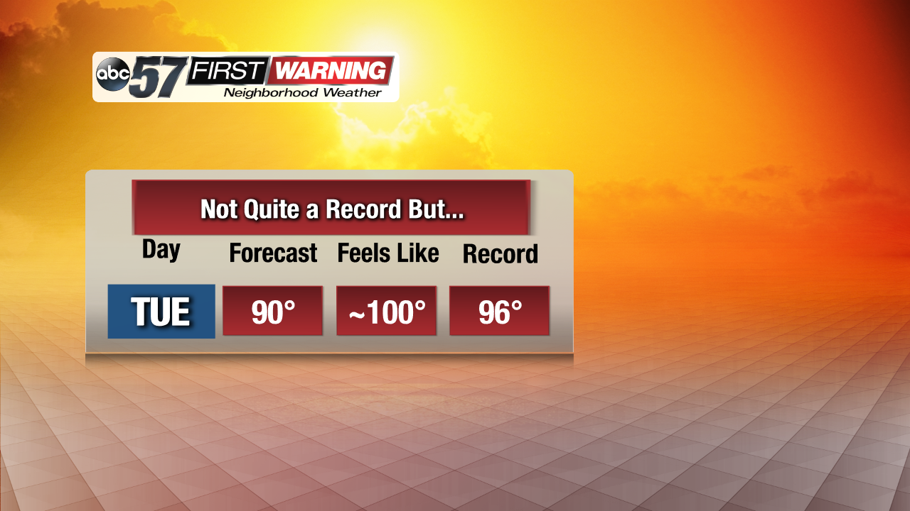
Like yesterday and the day before, it's a muggy start as the humidity continues to hold over Michiana. With highs expected near 90 degrees again and dewpoints staying high, expect another very hot afternoon. Our record high for today is 96 degrees, and that hasn't been touched for a long time. We won't get to that point today, but it'll feel like the upper 90s and low 100s again across all of Michiana. That's even hotter than the record high for today.
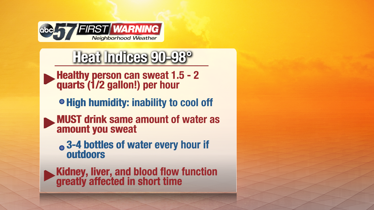
So, if you plan on working outdoors today or spending quite a bit of time outside, try your best to push it back to the evening or right around now. If you can't, be sure to drink plenty of water, about 3 to 4 bottles of water for every hour spent outside. And be aware that dehydration is likely if you don't drink as much as you sweat out. On hot and humid days, overheating is almost a guarantee as the your sweat can't evaporate as quickly thanks to all the humidity.
And with the showers and storms coming in tonight, some could be strong, especially off to the north and west. With the storms weakening as they slide southeast, NW Michiana has the best chance of seeing these risks. Heavy rain will definitely be our main concern. Just take a look at these precipitable water values.
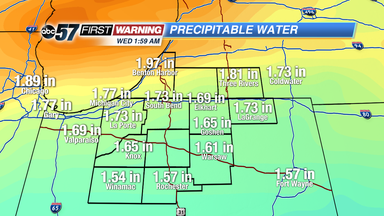
Around an inch and a half to two inches means that the atmosphere will be holding a lot of water vapor overnight, which points to the likelihood of heavy showers and downpours. That could lead to ponding on the roads early tomorrow morning, so watch out on the drive in, if you're planning on leaving early. Second is the risk of strong wind. Gusts could as high as 30 to maybe 40 mph in some locations, which bring down some smaller branches and a few power lines.

And third is the hail risk. We're not expecting very large hail, but the strongest of the storms could drop some quarter-size or smaller stones.