Heating up with evening showers and storms

-
0:47

South Bend Record Show takes over Gillespie Center Sunday
-
2:21

Ag Days wraps up at the St Joseph County Fairgrounds
-
0:57

President Donald Trump responds to Pope Leo’s statement Sunday
-
1:28

Stormy start to the week
-
0:59

Hot and cloudy today
-
1:03

Calm, warmer out the door
-
0:34

SBPD investigating shooting after walk-in gunshot victim
-
0:37

Tolson Center kicks off soccer season
-
1:37

No. 2 Notre Dame lacrosse defeats No. 1 North Carolina in 10-5...
-
0:53

South Bend celebrates Skilled Trades Day with Rebuilding Together...
-
2:32

Church hosts ‘Possibility Day’ to promote disability inclusion...
-
0:50

Springlike today, hotter tomorrow

ABC57 First Warning Neighborhood Weather
Wednesday, July 15th, 2020
Clouds increase as we head into the afternoon with rain and a couple of thunderstorms after 7pm. A few thunderstorms tonight could have gusty wind but the severe threat is low. Heavy rain is the main threat. A few showers could linger into early Thursday morning, otherwise clouds begin to clear out.
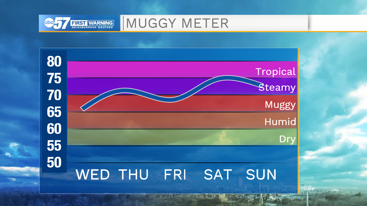
Friday brightens back up but we are hot and humid heading into the weekend! Heat indices will climb to the mid 90s to possibly 100. The heat and humidity will make for a good recipe of isolated thunderstorms over the weekend.
Today: Increasing clouds. Evening showers/storms. High 90.
Tonight: Showers and thunderstorms. Low 70.
Thursday: Early AM shower then clearing skies. High 84.
Friday: Mostly sunny. High 90.