Heavy rain, hail and wind threat Friday and Saturday
Posted: Oct 4, 2018 11:45 AM EDT
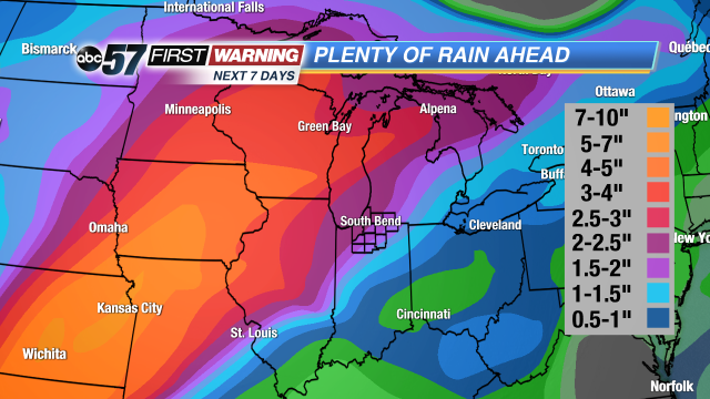
After a toasty Wednesday with near-record highs, fall has returned big-time today. The sunshine and cooler temperatures won't last, though. The pattern will likely become active Friday morning and last through Saturday evening. There could be a several rounds of showers and thunderstorms during that period, especially the farther north you are. The heaviest rain and most active zone will likely be just to the west and northwest of Michiana through Saturday night. The same can be said for next week. The best chance of heavy rain and flooding will be west of Indiana. Areas from Oklahoma and Kansas to Iowa and Illinois will have the potential to see round after round of rain and storms, leading to heightened flooding potential through mid-October.
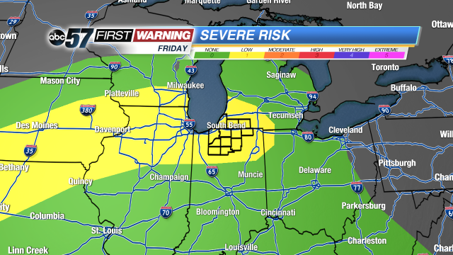
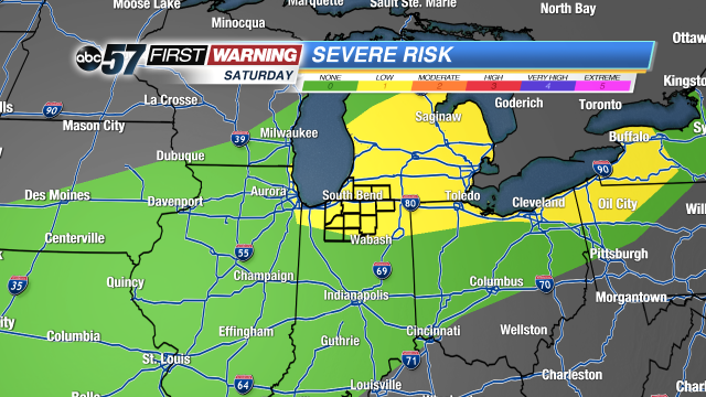
That's not to say that Michiana is in the clear regarding hefty rain totals and flooding chances. Depending on where exactly the heaviest showers and storms move, parts of Michiana could certainly see a few inches of rain and a chance of flooding over the next couple of days. This will be possible next week as well as the pattern stays active with rounds of rain and storms remaining possible. Alongside the chance for heavy rain is the threat of strong to severe thunderstorms. The Storm Prediction Center's severe weather outlooks for Friday and Saturday paint a low chance of severe weather for parts of the Midwest and Great Lakes, including all of Michiana.
The best chance of seeing a strong to severe storm will be Friday morning, Friday night and later in the day Saturday. The set up thru Saturday is not a "home run" scenario in terms of severe weather chances due to some disagreement among forecast models. However, the chance is certainly there for at least a few strong to severe wind gusts and some instances of larger hail. If you plan on venturing outside Friday or Saturday, it'll be a good idea to have the ABC 57 First Warning Neighborhood Weather App handy!


