
-
3:17

Benton Harbor leaders weigh Jean Klock Park upgrades amid debate...
-
1:40

Pollinator Playpath, a trail for kids, now open at Corson Riverwoods...
-
0:32

Ryan Newman racing Saturday at Plymouth Motor Speedway
-
3:08

Officials recover body of missing teenager in Lake Michigan off...
-
2:45

NCAA’s new eligibility rule could reshape Notre Dame roster...
-
1:08

Storms start this afternoon
-
0:56

Calm morning, storms tonight
-
2:43

South Bend residents see future plans for former Drewry’s Brewery
-
2:45

Damage assessment continues in Elkhart County following EF-2...
-
0:44

Indiana and Illinois set record for tornadoes
-
1:27

Community Build underway at Kathryn Park
-
2:34

Day two of searching for a missing child continues

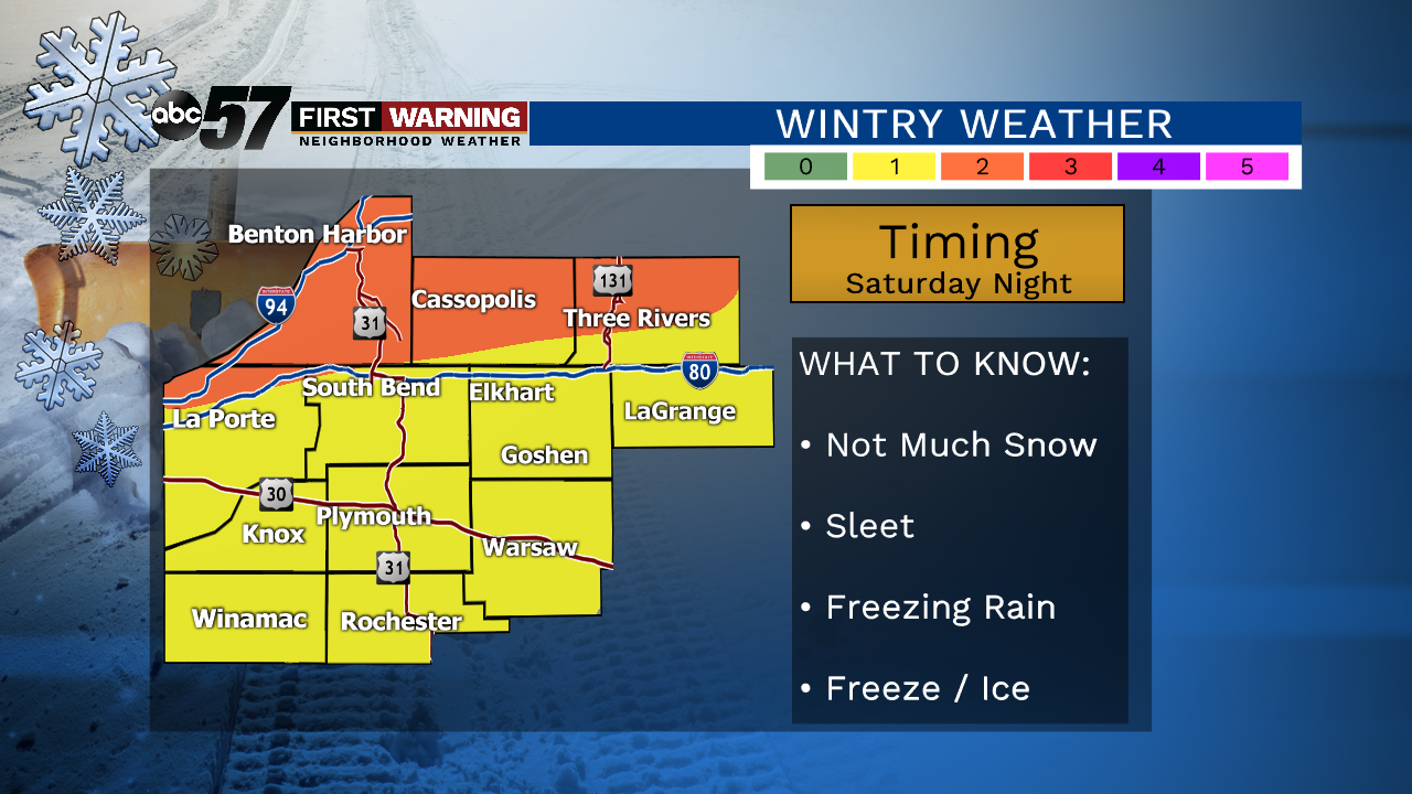
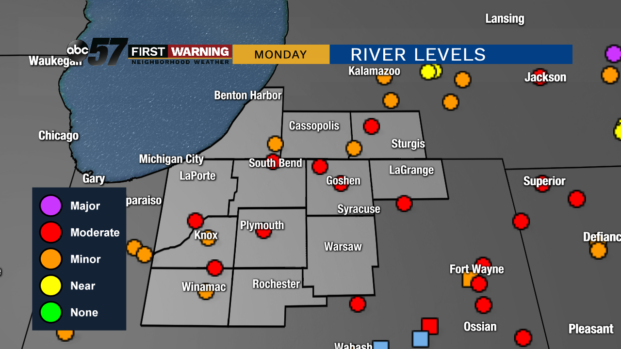
Steady rain, heavy at times, lasts through Saturday afternoon. Upwards for three inches of rain is likely, causing standing water and flooding. Temperatures fall from near 50 in the morning to the mid-30s by the afternoon. A wintry mix / freeze is the concern by early Sunday as temps fall into the mid-20s. Rivers rise quickly, peaking Monday in moderate flood stage.
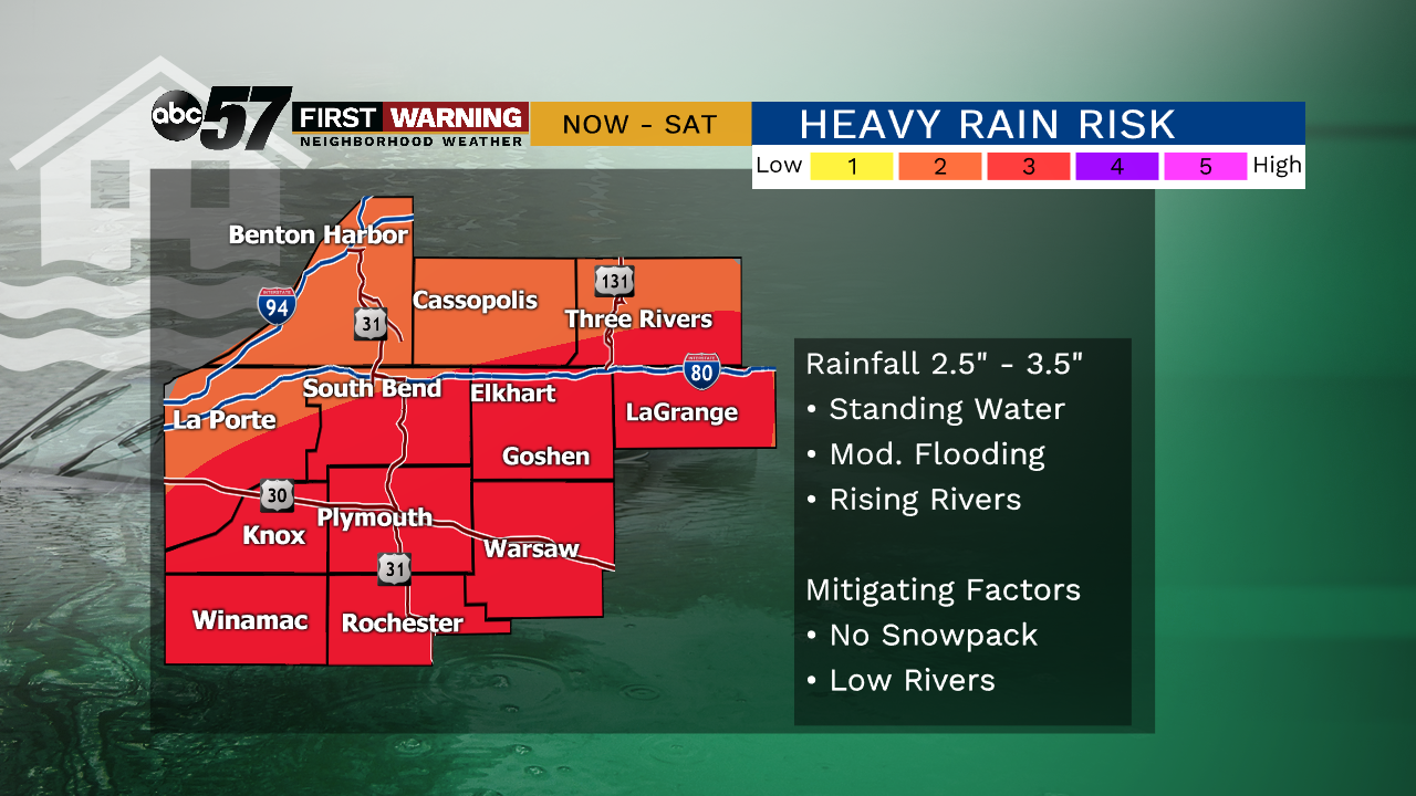
Tonight: Heavy rain, flooding possible, temperatures hold close to 50.
Saturday: Heavy rain, flooding possible, breezy, temperatures fall to 35.
Saturday Night: Sleet possible, standing water will freeze, low 25.
Sunday: Mostly cloudy. High of 34.
Monday: Mostly cloudy. High of 40.
Sign up for the ABC 57 Newsletter