Heavy rain still the biggest threat with messy end of week storm


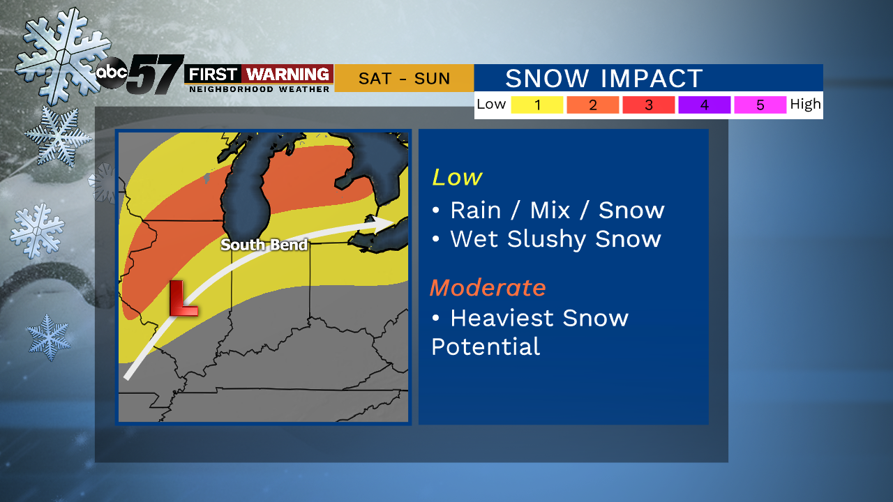
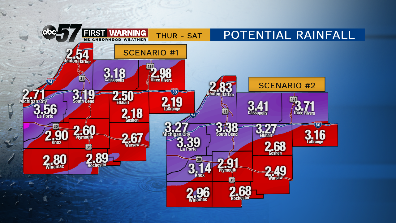
A one day cold snap, Wednesday. Temperatures will fail to reach 30 for a high, then the warm-up begins to end the week. Thursday will be breezy, gusts topping 30 mph as temperatures climb into the mid-40s. The forecast remains mild through Friday with widespread rain. The heavy rain threat may be greater than the snow threat, with more than two inches possible through midday Saturday. Rain changes to mix/snow Saturday afternoon as temperatures fall. The forecast remains slushy and sloppy.
Tonight: Mostly cloudy, chance of flurries. Low of 20.
Wednesday: Partly cloudy to mostly sunny. High of 27.
Thursday: Mostly cloudy, breezy, PM rain. High of 46.
Friday: Rainy. High of 48.
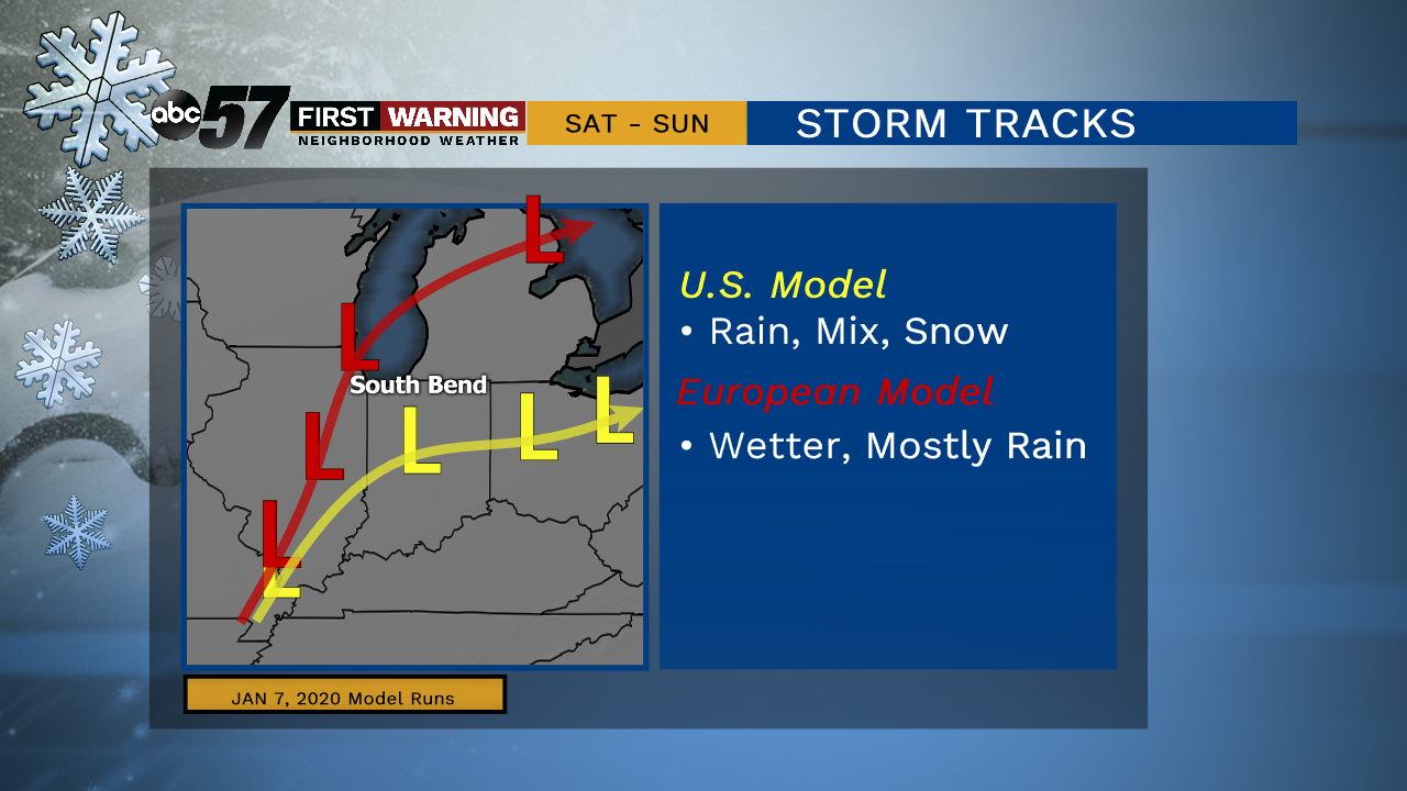
There is some model disagreement on the [day 4] forecast track of the low. Even with a disagreement in track both solutions trend less on a snow impact and more on rain, keeping the area in the ‘wet zone’ longer.