Heavy rain threat returns by Wednesday
Posted: Aug 14, 2018 11:12 AM EDT
As has been the case with many rainfall events this summer, the threat for heavy rain exists in association with an area of low pressure set to skirt on by Wednesday into Thursday. The low will allow Gulf of Mexico moisture to stream into the Ohio Valley and Lower Great Lakes. In turn, the potential is there for heavy rainfall rates and some hefty totals by the time all is said and done late Thursday. It isn't necessarily a guarantee that Michiana will see extremely heavy rain and flooding, but the threat is there courtesy of the variables that will be in place.
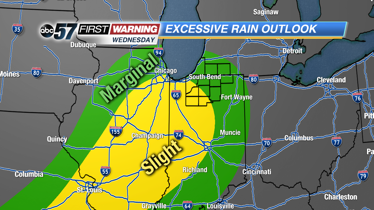
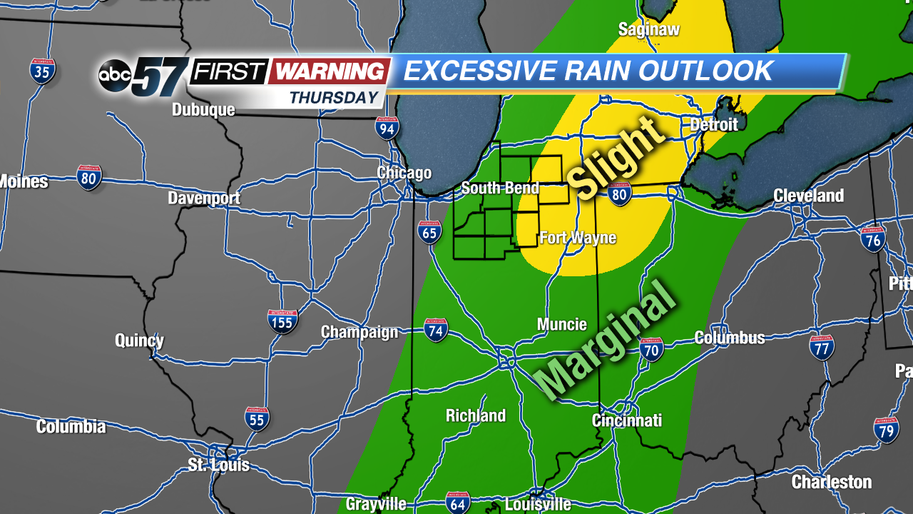
The Weather Prediction Center has put all of Michiana in at least a minor ("Marginal) risk for excessive rainfall meeting flash flood guidance within 25 miles of a particular point. Parts of the area have been placed in the 2nd of four categories ("Slight Risk"). What this means is that the variables in place will be potentially supportive of heavy rainfall leading to some instances of high water, standing water and minor flash flooding. The chances aren't overwhelming, but they are certainly there.
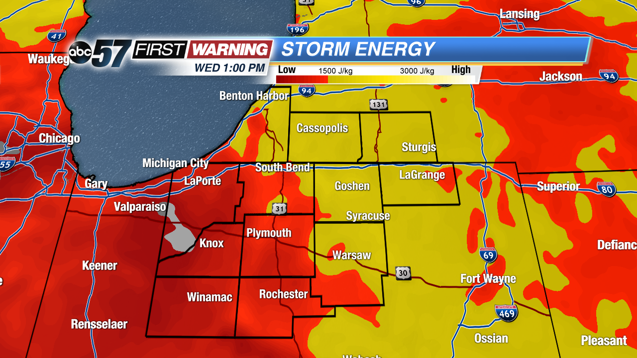
The other side of any rain and storm chance is the risk of severe weather. Fortunately, that risk appears to be very, very low. There will be a decent amount of "storm energy" in place, especially if we squeeze out any sunshine on Wednesday or Thursday. However, other variables will be significantly lacking. As a result, the Storm Prediction Center has not placed Michiana in any sort of severe threat for Wednesday or Thursday. This does not mean we won't see a stronger storm or two. That is always a possibility when there's moisture, energy and an area of low pressure. The main risks, aside from heavy rain, would be lightning and gusty winds with any stronger showers and storms.


