
-
1:24

Storm track timing could be shifting
-
0:57

The Unity Gardens brought music, food, and crafts for their Westside...
-
1:50

Quiet evening, Storms after Midnight
-
0:57

Deer Creek Hunt Club throws a skeet shoot event for Deputy Jon...
-
1:44

Two rounds of storms Monday
-
1:07

Mini heat wave starts out the door
-
2:23

La Porte community rallies for Sammy Strong Benefit, raising...
-
1:57

The Potawatomi Zoo opens its gates to Zoo Nights Live
-
2:50

Carson Kvapil wins his first O’Reilly Auto Parts Series win...
-
1:10

William Tuffs honored as the only Indiana man who took part of...
-
0:50

Beacon Health held a Health and Wellness fair for the community
-
1:03

Warm conditions start overnight

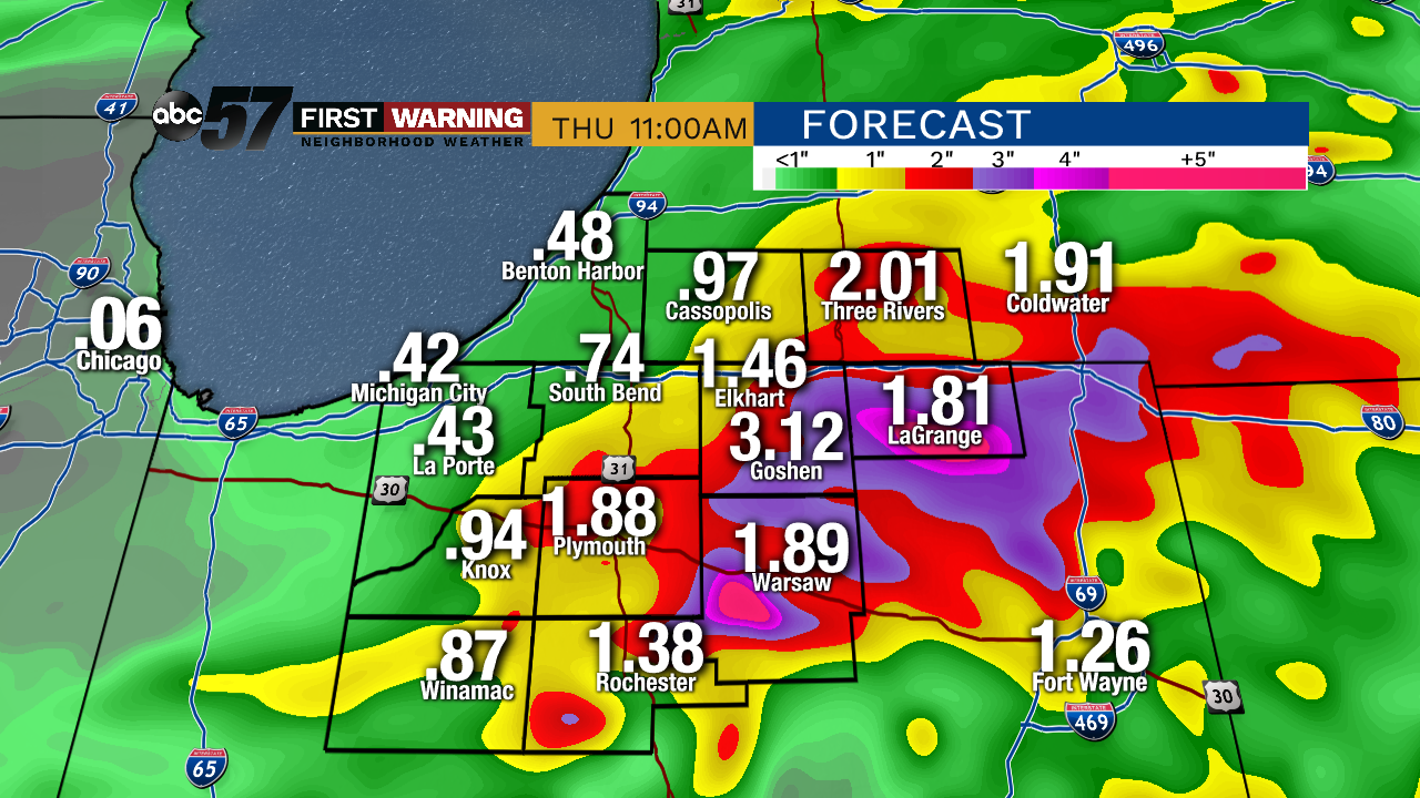
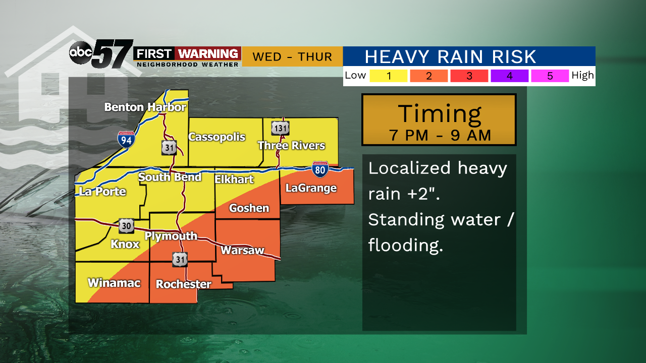
The weather stays dry for most of Wednesday but showers and storms become more likely by evening and overnight. Continuing the trend of late, heavy rain and flooding will be the top concern due our saturated atmosphere and soil. Localized downpours of more than two inches are possible with many seeing nearly one inch by Thursday afternoon. Warmer weather arrives with the Summer Solstice Friday, as highs look to stay near 80 for the foreseeable future. Warmer temps will also make pop-up showers and storms also more likely.
Tonight: Partly cloudy, low of 62.
Wednesday: Increasing clouds, chance of showers and storms, high of 78.
Thursday: AM showers, mostly cloudy, high of 68.
Friday: Mostly sunny, high of 78.
Sign up for the ABC 57 Newsletter