Here's why rain will be the primary precip with our next system


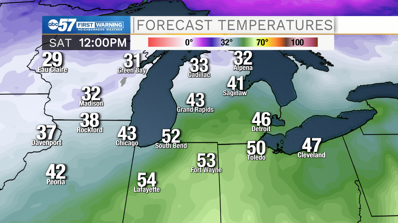
Rain showers will move into Michiana later tonight and stick around throughout most of your Saturday. Rain will be the primary precip type that we will deal with here in north central Indiana and southwest Michigan due to the track of the low pressure system. The same can't be said however for folks living in central and northern Michigan. Why is this?
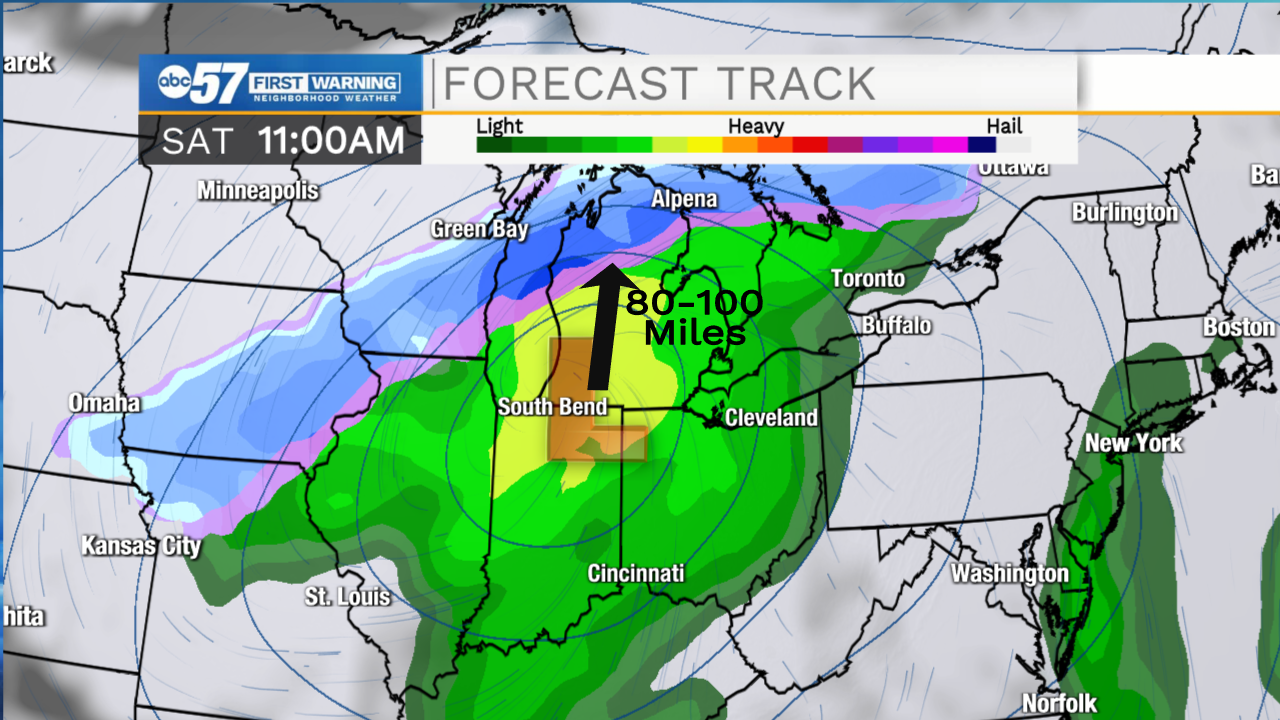
Typically this time of year in order for us to see system snow, not lake effect, here in Michiana we need a low pressure center to travel 80-100 miles south of us. This allows a deeper layer of cold air to interact with the available moisture and provide us with prolonged snow showers. With the system that arrives tonight, the low looks to move directly over the Michiana area. This gives places 80-100 miles north of us better chances for higher snow accumulation.
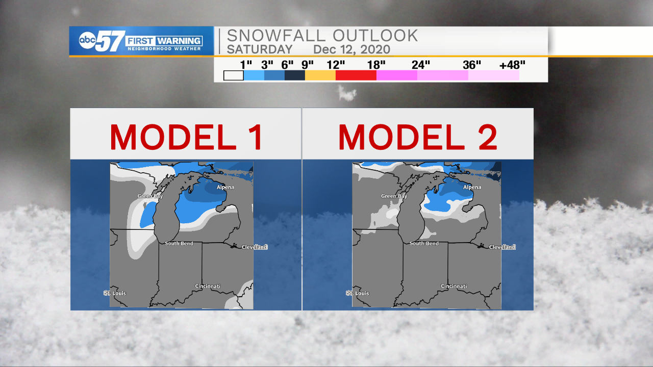
Temperatures throughout your Saturday will stay well above freezing as the cold front remains north and west of the Michiana area. It's not until later tomorrow night and Sunday morning that we finally see temperatures drop to near freezing, which is more supportive of a little snow development. We aren't tracking any notable accumulation, but a few slick spots are possible given the cold temperatures and wet pavement.