


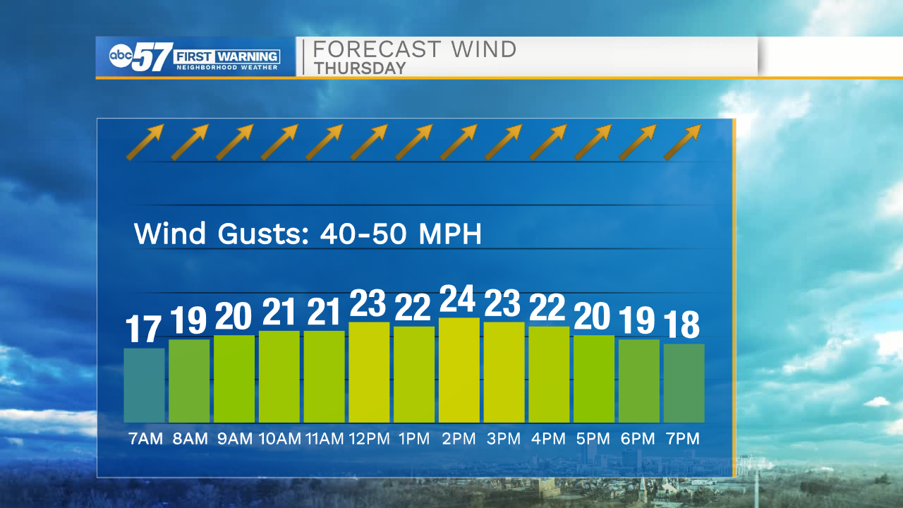
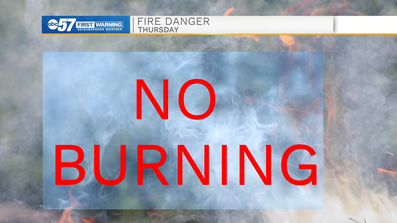
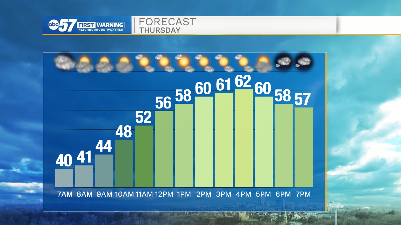
Strong winds are already present this morning and look to stick around through most of the day. The wind advisory in effect for all of Michiana remains in place through 5pm. Winds will range from 20-30mph with gusts into the 40-50mph range. Do not burning anything today as the strong winds and dry conditions make for a high fire danger. We will see some sunshine today, which will help temperatures warm into the lower 60s this afternoon.
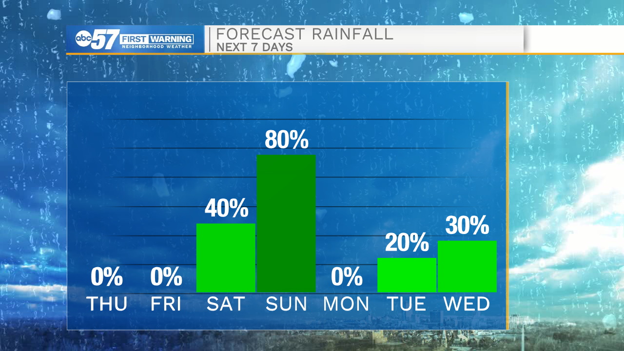
Rain chances return Saturday and look to stick around through Sunday night. The best chance for widespread rain here in Michiana will be Saturday night into Sunday morning. High temperatures this weekend will be in the mid 40s. More rain chances are in the forecast for most of next week. Temperatures next week will mostly remain in the 40s.
Today: Partly cloudy to mostly sunny. High 62.
Tonight: Partly cloudy. Low 48.
Tomorrow: Partly cloudy. High 60s.
Saturday Scattered showers. High 46.