


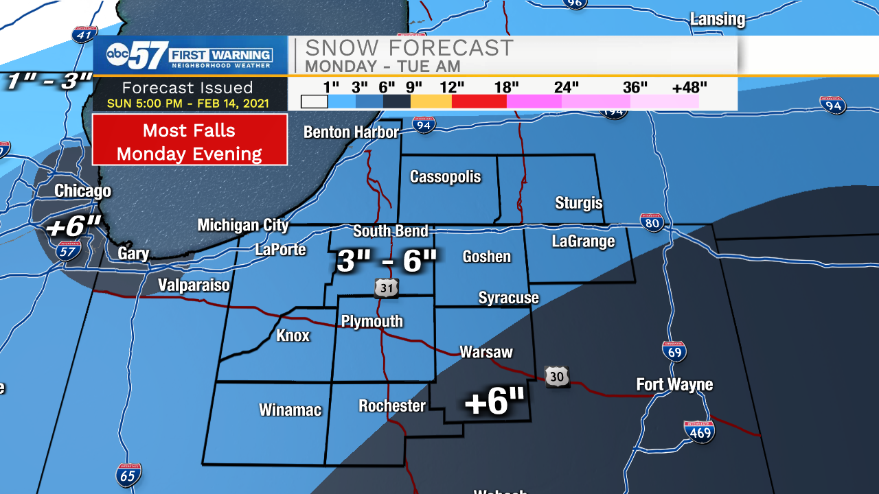
Isolated light snow showers remain ongoing for portions of Michiana. We will see a slight uptick of snow coverage later this evening into tomorrow morning. Snow showers will clear out tomorrow by mid to late morning before another round returns tomorrow afternoon and evening. Widespread moderate to heavy snow showers are expected Monday evening through the early morning hours Tuesday. Most places throughout Michiana will see 3-6 inches of snow with isolated higher totals in Kosciusko and Fulton counties. The highest travel impacts will come late Monday evening and Tuesday morning. Another round of accumulating snow looks to move into Michiana Thursday. Temperatures will slowly warm into the upper 20s to lower 30s by next weekend!
Tonight: Snow showers. Low 6.
Tomorrow: Snow showers. High 14.
Tuesday: AM Snow showers. High 16.
Wednesday: Partly cloudy. High 20.