
-
2:23

La Porte community rallies for Sammy Strong Benefit, raising...
-
1:57

The Potawatomi Zoo opens its gates to Zoo Nights Live
-
2:50

Carson Kvapil wins his first O’Reilly Auto Parts Series win...
-
1:10

William Tuffs honored as the only Indiana man who took part of...
-
0:50

Beacon Health held a Health and Wellness fair for the community
-
1:03

Warm conditions start overnight
-
1:02

Another pleasant day
-
0:42

Still cooler out the door
-
2:00

New Carlisle celebrates annual Hometown Days
-
1:40

Ross Chastain leads NASCAR O’Reilly Auto Parts Series practice...
-
2:27

Backpacks for Berrien hosts their Stuff-a-Bus event, ultimate...
-
2:59

Ludacris Opens Elkhart County 4-H Fair Concert Series Amid Ticket...

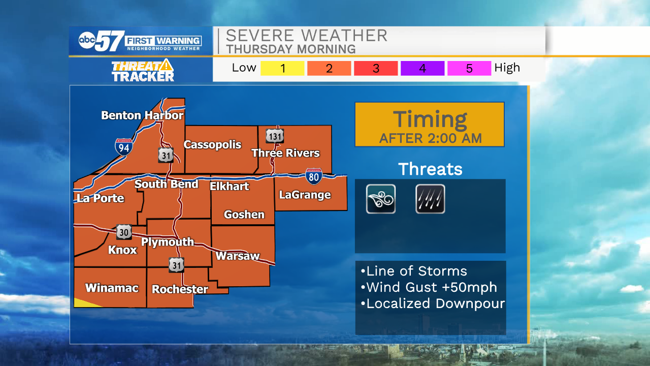
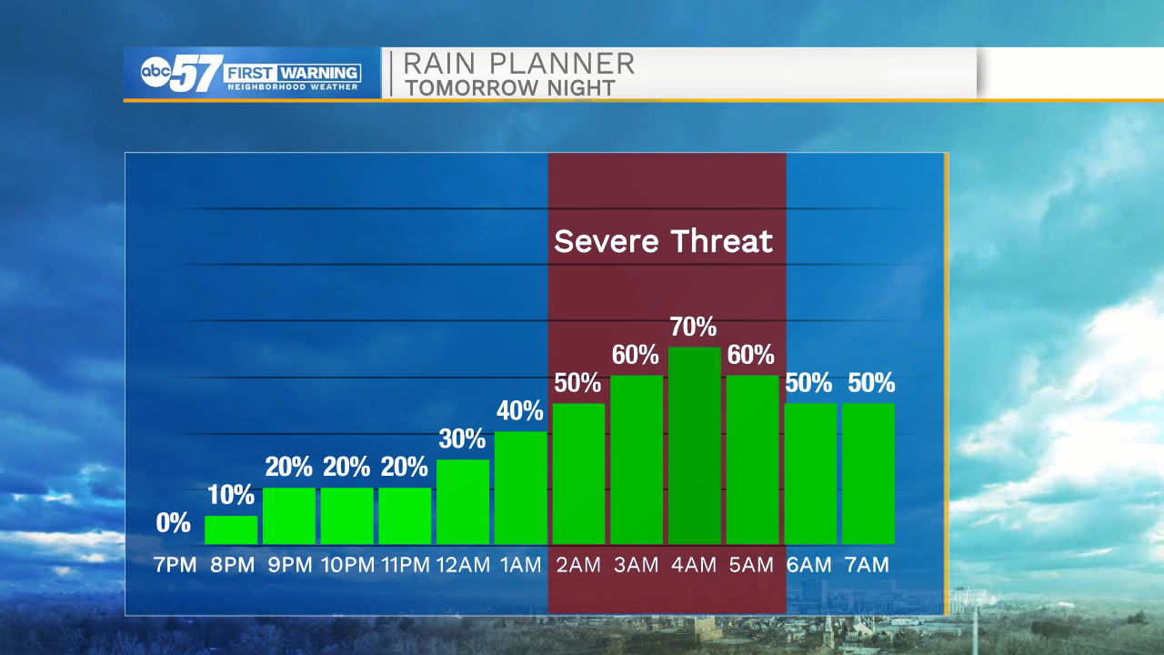
Steamy weather Wednesday, ahead of a round of storms early Thursday morning, then a drop in humidity to end the week. Focus will be on a complex of storms that forms across Wisconsin Wednesday night, arriving in Michiana early Thursday morning. The estimated arrival of storms is after 2:00 a.m. which lowers the severe risk, but severe weather is possible. The forecast is much milder Thursday and through the weekend.
Tonight: Mostly clear. Low 70.
Wednesday: Mostly sunny. High 88.
Thursday: AM showers/storms. High 82.
Friday: Partly cloudy. High 78.
Sign up for the ABC 57 Newsletter