ABC57 First Warning Neighborhood Weather Forecast
Monday, August 23rd, 2021
There are areas of patchy dense fog this morning. Plan on a little extra time for your morning commute. Fog will improve after 9 AM. For any school delays, click here.
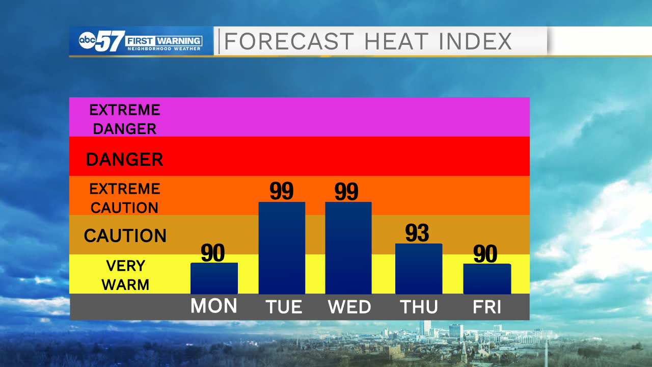
We have a hot and humid week ahead of us. Today we top out in the upper 80s and then in the low 90s Tuesday through Thursday. We settle into an active weather pattern as well with a chance lasting through Friday. We will still have times of sunshine each day, but you will need to stay updated on timing of storms to plan around them. The heat continues into the weekend. We finally see relief from a cold front on Monday.
Today: Mostly sunny. High 88.
Tonight: Partly cloudy. Low 70.
Tuesday: Hot and humid. Mostly sunny with scattered thunderstorms. High 90.
Wednesday: Hot and humid. Scattered thunderstorms. High 91.