Hot and humid with isolated evening storms

-
2:51

Governor Whitmer appeals FEMA federal aid denial for Southwest...
-
3:17

Benton Harbor leaders weigh Jean Klock Park upgrades amid debate...
-
1:40

Pollinator Playpath, a trail for kids, now open at Corson Riverwoods...
-
0:32

Ryan Newman racing Saturday at Plymouth Motor Speedway
-
3:08

Officials recover body of missing teenager in Lake Michigan off...
-
2:45

NCAA’s new eligibility rule could reshape Notre Dame roster...
-
1:08

Storms start this afternoon
-
0:56

Calm morning, storms tonight
-
2:43

South Bend residents see future plans for former Drewry’s Brewery
-
2:45

Damage assessment continues in Elkhart County following EF-2...
-
0:44

Indiana and Illinois set record for tornadoes
-
1:27

Community Build underway at Kathryn Park

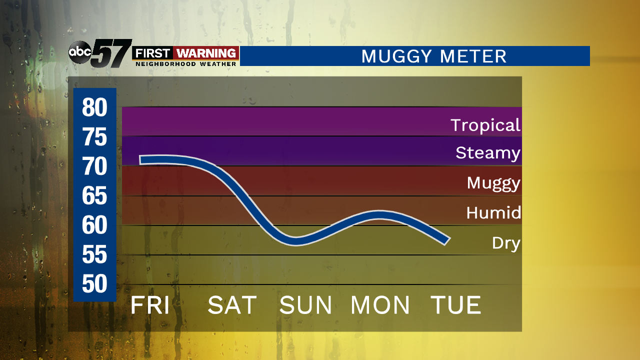
Happy 4th of July! The pattern of sunshine during the day and isolated storms in the evening continues today. It’s another hot and humid as well so make sure you’re drinking plenty of water while celebrating the holiday. Scattered showers and storms work their way through on Friday as a cold front sweeps through the area. A couple showers could linger into Saturday morning. The cold front will knock temperatures into the low 80s with low humidity over the weekend. We then have a nice stretch of sunny days heading into next week.
Today: Partly cloudy, isolated evening storms possible, high of 88.
Tonight: Isolated storms possible, partly cloudy, low of 72.
Friday: More clouds than sun, scattered thunderstorms, high of 87.
Saturday: Morning showers / storms then clearing, high of 83.