
-
1:03

Mentone Egg festival brings a clutch of people to enjoy its history
-
0:46

9th annual Hall of Heroes Comic Con concludes its first day
-
2:39

South Bend Barber celebrates retirement after 59 years
-
0:45

OC fireworks reveal their new showroom
-
0:57

Thousands take part in Sunburst Run to raise funds
-
2:00

Annual Studebaker car show takes over Ironwood Plaza
-
0:55

Beautiful weekend expected
-
1:05

Truly wonderful conditions
-
0:41

One person left with serious injuries after high-speed pursuit...
-
2:15

Fort Wayne Tin Caps put an end to the SB Cubs winning streak
-
1:21

This weekend is the annual Hall of Heroes Comic Con
-
0:46

Elkhart Police Department respond to shots fired call at the...

The threat of rain overnight is minimal with only isolated pop-up showers.
No relief from the humidity Friday, hot and very humid with a head index 95 to 100. Friday night and early Saturday is the time frame for the next round of storms. The latest set models predict a one-two punch, Friday evening and again Saturday morning. Both could bring severe weather and combined the total rainfall could produce flooding with more the two inches possible. The steamy and stormy pattern end Sunday into Monday.
Tonight: Partly cloudy, extremely muggy, low 70
Friday: Very humid, high of 90, evening thunderstorms
Saturday: Morning thunderstorms, highs in the mid-80s.
 Heat index Friday forecast back between 95 and 100.
Sunday: Mostly sunny, high in the mid-80s.
 Round 1 of storms Friday evening
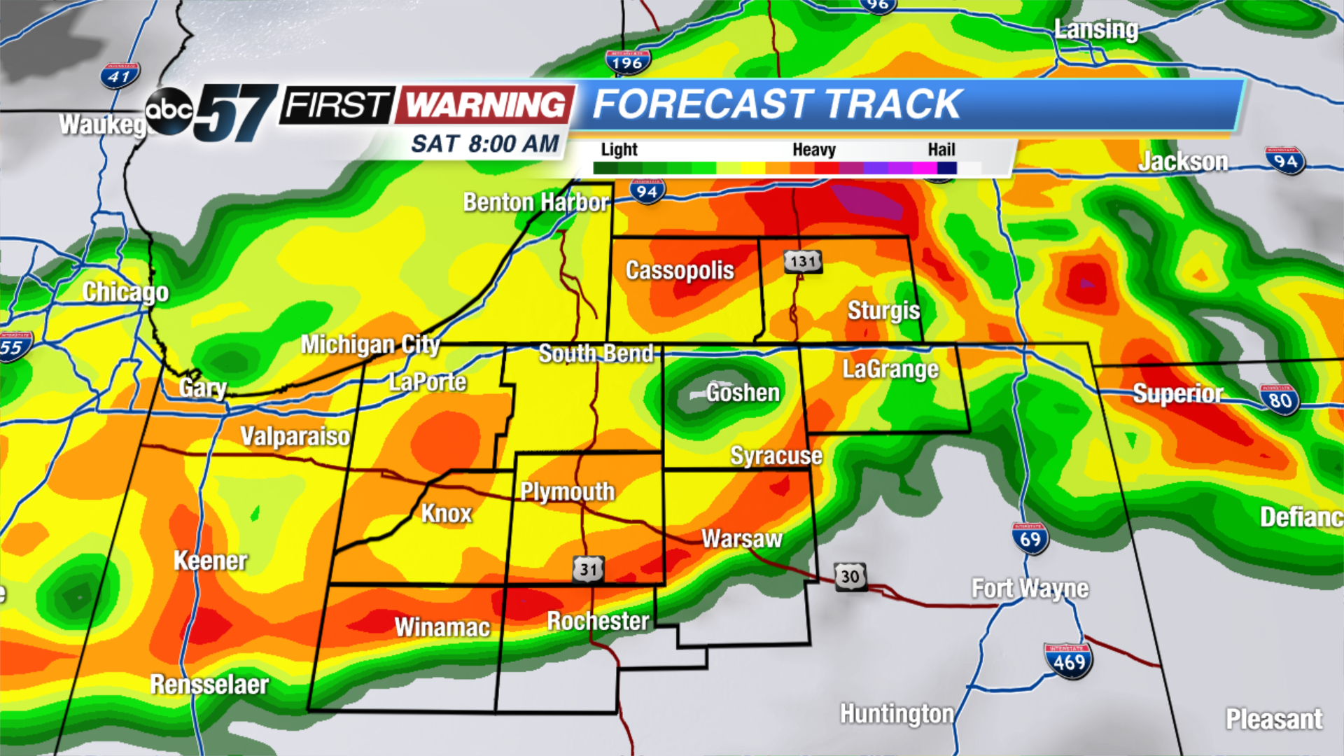 Round 2 of storms Saturday morning.
Sign up for the ABC 57 Newsletter