
-
1:33

Cool out the door, Mild by afternoon
-
1:50

Top Ten Snow Year 2025-26
-
1:17

South Bend Cubs unveil fan-focused upgrades ahead of Opening...
-
2:21

Notre Dame Fighting Irish ready for spring football
-
2:06

Fighting Irish using time off to refocus ahead of spring practice
-
2:35

What are the privacy implications of SBPD’s ’Drone as First...
-
1:22

Expert discusses Wednesday’s Fed decision
-
3:19

New legislation could make Michigan the 30th constitutional carry...
-
2:15

SBPD using drones to help improve response time
-
1:20

The March roller coaster ride continues
-
1:52

Snow today, rain tomorrow, and warm this weekend
-
0:49

Celebrating St. Patrick’s Day at Corby’s Irish Pub

The dog days of summer last through Wednesday, highs near 90 and rising humidity. The heat breaks Thursday with morning showers and thunderstorms, at this point a severe threat is very low. Thursday morning may be the only chance of rain over the next ten days as we trend drier and milder through the weekend.
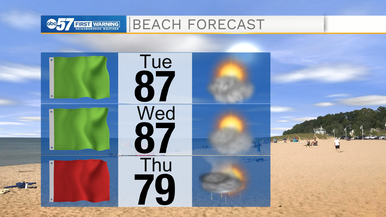
The haze also returns Tuesday and Wednesday, but the cold front Thursday should clear the air along with the humidity.
Tonight: Mostly clear. Low 66.
Tuesday: Mostly sunny. High 90.
Wednesday: Partly cloudy. High 90.
Thursday: AM showers. High 82
Sign up for the ABC 57 Newsletter