


Storms from the overnight hours will be wrapping up early this morning. There’s a dry period through the early afternoon, then we will watch for another round of showers and thunderstorm in the second half of the day.
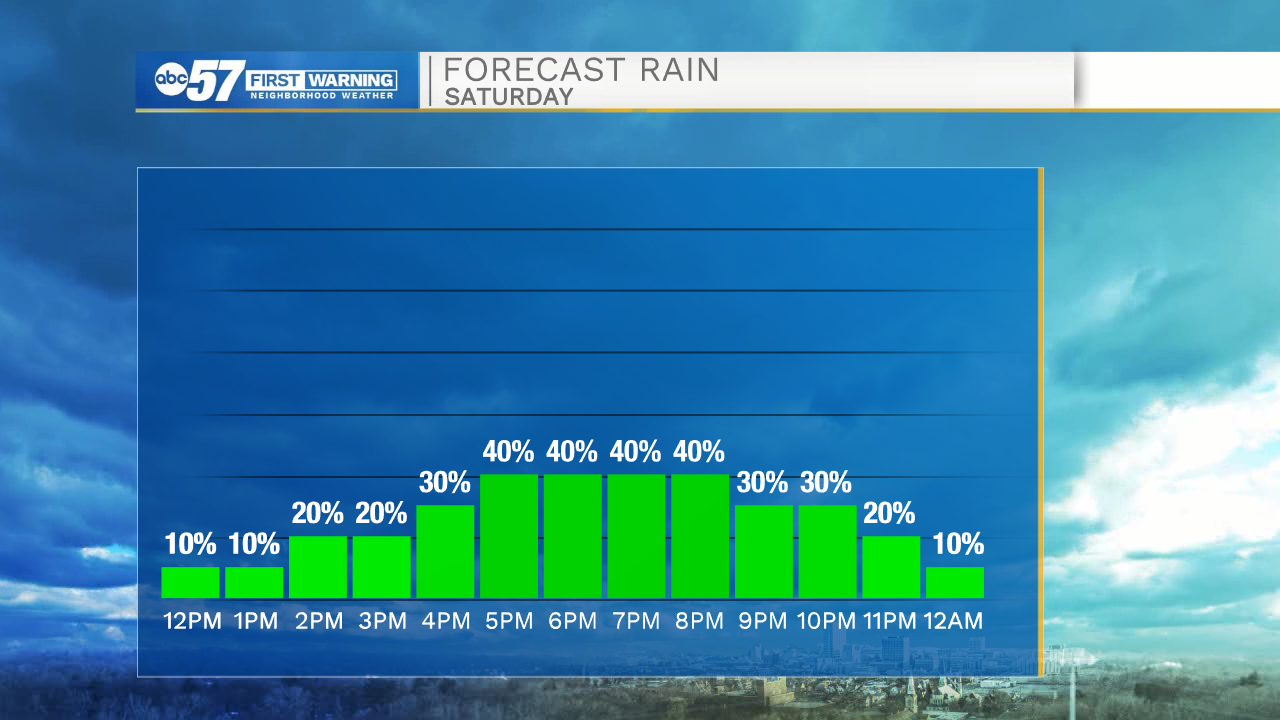
Some of this afternoon’s showers could have periods of heavy rain or gusty winds. No severe weather is expected.
While a few showers or storms could linger into the overnight hours, Sunday is trending mostly dry. If you have plans to get outdoors, keep in mind it is hot and humid. While Sunday’s high is around 90, it may feel like the mid 90s with humidity. Stay hydrated!
Beach forecast this weekend looks good to go; green flag is expected both days. There are additional storm chances this week and the heat stays high.
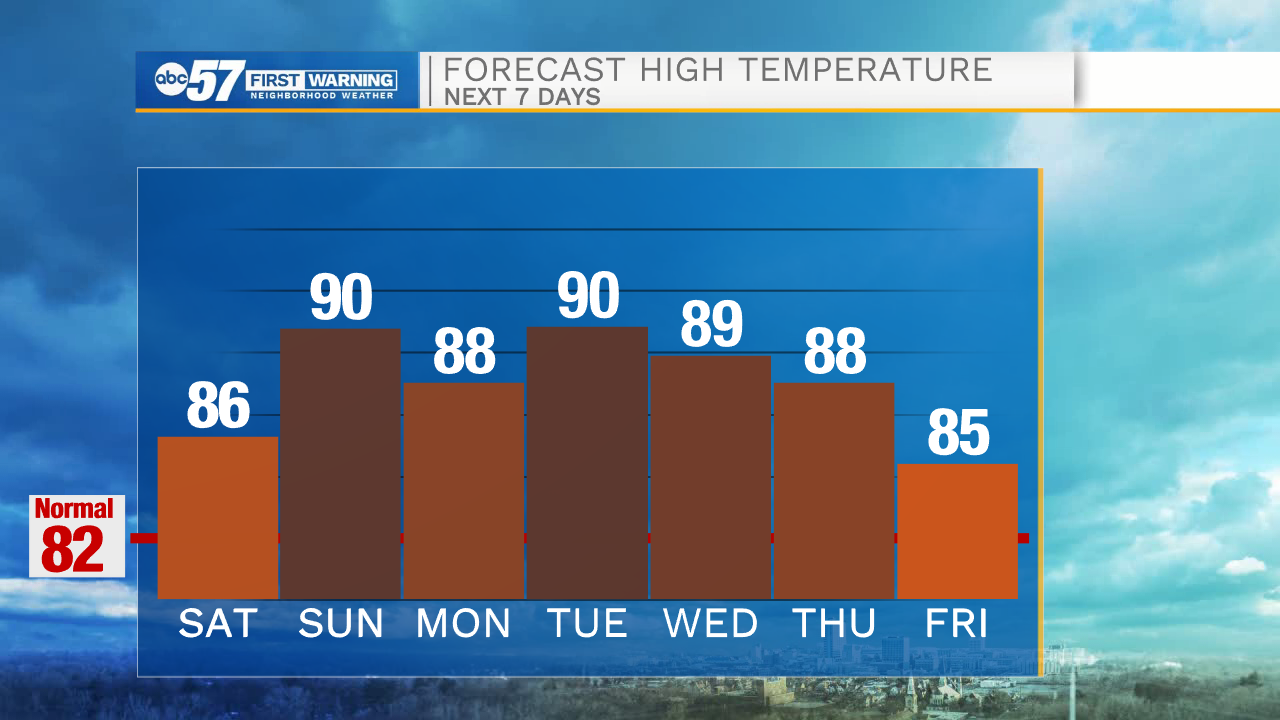
Today: Partly to mostly cloudy. Afternoon storms. High 86.
Tonight: Storms early. Low 70.
Sunday: Mostly sunny and hot. High 90.
Monday: Scattered thunderstorms. High 88.