The threat for strong to severe thunderstorms and heavy rain is increasing for the Thursday afternoon thru Friday evening period courtesy of a frontal boundary and area of low pressure that will be nearby.
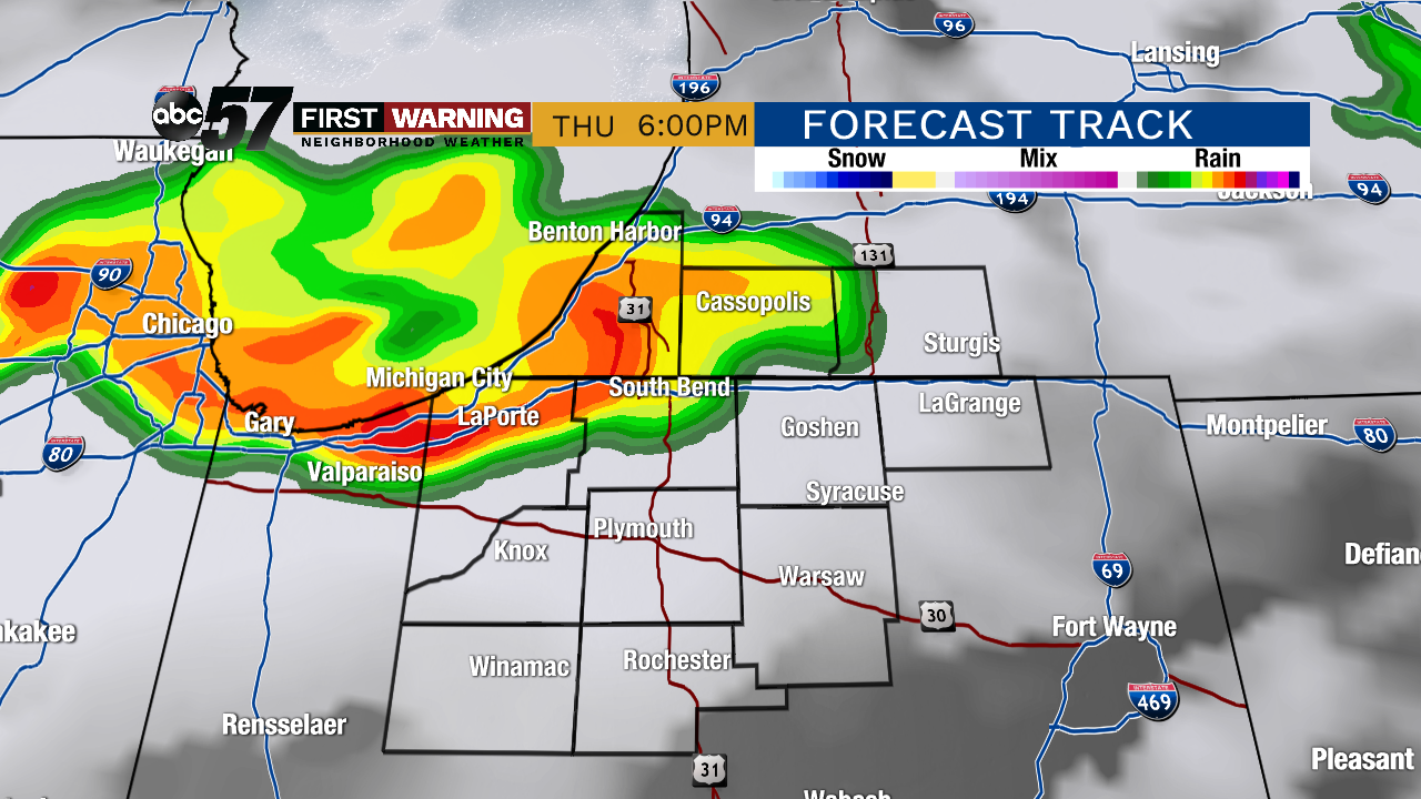
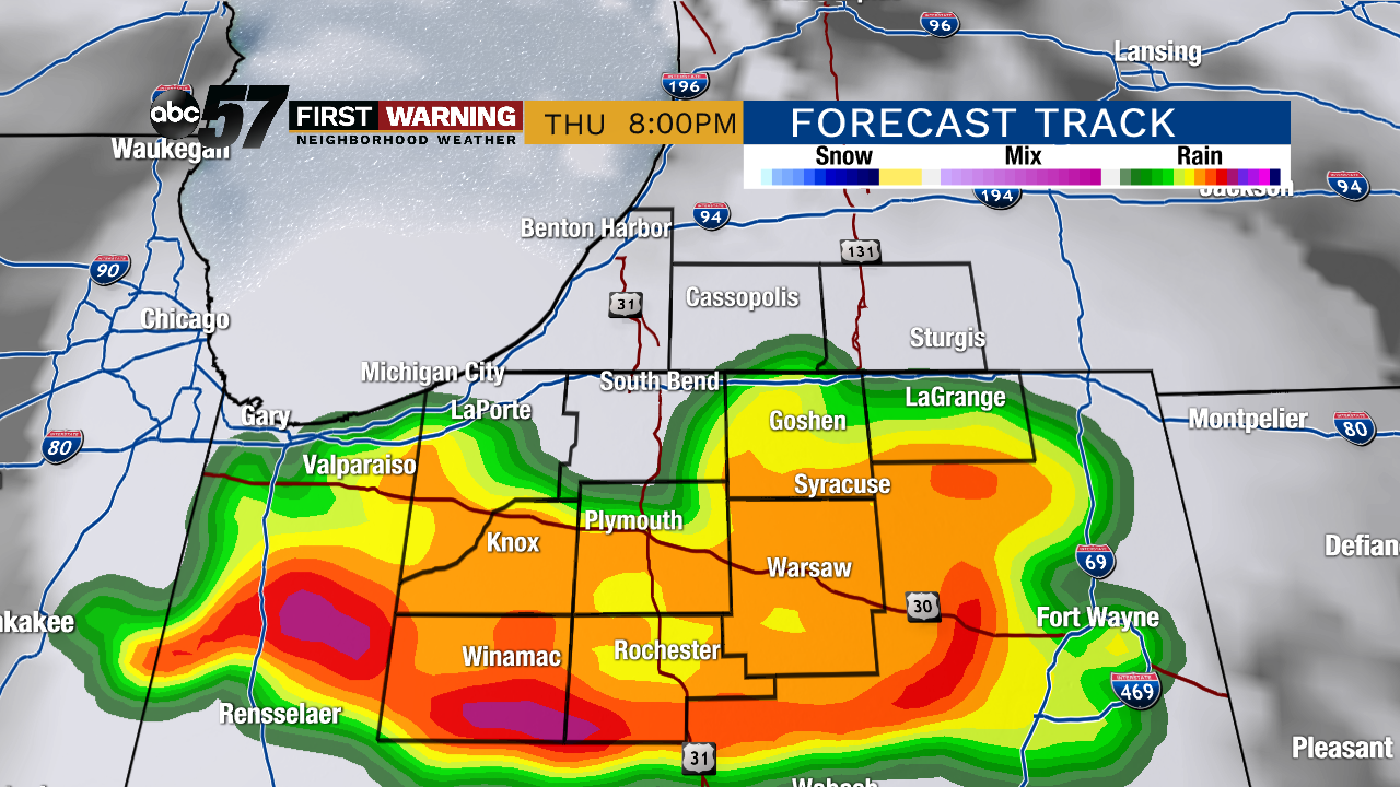
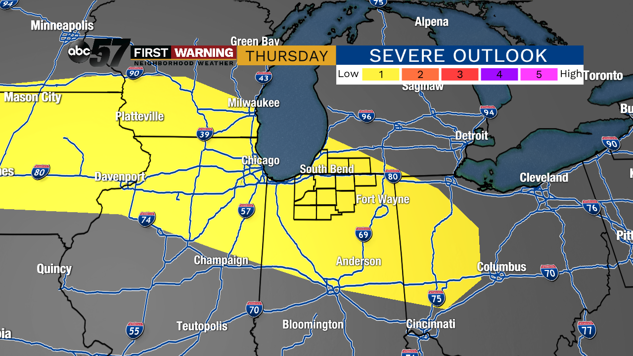
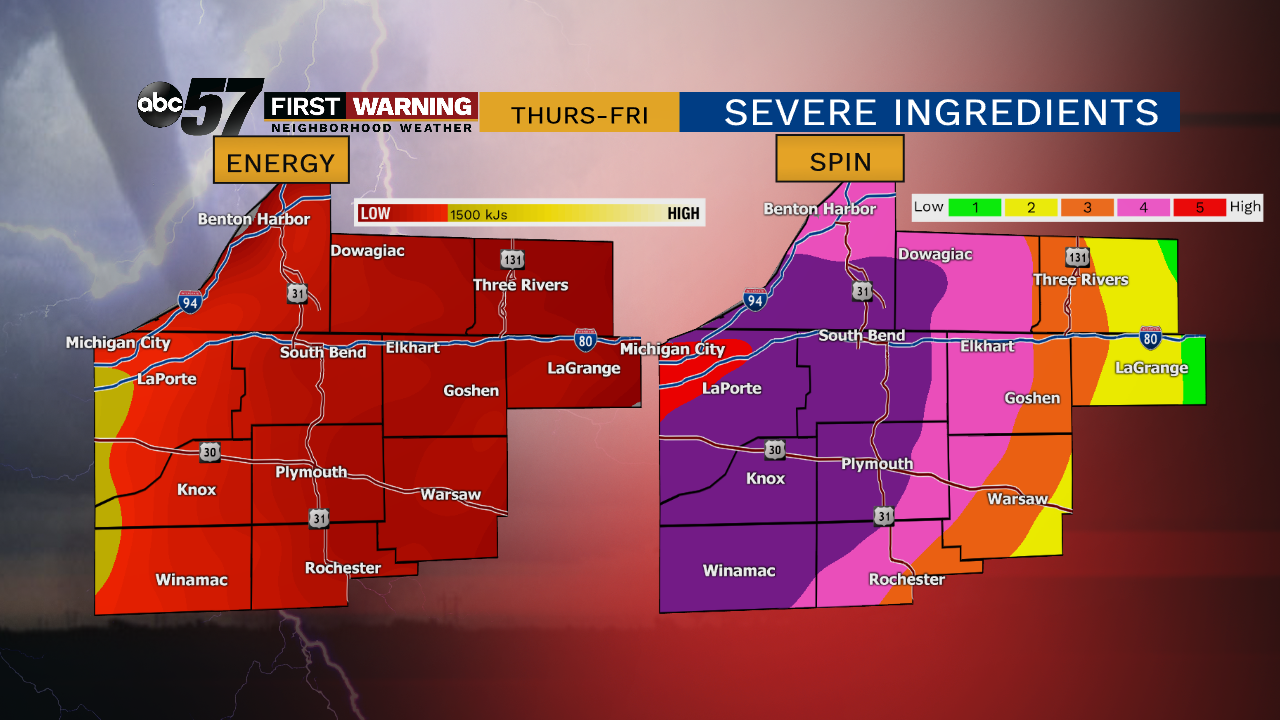
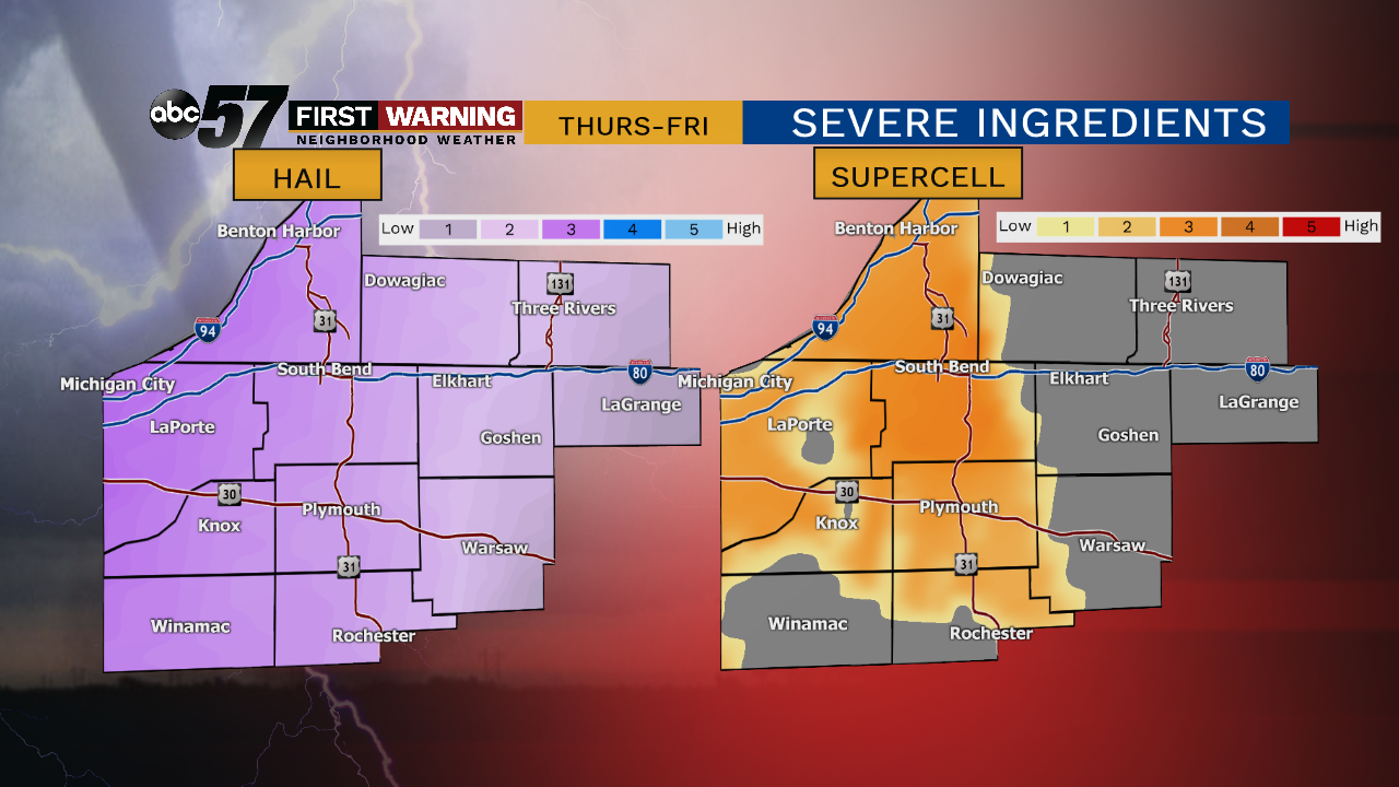
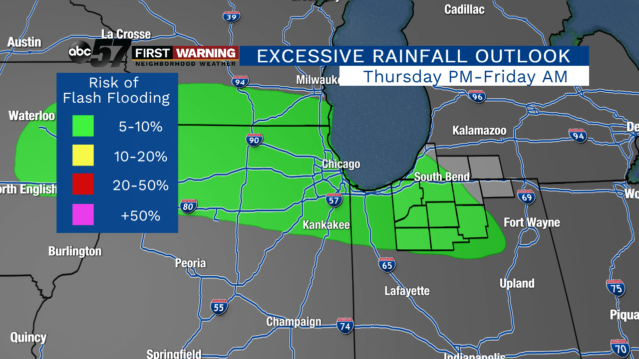
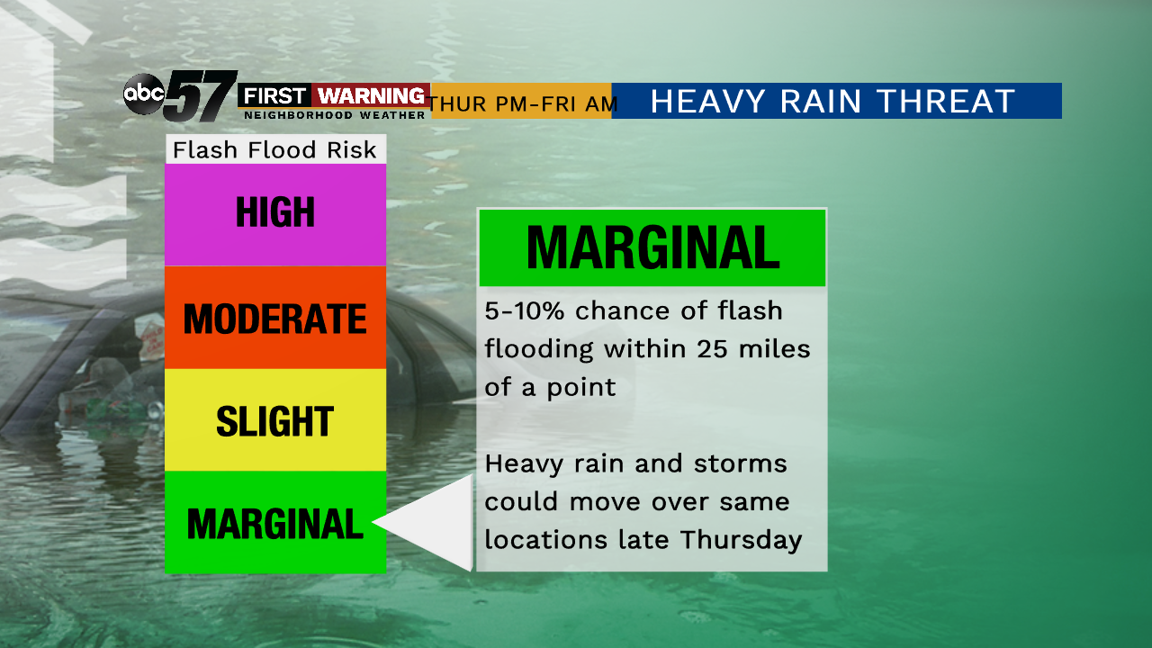
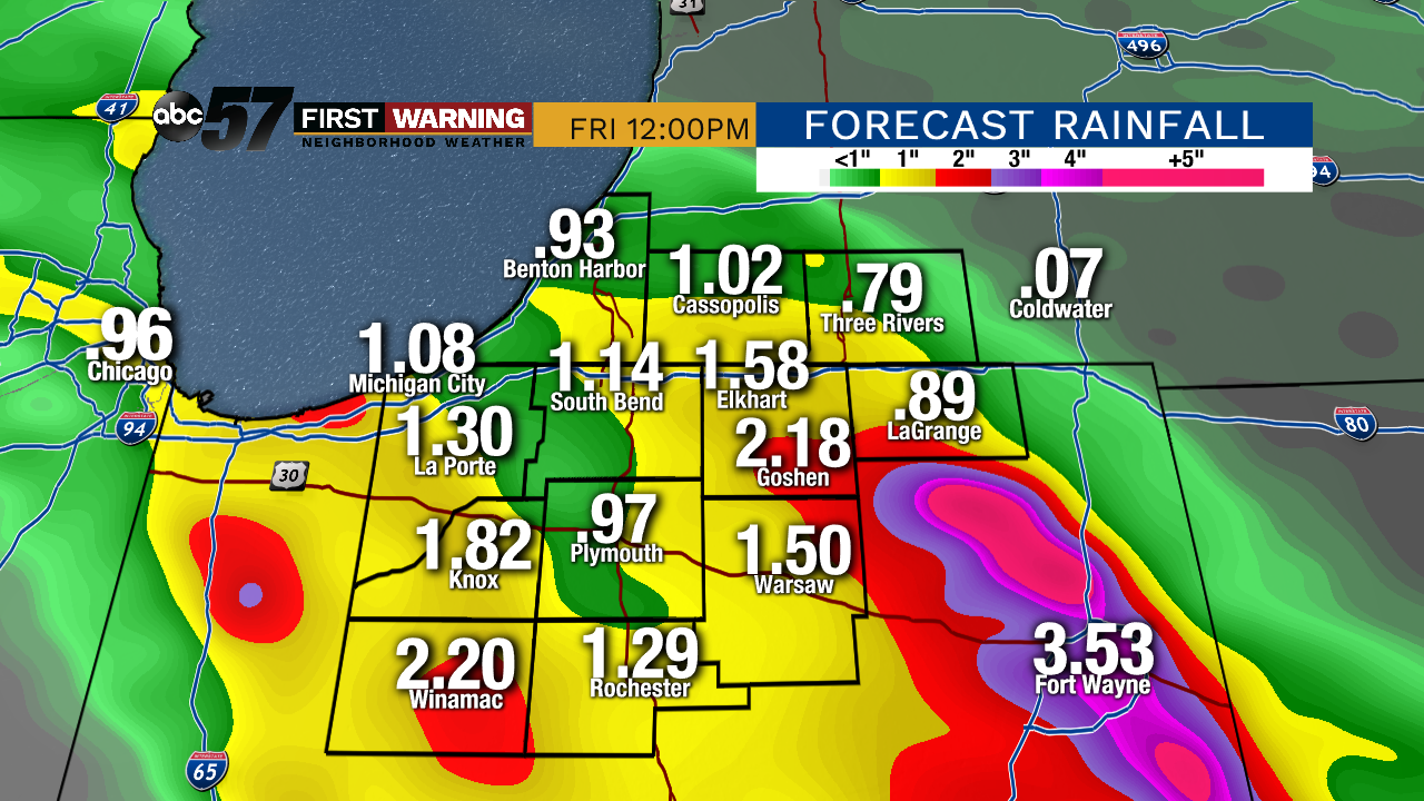
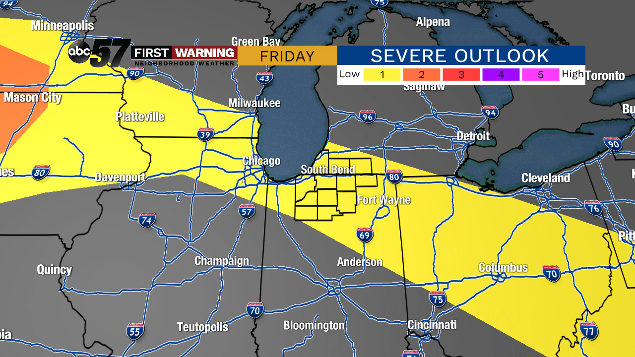
The latest information as of early Wednesday afternoon suggests a few rounds of rain and thunderstorms are likely. Round one could come through during the 4-9 p.m. window Thursday. You can see the future radar images at both 6 p.m. and 8 p.m. shown above and below. Most models agree on some sort of line or complex of thunderstorms moving through during that period, give or take a few hours. The potential will certainly exist for damaging winds, hail and torrential rain with that complex of storms. As a result, the entire Michiana viewing area has been placed under a "Marginal Risk" for severe weather, per the Storm Prediction Center. That is the lowest of severe risks, but the potential for an upgrade is there, especially considering the latest information coming in. For example, let's take a look at four variables that meteorologists often analyze to determine whether or not there will be a severe weather threat. Storm energy and spin energy will be in the moderate to even high category Thursday evening and night. That alone can support at least a few strong to severe thunderstorms. The hail index and supercell index are also running in the moderate category Thursday evening depending on how things set up. Essentially, what you need to know is that the ingredients to support strong and severe thunderstorms will be in place Thursday late afternoon thru Thursday night. Will everyone see severe weather? Probably not. Are we expecting numerous severe thunderstorms? Not at this time. What we are saying is the threat for strong to severe wind and hail is there between 3 p.m. Thursday and Friday morning. The other threat we are monitoring with any storms that move through is heavy rain and flash flooding. The Weather Prediction Center has already placed much of Michiana under a "Marginal Risk" for flash flooding Thursday into Thursday night. What that means is there is a 5-10% chance of flash flooding within 25 miles of any point. In other words, there is a low chance of heavy rainfall that could lead to flash flooding at any point between Thursday afternoon and Friday morning. It will all depend on where exactly the heaviest rain falls. It's difficult to say where exactly the heaviest rain will fall, but it could be anywhere in Northern Indiana or Southwest Lower Michigan. If multiple waves of rain and thunderstorms move over the same area, that's when the risk of flash flooding becomes elevated. If storms do wind up affecting the same areas, upwards of 1-3" of rain is possible in a short duration of time, so be prepared for potentially quickly-changing conditions. Additional rain and storms are possible Friday as the front will still be close by. The Storm Prediction Center again places all of Michiana in the "Marginal Risk" for severe weather on Friday. Again, this is the lowest of risk categories, but the threat is there for a few strong storms capable of gusty winds, hail and heavy rain on Friday. Any areas that see rain on Friday after getting heavy rain Thursday or Thursday night will have an elevated flood risk.
