Isolated evening storms, otherwise drying out, hot and humid

-
0:36

Eddies Circuit Robotics holds competition Saturday
-
0:32

21st annual Nappanee Model Train Show
-
0:38

Local boys basketball team headed to IHSAA state finals
-
3:49

Midwest Meowfest brings kitten advocacy to attendees, new homes...
-
1:52

Mild tonight, showers tomorrow
-
1:43

Pleasant to start the weekend
-
3:06

Pulaski County weighs stricter solar rules amid resident concerns
-
0:40

Marian High School hosts World Down Syndrome Awareness Walk
-
2:33

South Bend leaders call for an end to gun violence
-
2:01

Tae Johnson, Notre Dame secondary stands out as Irish open spring...
-
2:21

Backup quarterback competition, position battles highlight Notre...
-
2:25

A new Pathway to the Golden Dome

ABC57 First Warning Neighborhood Weather
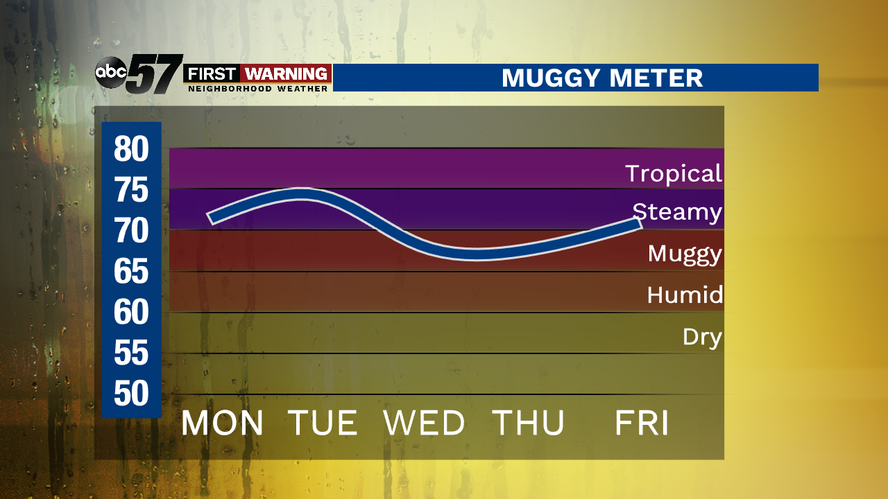
Monday, June 29th, 2020
This week is hot and humid. Daytime highs climb into the upper 80s the next two days and then into the low 90s through the holiday weekend. Make sure you’re drinking plenty of water and taking breaks from the heat. Today there is a chance of isolated storms this evening and overnight. A shower or storm may linger into Tuesday morning, otherwise the rest of the day is dry with clouds breaking up. The rest of the week is sunny and dry. Due to the lack of rain, take extra precautions when lighting off fireworks.
Today: Partly sunny. Evening thunderstorm possible. High 88.
Tonight: Isolated storm, mostly cloudy. Low 72.
Tuesday: Early morning t-storm possible then partly cloudy. High 88.
Wednesday: Mix of sun and clouds. High 90.