Isolated storms this evening, humidity on the rise

-
1:50

Showers and storms this afternoon
-
0:20

One person injured in shooting
-
0:36

Eddies Circuit Robotics holds competition Saturday
-
0:32

21st annual Nappanee Model Train Show
-
0:38

Local boys basketball team headed to IHSAA state finals
-
3:49

Midwest Meowfest brings kitten advocacy to attendees, new homes...
-
1:52

Mild tonight, showers tomorrow
-
1:43

Pleasant to start the weekend
-
3:06

Pulaski County weighs stricter solar rules amid resident concerns
-
0:40

Marian High School hosts World Down Syndrome Awareness Walk
-
2:33

South Bend leaders call for an end to gun violence
-
2:01

Tae Johnson, Notre Dame secondary stands out as Irish open spring...

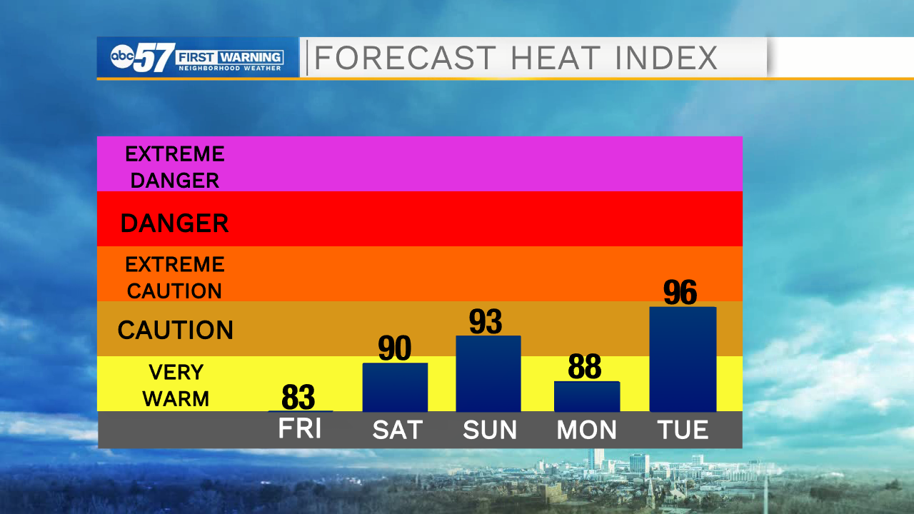
ABC57 First Warning Neighborhood Weather Forecast
Friday, August 6th, 2021
A few more clouds move in this afternoon with isolated thunderstorms during the evening. A strong to severe storm cannot be ruled out. Scattered thunderstorms last overnight and may linger into the early hours of Saturday.
The rest of Saturday is dry and partly cloudy. Humidity rises again this weekend and it turns hot for Sunday. More scattered storms move in on Monday, some of which could be strong to severe. Next week in general is hotter and muggy with more storm chances.
Today: Partly to mostly cloudy, isolated evening storms. High 83.
Tonight: Scattered thunderstorms. Low 68.
Saturday: AM shower/storm possible. Partly cloudy. High 86.
Sunday: Partly cloudy. High 90.