Lake effect and record breaking cold

-
1:03

Mentone Egg festival brings a clutch of people to enjoy its history
-
0:46

9th annual Hall of Heroes Comic Con concludes its first day
-
2:39

South Bend Barber celebrates retirement after 59 years
-
0:45

OC fireworks reveal their new showroom
-
0:57

Thousands take part in Sunburst Run to raise funds
-
2:00

Annual Studebaker car show takes over Ironwood Plaza
-
0:55

Beautiful weekend expected
-
1:05

Truly wonderful conditions
-
0:41

One person left with serious injuries after high-speed pursuit...
-
2:15

Fort Wayne Tin Caps put an end to the SB Cubs winning streak
-
1:21

This weekend is the annual Hall of Heroes Comic Con
-
0:46

Elkhart Police Department respond to shots fired call at the...

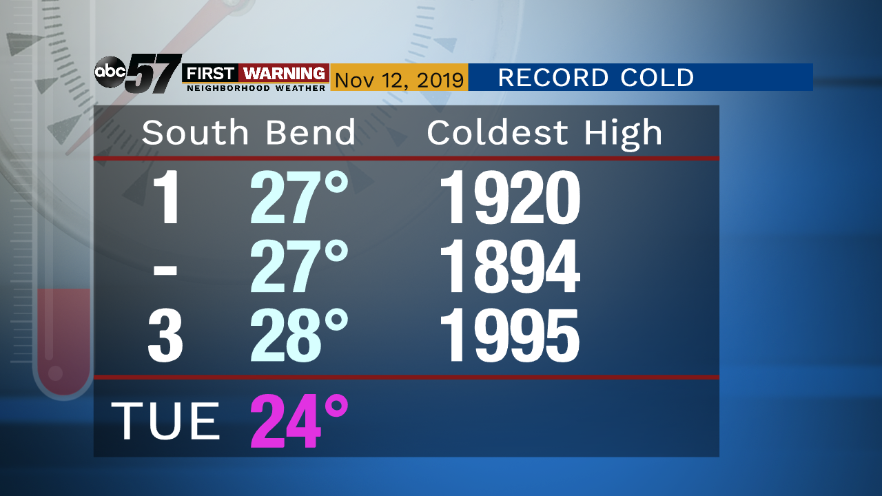
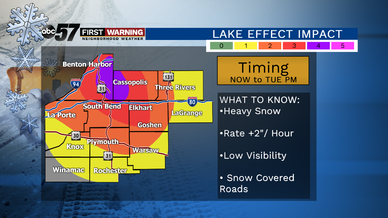
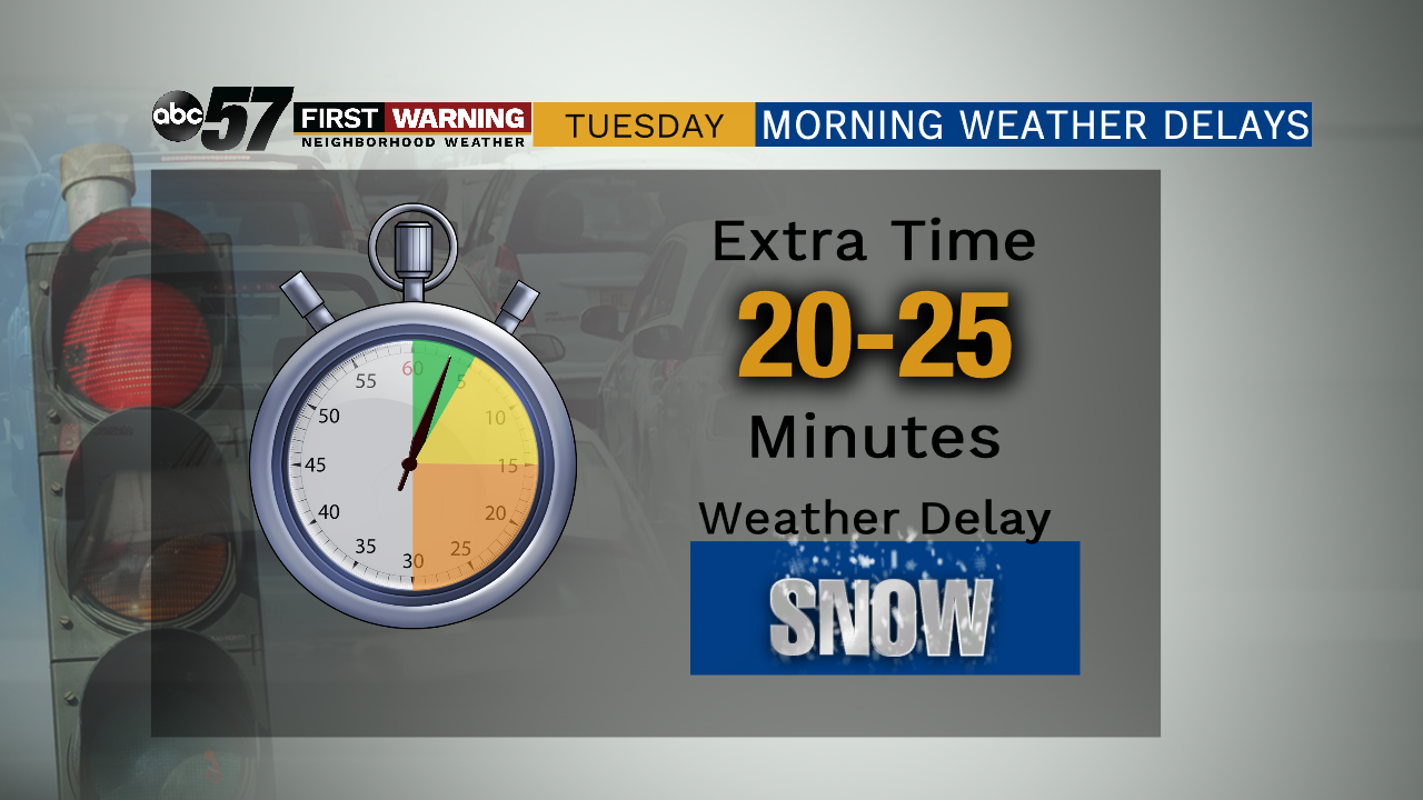
Tuesday, November 12th, 2019
Lake effect snow showers persist this morning, heavy in spots. Plan on slow going commutes as delays in travel are likely. Lake effect starts to taper down later this evening but it stays bitter cold. So cold in fact that we will likely break the record cold high as we only top out at 24 degrees today. It’s going to feel even cold as it will be breezy today. It bottoms out tonight, falling into the single digits. It’s another cold one Wednesday but thankfully without the snow. Temperatures slowly start to improve into the weekend.
Today: Lake effect snow showers, record-breaking cold. High of 24.
Tonight: Lake effect snow tapering off. Low of 8.
Wednesday: Mostly to partly cloudy. High of 28.
Thursday: Mostly cloudy, slight chance of snow. High of 32.