
-
3:38

Michigan synagogue attack hits home for ABC57’s Leo Goldman
-
1:29

What’s leading to higher gas prices right now
-
2:06

EF-2 tornado leaves half mile path of damage
-
2:49

St. Joseph County property assessments will see four percent...
-
2:04

South Bend locals take matters into their own hands as they wait...
-
2:16

The fierce March weather continues, wind, storms, snow ahead
-
2:50

Nine people charged in alleged murder at Miami Correctional Facility
-
2:31

National Weather Service confirms tornadoes
-
2:04

Cold out the door, Fair by afternoon
-
0:20

School City of Mishawaka approves Growing Together Preschool,...
-
2:15

“Hoosier Hospitality, Hoosier Lanes” local business in Wheatfield...
-
2:34

Local student earns spot at the Scripps Howard National Spelling...

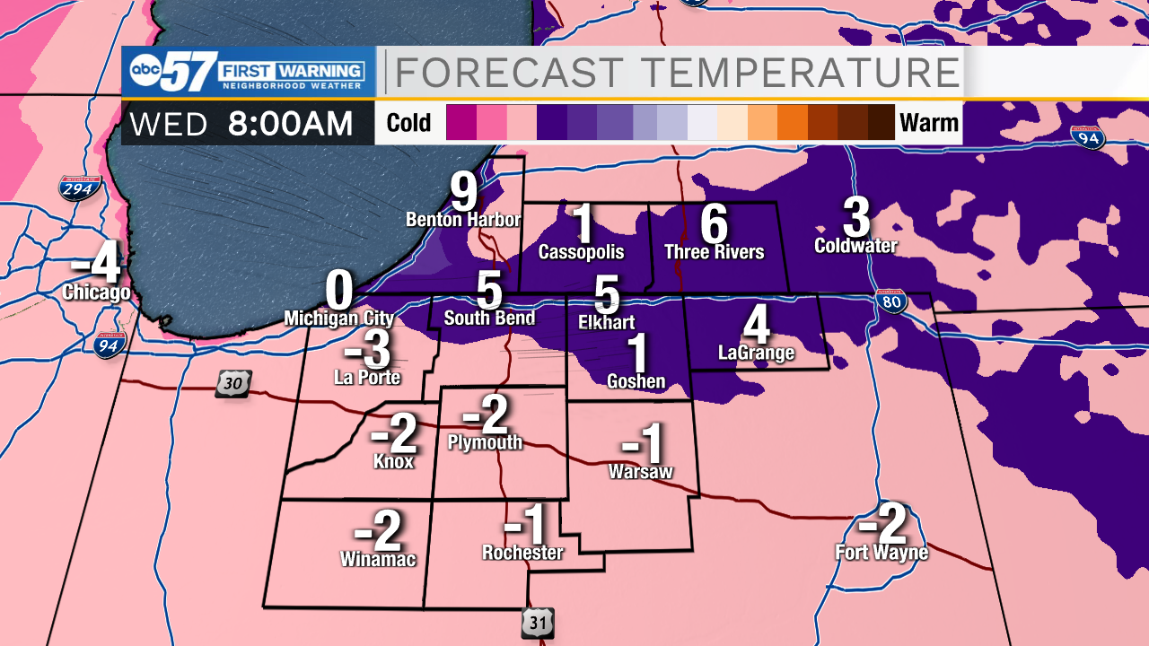
Lake effect snow and bitter cold midweek. Lake effect snow will gradually ramp up-and-down Tuesday. A surge of snow develops in the snow belt early Tuesday morning, then wanes during the day, surging again Tuesday night as temperatures drop again. In total, most the snow belt will see more than three inches of snow, with some in Berrien county getting more than six inches. Wednesday is the coldest day, with temperatures nearing zero at night. The pattern stays cold through the weekend.
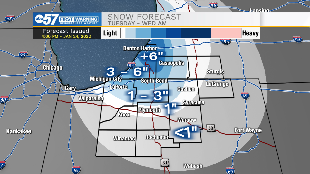
Tonight: Lake effect snow. Low 12.
Tuesday: Lake effect snow. High 18.
Wednesday: Partly cloudy and cold. High 12.
Thursday: Evening snow showers. High 30.
Sign up for the ABC 57 Newsletter