
-
3:06

Pulaski County weighs stricter solar rules amid resident concerns
-
0:40

Marian High School hosts World Down Syndrome Awareness Walk
-
2:33

South Bend leaders call for an end to gun violence
-
2:01

Tae Johnson, Notre Dame secondary stands out as Irish open spring...
-
2:21

Backup quarterback competition, position battles highlight Notre...
-
2:25

A new Pathway to the Golden Dome
-
2:33

Howard Park aims to install bandshell
-
1:37

March Madness and gambling responsibly
-
1:19

There are two big temperatures drops next week
-
1:48

Longer days for the first day of Spring
-
1:30

Country music star Jake Owen to play at Blue Gate Performing...
-
1:51

Warm and sunny stretch with a few showers possible this weekend

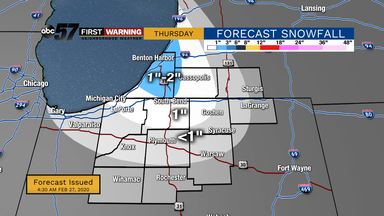
Thursday, February 27th, 2020
Lake effect snow showers are coming down this morning but will taper down later today. An additional 1-2” is possible for our Michigan counties but less than an inch is expected outside of that. A few flurries will hang on through Friday morning, otherwise it just stays cold and breezy.
Temperatures start to improve over the weekend with a lot more sunshine in store. Daytime highs climb into the 40s again by Sunday. It stays mild for the beginning of the work week but rain chance returns along with it.
Today: Lake effect snow showers and breezy. High 26.
Tonight: Flurries possible, mostly cloudy. Low 16.
Friday: AM flurries, then mostly to partly cloudy. High 25.
Saturday: Partly cloudy. High 30.
Sign up for the ABC 57 Newsletter