
-
2:51

Governor Whitmer appeals FEMA federal aid denial for Southwest...
-
3:17

Benton Harbor leaders weigh Jean Klock Park upgrades amid debate...
-
1:40

Pollinator Playpath, a trail for kids, now open at Corson Riverwoods...
-
0:32

Ryan Newman racing Saturday at Plymouth Motor Speedway
-
3:08

Officials recover body of missing teenager in Lake Michigan off...
-
2:45

NCAA’s new eligibility rule could reshape Notre Dame roster...
-
1:08

Storms start this afternoon
-
0:56

Calm morning, storms tonight
-
2:43

South Bend residents see future plans for former Drewry’s Brewery
-
2:45

Damage assessment continues in Elkhart County following EF-2...
-
0:44

Indiana and Illinois set record for tornadoes
-
1:27

Community Build underway at Kathryn Park

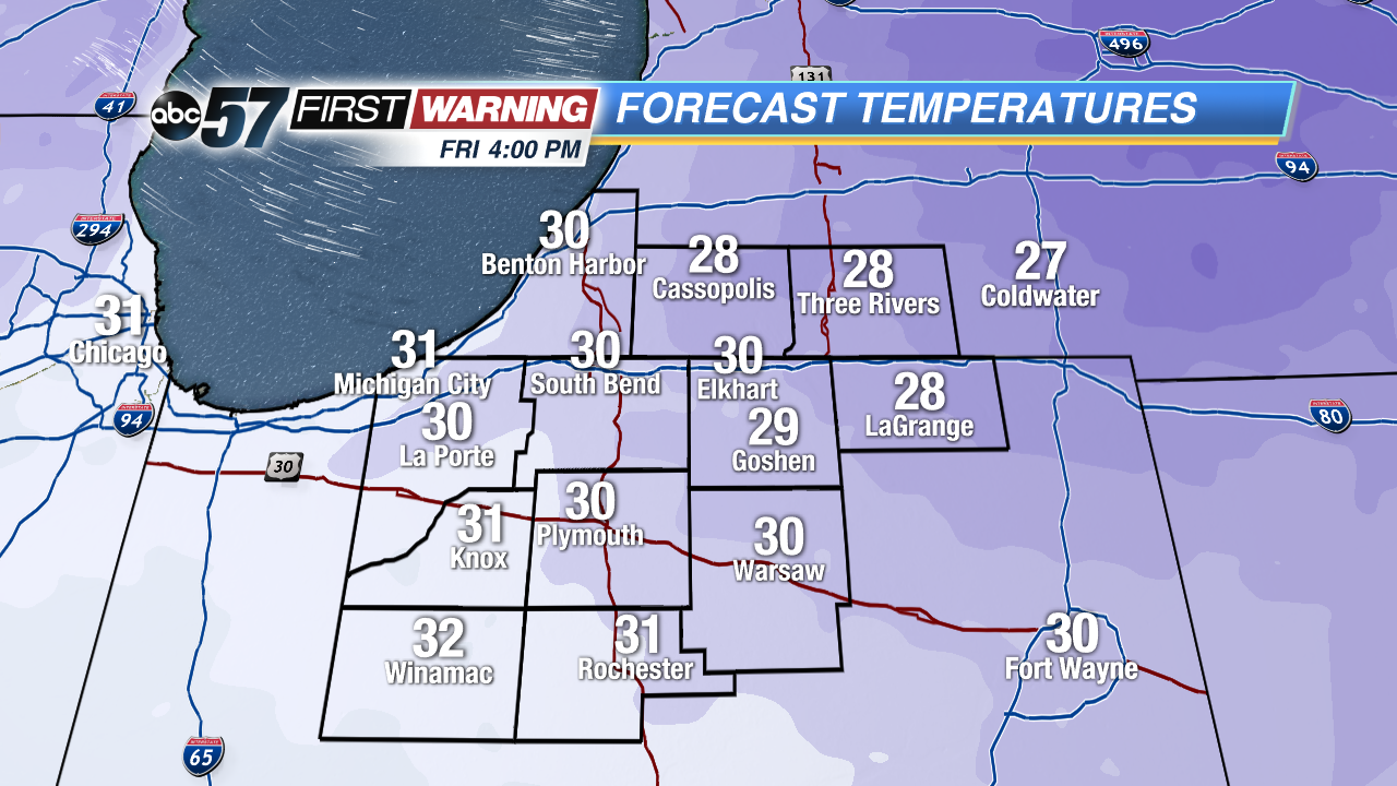 Highs may not break the freezing mark Friday afternoon
Temperatures plummet this evening into the 20s, lake effect snow will ramp-up overnight but will not last long. A dusting is possible with areas closer to the lake of an inch or more.
Friday will be the coldest day so far this season, temperatures will struggle to break the freezing mark. Temps warm slowly through the weekend. Saturday night into Sunday another storm system will bring a mix of rain and snow, changing to all rain and temps rise, Sunday morning. Next week will be milder with highs in the low 50s.
Tonight: Cold and breezy with lake effect snow showers, low 20. 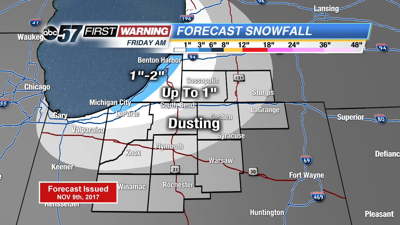 Lake Effect Snow forecast through Friday morning
Friday: Morning flurries, becoming mostly sunny, high of 32.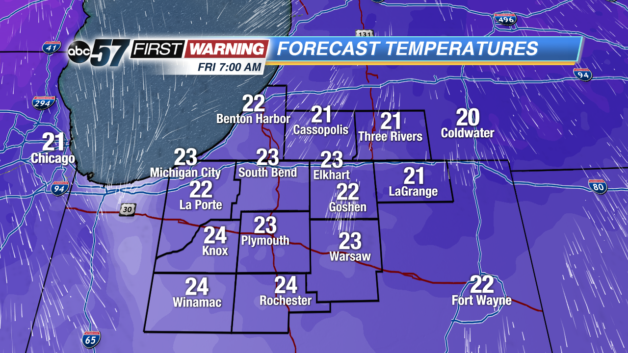 Lows Friday morning will be in the lower 20s
Saturday: Partly cloudy, high 40.
Sunday: Rain/snow mix changing to rain, highs in the low 40s.