


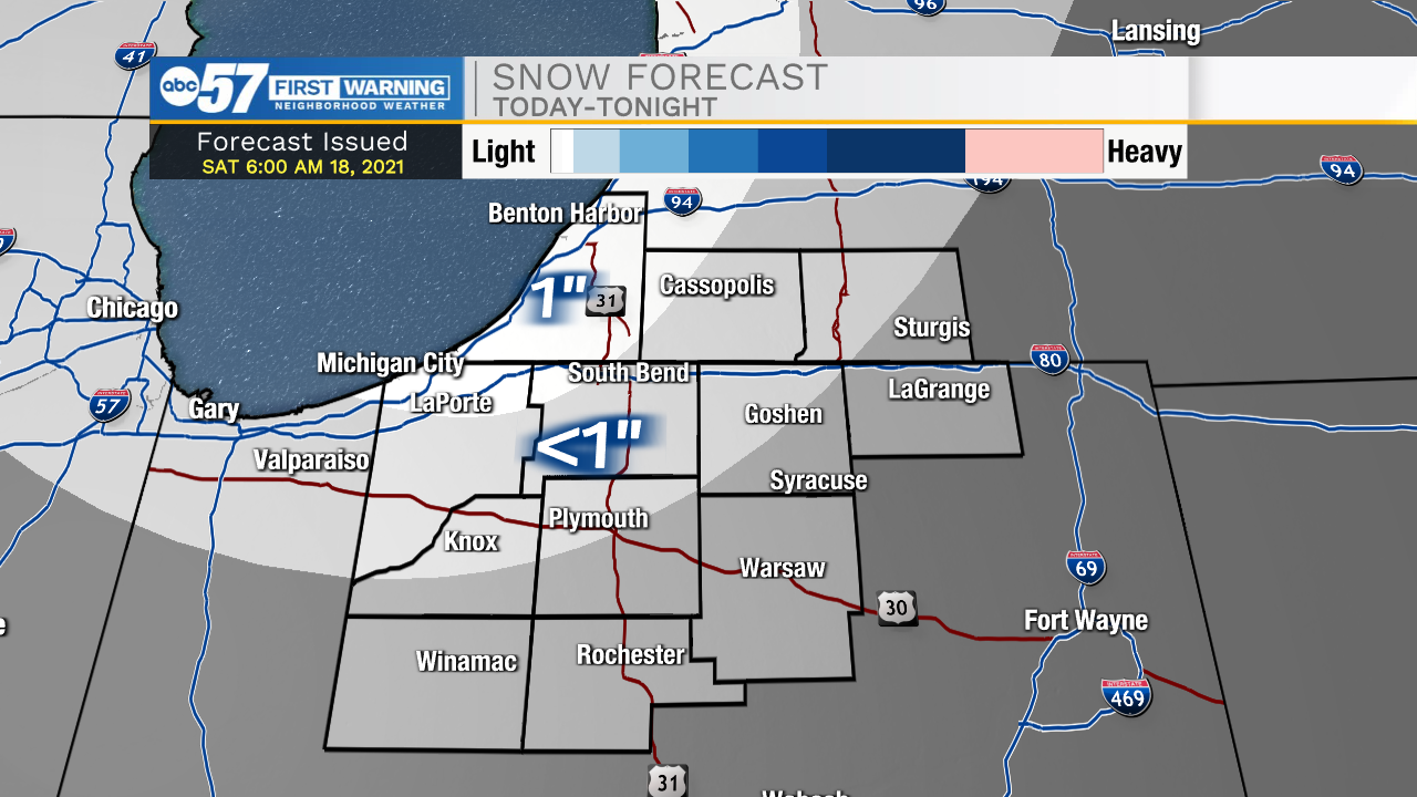
Scattered showers and mixed wintry precip will impact Michiana through most of the morning. Rain will move out around 9-10am, but lake effect snow showers and some mixed wintry precip will still impact portions of Laporte, northwestern St. Joseph, Berrien, and western Cass counties through the afternoon. Those areas could see around an inch of snow by later today. Isolated slick spots will be possible on bridges and overpasses in northwest Michiana. High temperatures today will only top out in the mid to upper 30s. Tomorrow will be dry with partly cloudy skies and highs again in the mid to upper 30s. Sunshine returns on Monday along with 40 degree temperatures. Most of next week looks dry for now, with some precip chances closer to Christmas.
Today: Snow showers north. High 38.
Tonight: Mostly cloudy. Low 28.
Tomorrow: Partly cloudy. High 36.
Monday: Mostly sunny. High 40.