


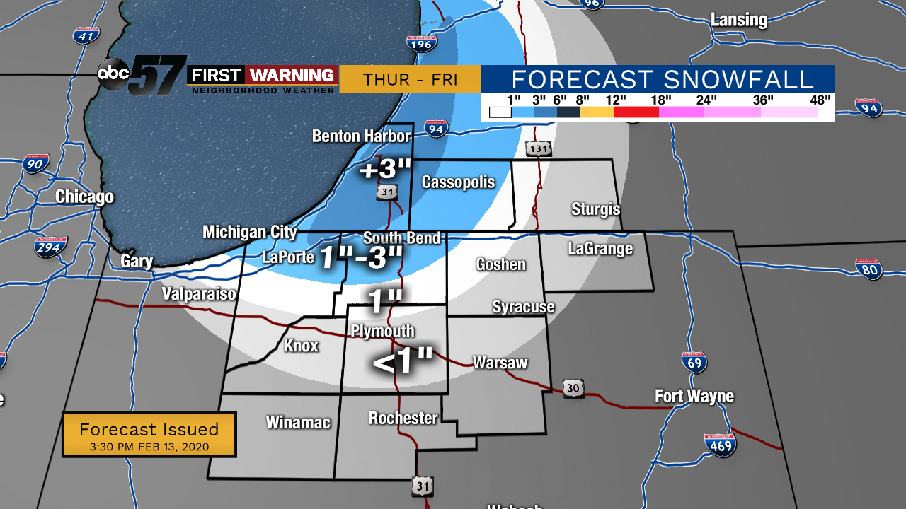
Lake effect snow showers will be most intense Thursday evening and start to taper-off by Friday morning. Most in the snow-belt will see around 2" but more than 3" is possible.
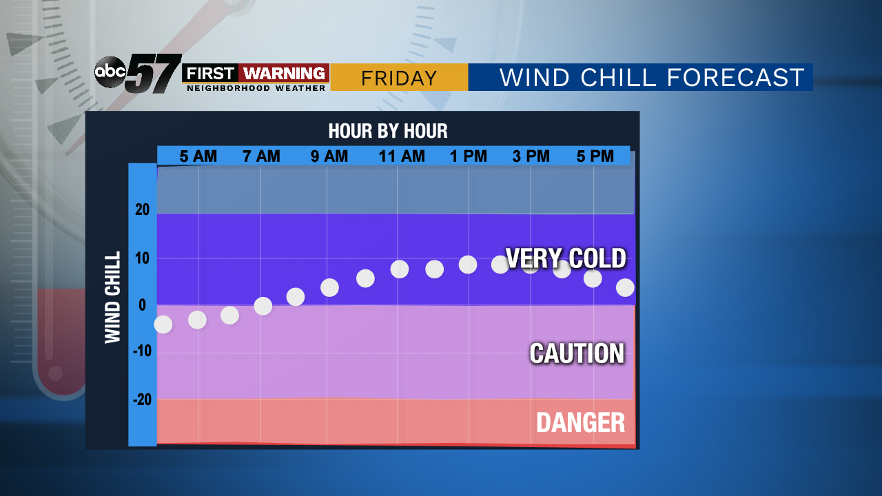
A few lake effect flurries linger into Friday morning. Temperatures will be chilly throughout the day, but wind chill temperatures will be below zero in the morning. Cloud cover decreases and by afternoon we will see some sunshine. Another chilly night on Friday, then temperatures warm again for the weekend. Saturday cloud cover increases again ahead of evening snow. These lighter snow showers should have a relatively low impact. Sunday is dry but by early next week, another rain system will move into the area.
Tonight: Lake effect snow continues. Low 10.
Friday: AM flurries, then decreasing cloud cover. High 18.
Saturday: Increasing clouds, then late snow showers. High 33.
Sunday: Decreasing clouds. High 36.