Light lake effect snow and cold
By: Emily Kennedy
Posted: Nov 27, 2018 3:00 AM EDT

-
0:36

Eddies Circuit Robotics holds competition Saturday
-
0:32

21st annual Nappanee Model Train Show
-
0:38

Local boys basketball team headed to IHSAA state finals
-
3:49

Midwest Meowfest brings kitten advocacy to attendees, new homes...
-
1:52

Mild tonight, showers tomorrow
-
1:43

Pleasant to start the weekend
-
3:06

Pulaski County weighs stricter solar rules amid resident concerns
-
0:40

Marian High School hosts World Down Syndrome Awareness Walk
-
2:33

South Bend leaders call for an end to gun violence
-
2:01

Tae Johnson, Notre Dame secondary stands out as Irish open spring...
-
2:21

Backup quarterback competition, position battles highlight Notre...
-
2:25

A new Pathway to the Golden Dome

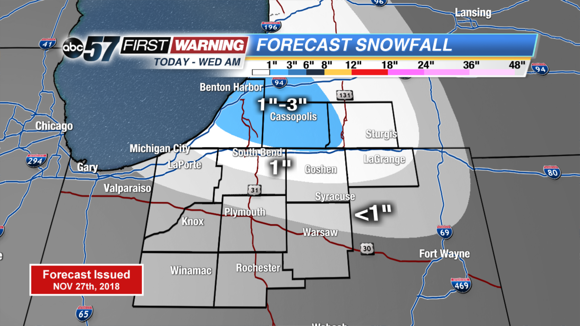
Lake effect snow shower pick back up today but remain light. Some in our Michigan counties could see 1” to 3” of snow but most will be on the lower end. Up to 1” is possible just south of the state line. It stays cold today and tomorrow with highs only in the upper 20s. We could see a couple peeks of sunshine tomorrow afternoon. Otherwise clouds move right back in Thursday along with a wintry mix. Temperatures warm up into the low to mid 40s over the weekend with a chance of rain Saturday.
Today: Mostly cloudy, lake effect snow showers possible, high of 27.
Tonight: Mostly cloudy, light lake effect snow, low of 18.
Wednesday: AM flurries, mostly to partly cloudy, high of 28.
Thursday: Cloudy, wintry mix possible, high of 35.
Sign up for the ABC 57 Newsletter