Light morning snow then flurries possible
By: Emily Kennedy
Posted: Jan 26, 2021 2:57 AM EDT

-
1:44

Two rounds of storms Monday
-
1:07

Mini heat wave starts out the door
-
2:23

La Porte community rallies for Sammy Strong Benefit, raising...
-
1:57

The Potawatomi Zoo opens its gates to Zoo Nights Live
-
2:50

Carson Kvapil wins his first O’Reilly Auto Parts Series win...
-
1:10

William Tuffs honored as the only Indiana man who took part of...
-
0:50

Beacon Health held a Health and Wellness fair for the community
-
1:03

Warm conditions start overnight
-
1:02

Another pleasant day
-
0:42

Still cooler out the door
-
2:00

New Carlisle celebrates annual Hometown Days
-
1:40

Ross Chastain leads NASCAR O’Reilly Auto Parts Series practice...

ABC57 First Warning Neighborhood Weather Forecast
Tuesday, January 26th, 2020
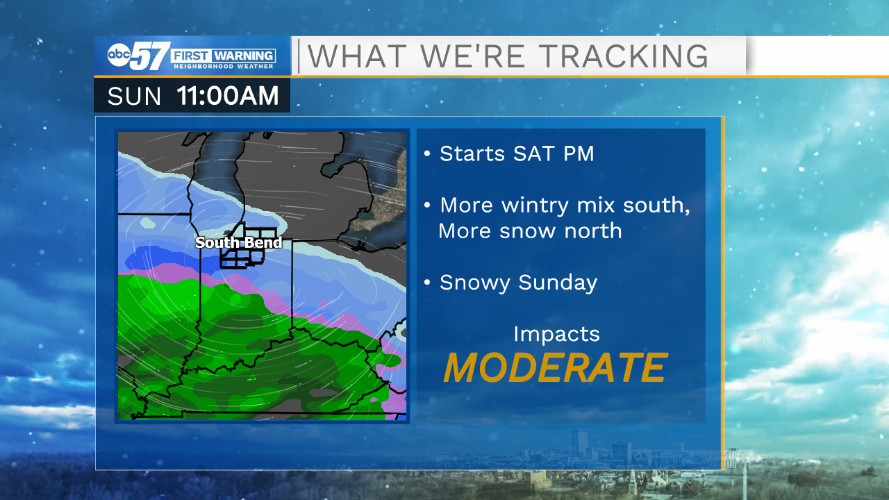
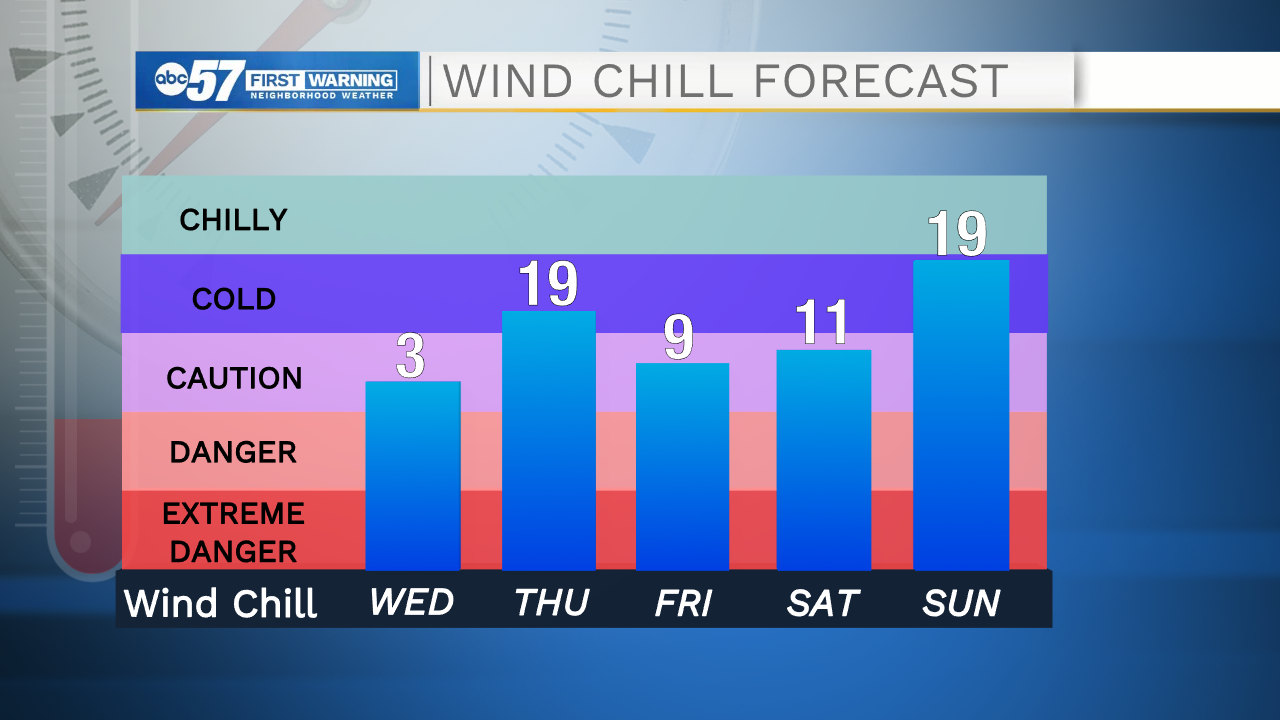
Snow showers persist through Tuesday morning but there's little additional accumulation, flurries are possible into the afternoon and evening. Temperatures drop for the rest of the week with daytime highs not even making it out of the 20s. Overnight lows sink to the teens as well. We will get to see some sunshine though for Thursday and Friday. We are watching for potential lake effect snow west of US-31 Thursday morning. Saturday and Sunday look to be another round of snow / wintry mix.
Today: Scattered snow showers. High 29.
Tonight: Mostly cloudy. Low 18.
Wednesday: Mostly cloudy High 26.
Thursday: AM flurries, partly cloudy. High 27.
Sign up for the ABC 57 Newsletter