
-
2:28

Kicking off day two of the Gus Macker Basketball Tournament
-
0:55

Enjoy this weekend
-
0:50

Beautiful weekend starts this morning
-
2:32

Gus Macker Three-on-Three Basketball Tournament is taking over...
-
1:44

Feeling like a sauna next week
-
3:12

How to keep yourself and others protected during firework season
-
0:49

Showers creeping into Michiana
-
1:32

Judge approves $25 million water lawsuit settlement in Benton...
-
1:00

Scattered showers through the day
-
1:53

Hispanic Community Child Safety Meeting: A Call To Action
-
2:51

Obama Presidential Center features work of South Bend company
-
1:54

This week’s ABC57 Cub Reporter is Isaac Knefely

Light lake effect snow showers, mostly west of South Bend could bring up to an inch of accumulation for some. Temperatures fall into the lower 20s and upper teens tonight.
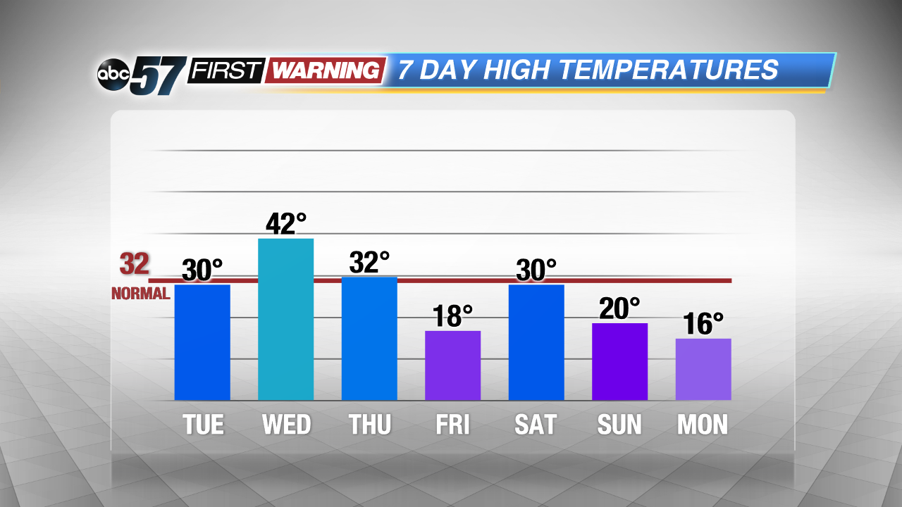
The forecast midweek is still up-and-down, highs struggle to break the freezing mark Tuesday, warm into the 40s Wednesday and then crash again Thursday into Friday. The start of February looks cold again with below normal temperatures and a chance of accumulating snowfall this weekend.
Tonight: Mostly cloudy, lake effect snow, low of 20.
Tuesday: Snow ending, partly cloudy, highs of 30.
Wednesday: Mostly cloudy, high of 42, chance of wintry mix late.
Thursday: Partly cloudy, temperatures fall from the mid-30s.
Sign up for the ABC 57 Newsletter