-
1:44

Two rounds of storms Monday
-
1:07

Mini heat wave starts out the door
-
2:23

La Porte community rallies for Sammy Strong Benefit, raising...
-
1:57

The Potawatomi Zoo opens its gates to Zoo Nights Live
-
2:50

Carson Kvapil wins his first O’Reilly Auto Parts Series win...
-
1:10

William Tuffs honored as the only Indiana man who took part of...
-
0:50

Beacon Health held a Health and Wellness fair for the community
-
1:03

Warm conditions start overnight
-
1:02

Another pleasant day
-
0:42

Still cooler out the door
-
2:00

New Carlisle celebrates annual Hometown Days
-
1:40

Ross Chastain leads NASCAR O’Reilly Auto Parts Series practice...

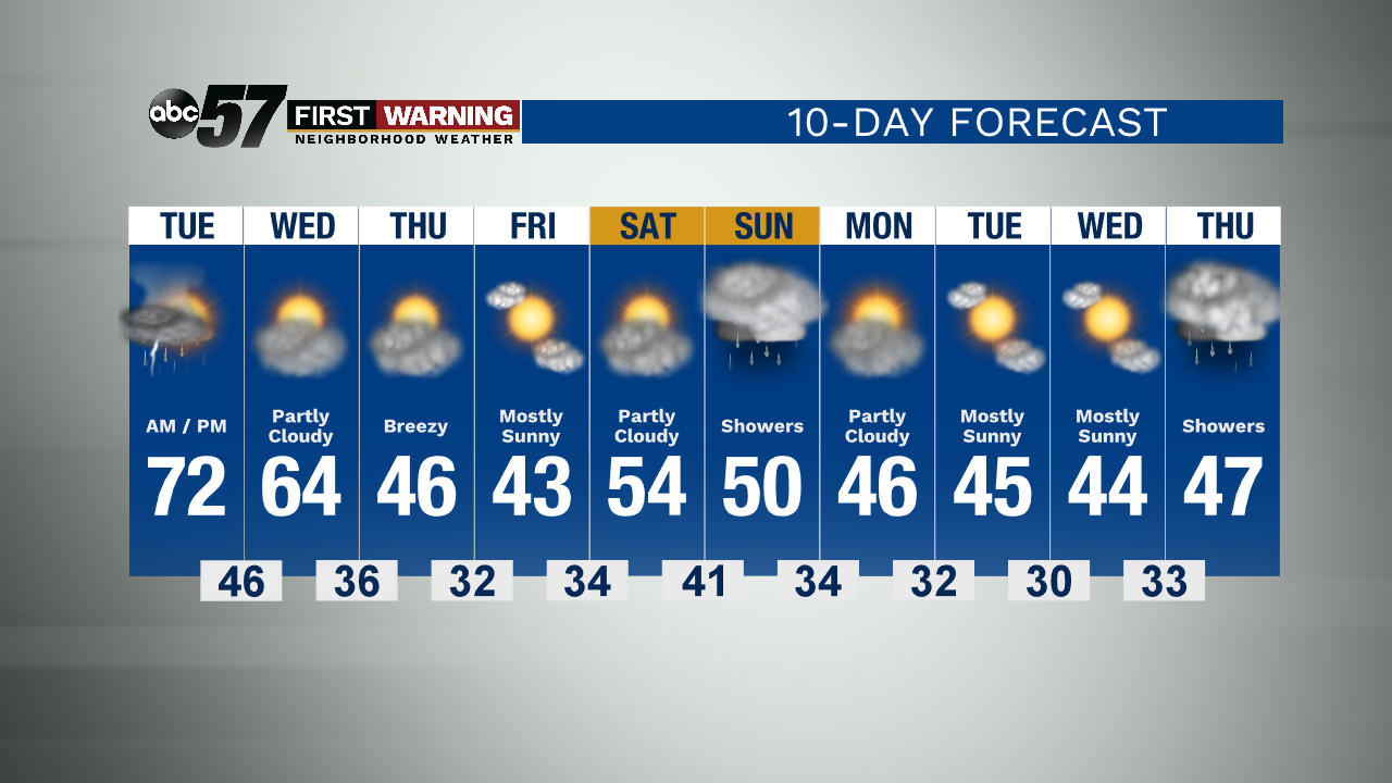
Thunderstorms overnight could be loud with heavy rain, lightning and hail. More an an inch of rain could fall, mostly favored across the northern half of the area. Life threatening severe weather is unlikely. Most of the storm activity is after midnight.
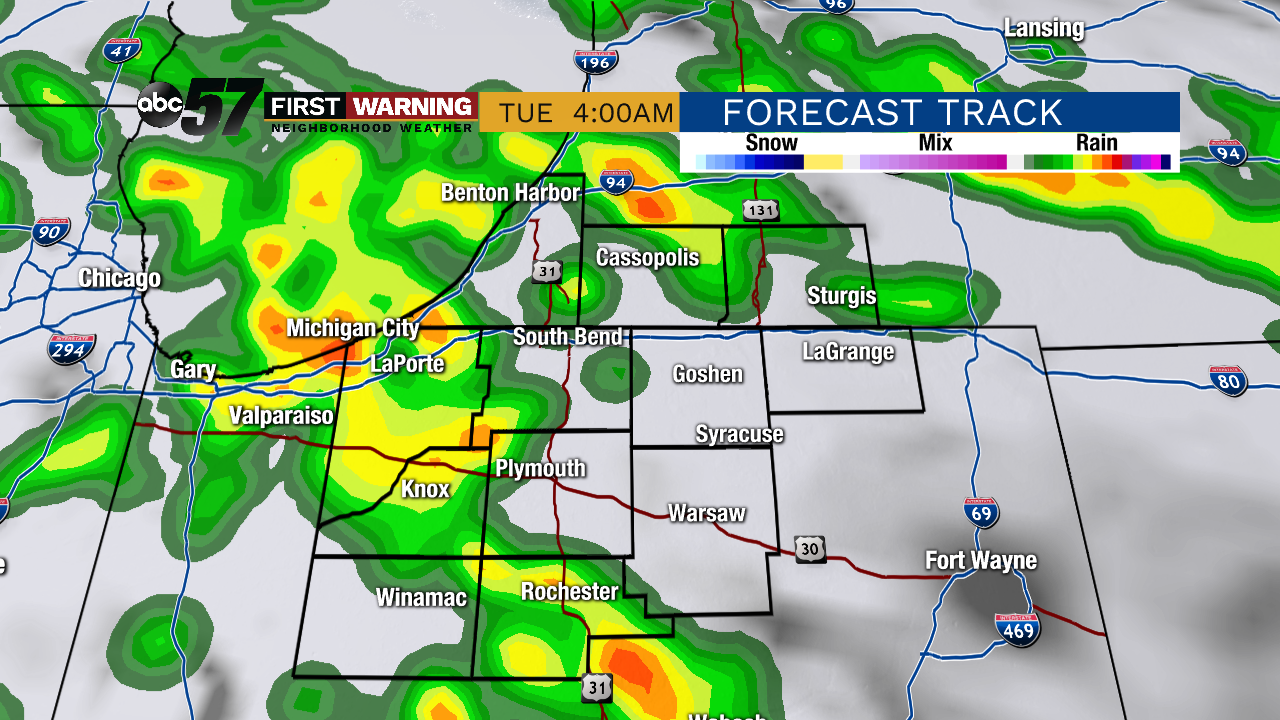
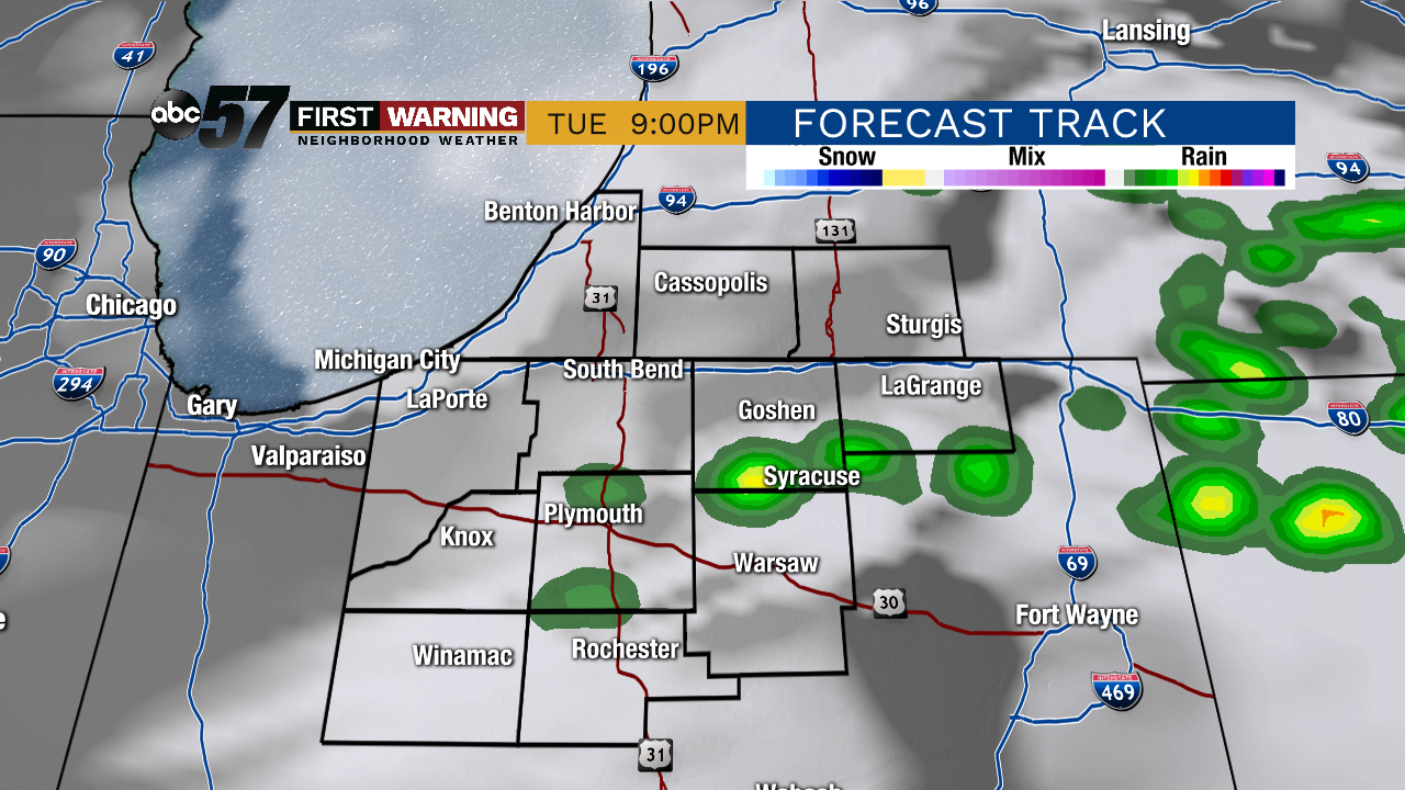
A few showers / thunderstorms linger into early Tuesday, the rain ends and temperatures warm into the 70s by the afternoon during the lull ahead of the cold front. Scattered storms move through Tuesday evening, a few of those storms could be strong to severe, with gusty wind being the main threat. Temperatures fall to end the week, 60s on Wednesday, 40s Thursday and Friday.
Tonight: Overnight thunderstorms. Low of 53.
Tuesday: AM Showers / Evening storms High 72.
Wednesday: Partly sunny. High 64.
Thursday: Breezy. High of 46.