Low rain chances tonight, Cooler temperatures next week


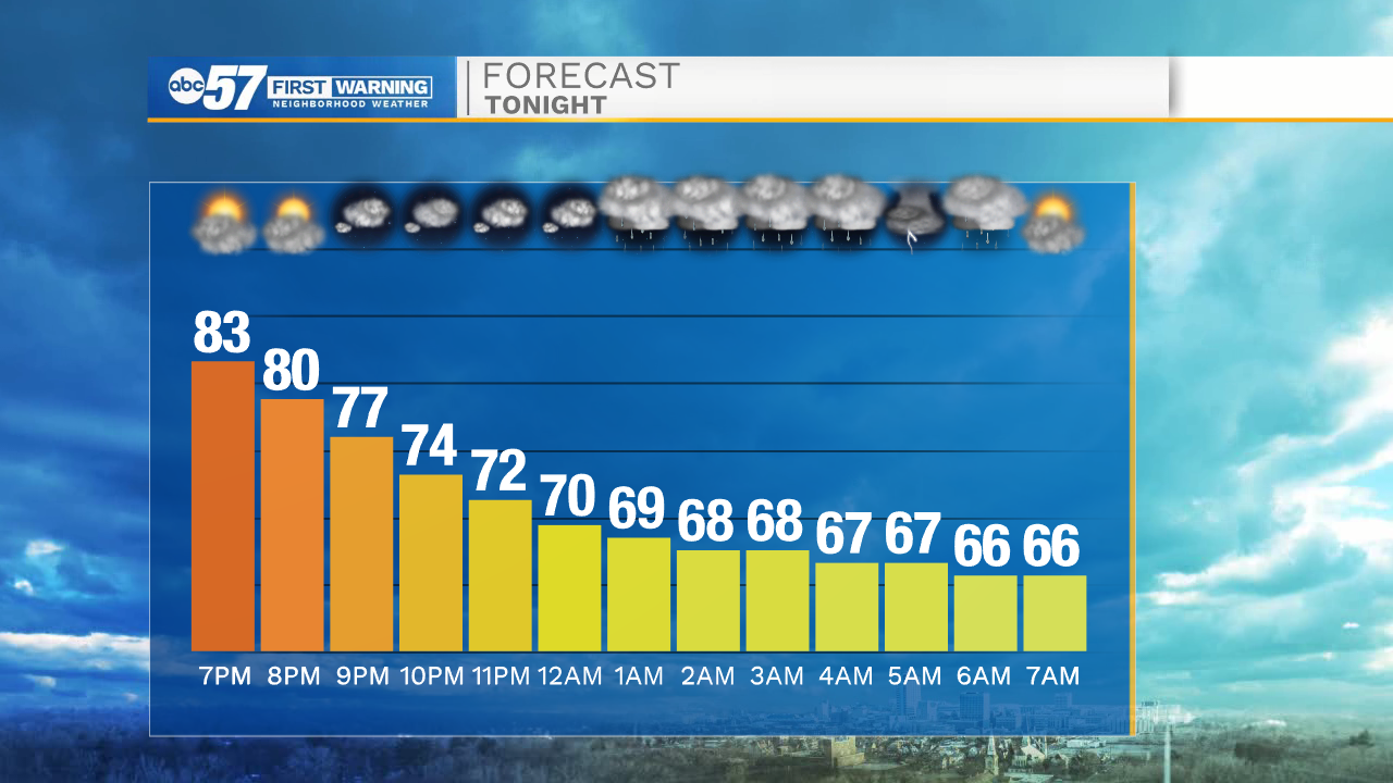
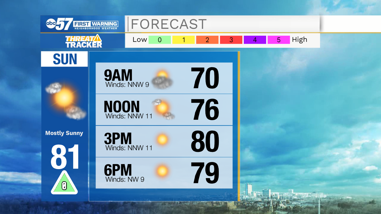
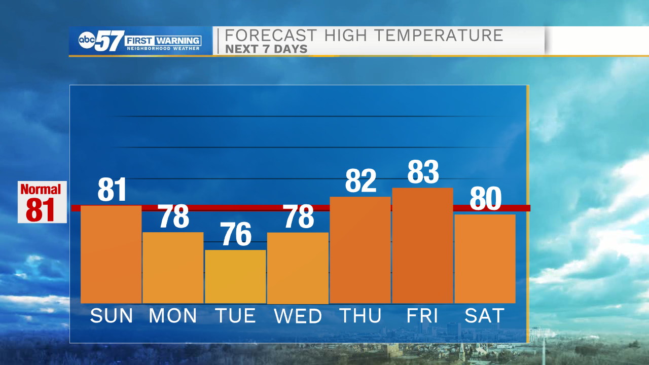
This evening most will stay dry, but a few isolated showers and low end thunderstorms can’t be ruled out. Better rain chances will arrive during the overnight hours into mid-morning Sunday. Those showers will move out, and then another round of isolated showers and storms are possible tomorrow evening into Monday morning. High temperatures tomorrow will be in the lower 80s.
Monday afternoon there will still be the low chance for an isolated thunderstorm or two. Tuesday looks nice and dry with mostly sunny skies and high temperatures in the mid 70s.Low rain chances are in the forecast for Wednesday afternoon. We will clear things out again late next week with high temperatures climbing back into the lower 80s. More rain and storm chances look to arrive next weekend. High temperatures will remain in the lower 80s heading into that following week.
Tonight: Isolated showers and storms. Low 66.
Tomorrow: Mostly sunny, isolated showers. High 81.
Monday: Partly cloudy, isolated storms. High 78.
Tuesday: Mostly sunny. High 76.