


Friday evening, through mid-morning Saturday will be sloppy! A burst of heavy wet snow will transition to sleet and rain after midnight. Freezing rain and ice will be the greatest concern in the early morning, 6:00 to 9:00 a.m.
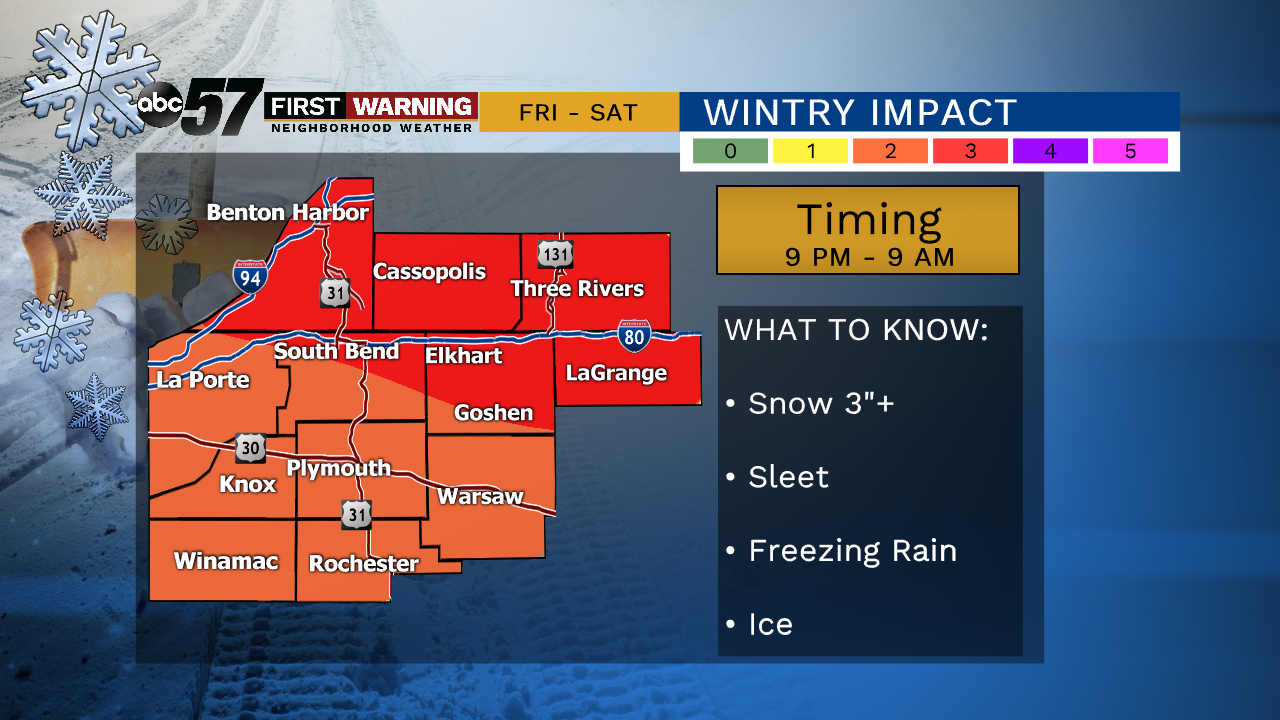
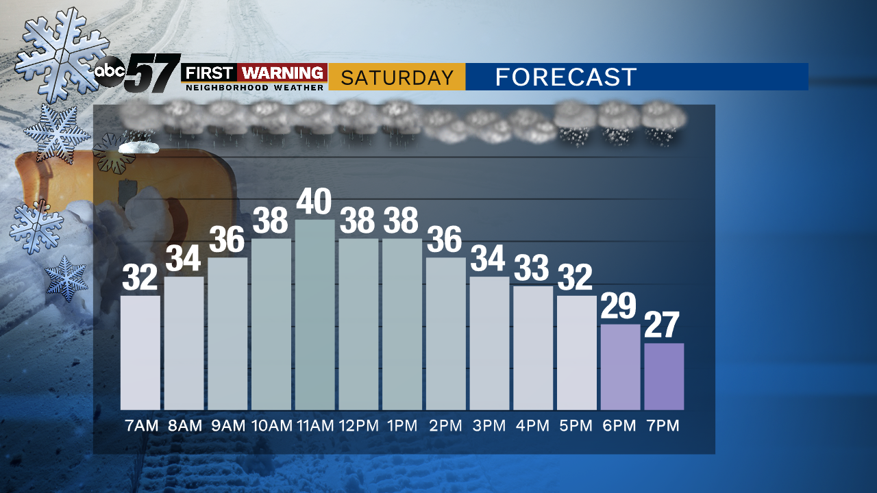
Sloppy Saturday, ice and snow melt as rain falls and temperatures spike to 40 midday. Most of the snow / slush will melt but there is concern for a re-freeze Saturday night as temperatures tank to the teens by Sunday morning. Lake effect snow showers are likely Sunday and Monday, accumulation of more than four inches is most likely in Southwest Michigan by Sunday evening.
Tonight: Heavy wet snow changing to sleet/rain. Temperatures rising from 30.
Saturday: Rain then snow (again). High of 40.
Sunday: Lake effect snow showers. High of 18.
Monday: Lake effect snow showers. High of 24.