Messy system moves to end the week then bitter cold

-
1:04

Overall pleasant for Michiana
-
1:52

South Bend Common Council issues an official apology to residents...
-
0:54

Slightly cool out the door
-
1:54

Suspect identified, charged in fatal hit-and-run of Timothy Johnson
-
0:39

Prairie Street Cemetery works to clear storm damage
-
1:36

Reaching out for support gives father a second chance in life
-
2:08

St. Joseph County police investigating Bypass incident from Saturday...
-
2:07

Color guard coach charged with Sexual Misconduct with a Minor
-
1:09

Pleasant for the rest of today
-
0:52

Still raining out the door
-
1:17

The 80s return next week
-
1:22

Rain showers for the rest of the day

Thursday, January 16th, 2020
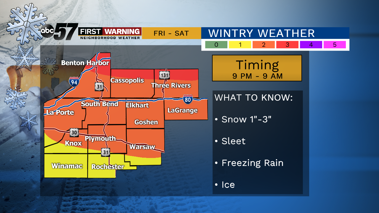
Sunshine today for some but lake effect clouds will keep our northern counties covered more often. While temperatures start in the 30s early in the morning, they will fall to the mid 20s by the afternoon.
The next system moves in late Friday, starting out at as snow but it turns to a freezing rain and sleet Saturday morning. As temperatures rise, the wintry mix will turn to rain, melting much of the snow and ice. The sharp drop in temperatures comes Sunday, behind the system. Lake effect snow will be possible with daytime highs only in the 20s.
Today: Mostly to partly cloudy, breezy. Temperature falls from 30.
Tonight: Few clouds. Low of 20.
Friday: Mostly cloudy, snow late. High of 30.
Saturday: Freezing rain early, then all rain. High of 40.