
-
1:08

Storms start this afternoon
-
0:56

Calm morning, storms tonight
-
2:43

South Bend residents see future plans for former Drewry’s Brewery
-
2:45

Damage assessment continues in Elkhart County following EF-2...
-
0:44

Indiana and Illinois set record for tornadoes
-
1:27

Community Build underway at Kathryn Park
-
2:34

Day two of searching for a missing child continues
-
3:47

The Elkhart community is searching for answers after a 2-year-old...
-
1:04

Overall pleasant for Michiana
-
1:52

South Bend Common Council issues an official apology to residents...
-
0:54

Slightly cool out the door
-
1:54

Suspect identified, charged in fatal hit-and-run of Timothy Johnson

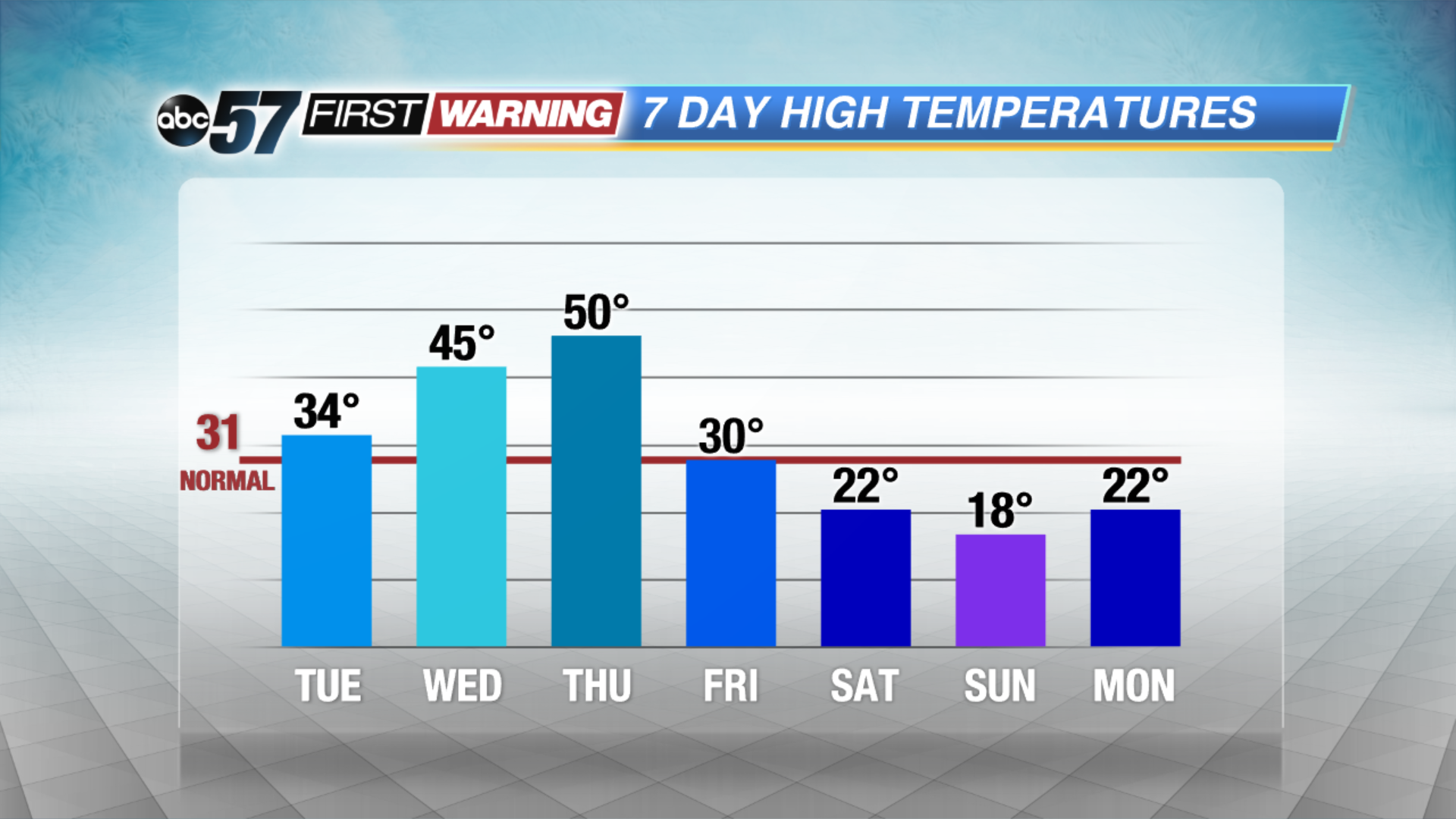
A mid-winter warm-up this week will bring a new set of hazards. The freeze-thaw cycle increases the chance of black ice, fog and potholes, mostly in the morning hours. Highs will rise from just above freezing Tuesday to possibly the 50s on Thursday. We’ll watch for a potential snow-maker later this week before another crash in temperatures this weekend.
Tonight: Partly cloudy with morning fog developing, low 22.
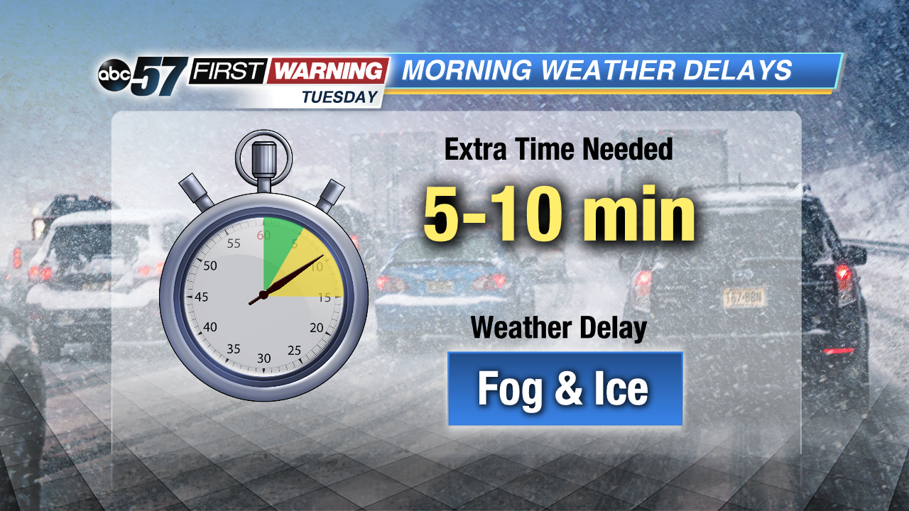 Watch for fog and black ice in the morning
Tuesday: Partly cloudy, high of 34.
Wednesday: Fog and drizzle, high of 45.
Thursday: Rain and fog, highs near 50.
 A quick thaw will melt a lot but not all of our snow pack.
Sign up for the ABC 57 Newsletter