
-
1:03

Mentone Egg festival brings a clutch of people to enjoy its history
-
0:46

9th annual Hall of Heroes Comic Con concludes its first day
-
2:39

South Bend Barber celebrates retirement after 59 years
-
0:45

OC fireworks reveal their new showroom
-
0:57

Thousands take part in Sunburst Run to raise funds
-
2:00

Annual Studebaker car show takes over Ironwood Plaza
-
0:55

Beautiful weekend expected
-
1:05

Truly wonderful conditions
-
0:41

One person left with serious injuries after high-speed pursuit...
-
2:15

Fort Wayne Tin Caps put an end to the SB Cubs winning streak
-
1:21

This weekend is the annual Hall of Heroes Comic Con
-
0:46

Elkhart Police Department respond to shots fired call at the...

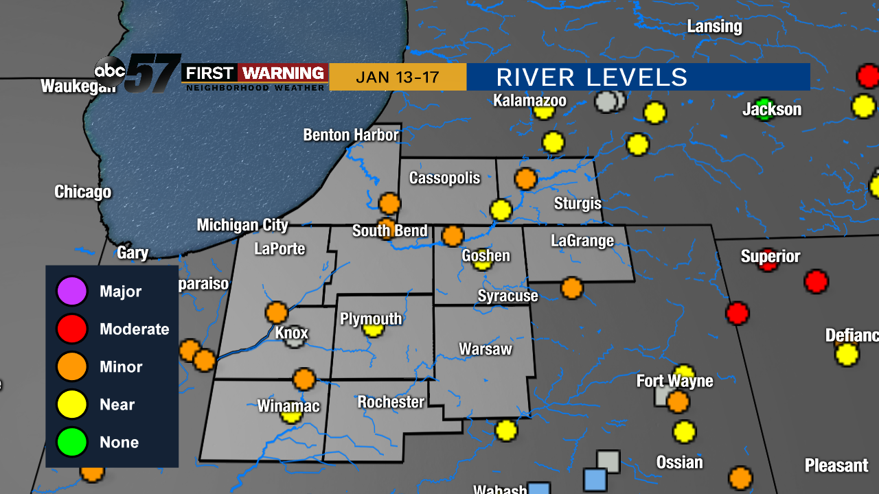
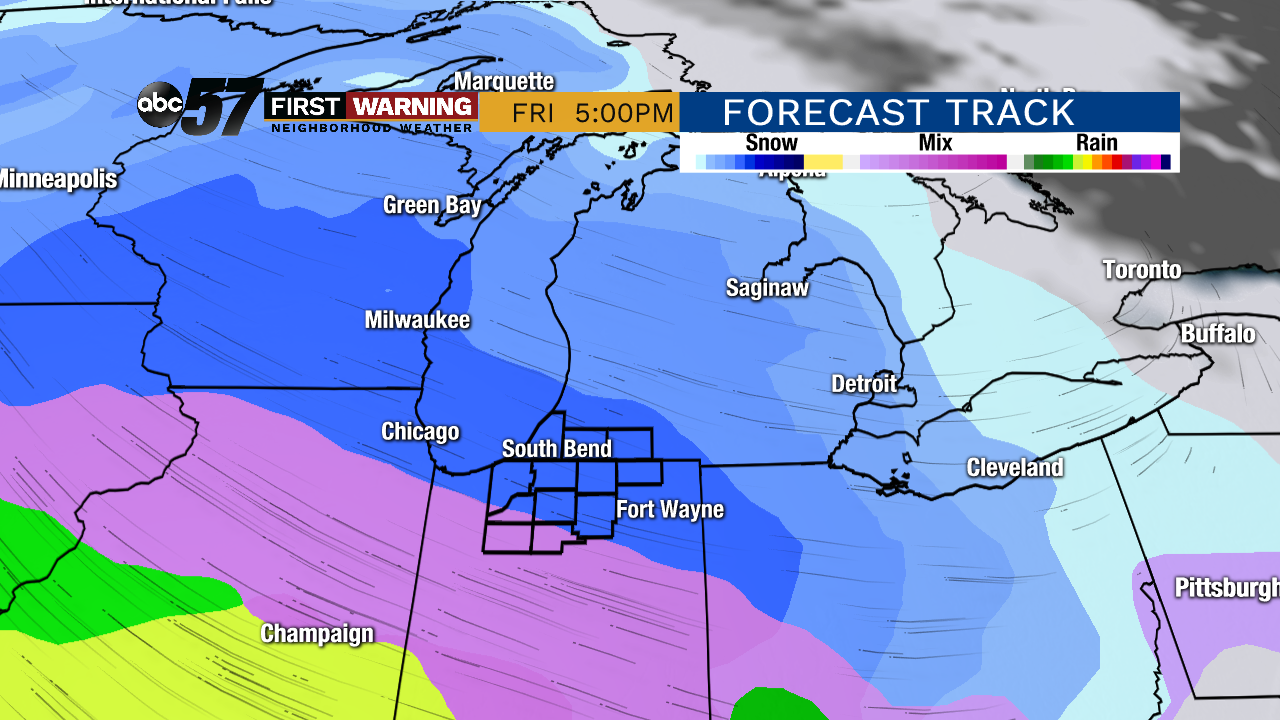
Rivers peak and gradually recede, with mostly dry weather forecast this week. Mild temperatures last through Wednesday, then temperatures drop through Friday morning. The main focus will be on a messy system Friday-Saturday. Snow will change to a wintry mix and rain as temperatures warm from the 20s into the upper 30s. Be aware of slick conditions being possible.
Tonight: Mostly cloudy. Low of 32
Tuesday: Mostly cloudy. High of 46.
Wednesday: Mostly cloudy, chance of wintry mix. High of 42.
Thursday: Partly cloudy, breezy, colder. High of 30.
Sign up for the ABC 57 Newsletter